Greenmount, Western Australia
| Greenmount Perth, Western Australia | |||||||||||||
|---|---|---|---|---|---|---|---|---|---|---|---|---|---|
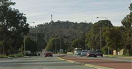 Greenmount Hill from the Great Eastern Highway | |||||||||||||
 Greenmount | |||||||||||||
| Coordinates | 31°51′25″S 116°03′25″E / 31.857°S 116.057°ECoordinates: 31°51′25″S 116°03′25″E / 31.857°S 116.057°E | ||||||||||||
| Population | 2,466 (2006 census)[1] | ||||||||||||
| Postcode(s) | 6056 | ||||||||||||
| LGA(s) | Shire of Mundaring | ||||||||||||
| State electorate(s) | Midland | ||||||||||||
| Federal Division(s) | Pearce | ||||||||||||
| |||||||||||||

Greenmount is a locality and a geographical feature in the Shire of Mundaring, Western Australia, on the edge of the Darling Scarp. It is a vital point in the transport routes from the Swan Coastal Plain into the hinterland of Western Australia.
Early colonial history
Ensign Robert Dale reached the summit on 18 October 1829. John Septimus Roe communicated with Dale over the York Road he had used the name Green Mount.
In the era of the Swan River Colony the name 'Greenmount' was used for two points on the Darling Scarp. In the 1840s the York Road was known as York Greenmount, and the road further north along the Scarp was known as Toodyay Greenmount. It is possible that these two locations might have had slightly different coloured foliage compared to the grey blue green colour of the Scarp.
During the convict era, in 1854 Edward Du Cane was the supervisor of the building of a convict depot on the slopes of the hill. In the 1870s a government bluestone quarry was developed on the western slope of the hill.
Chippers Leap
Chippers Leap is a memorial stone on the northern edge of the Great Eastern Highway between the two points where the Old York Road remains linking with the highway.
Highway
Greenmount Hill, either by Old York Road, or Great Eastern Highway is the main ascent to, or descent from the Darling Scarp, and has been a regular site of vehicle breakdowns or accidents due to the slope.[2]
Due to a large increase of heavy truck traffic using the hill, the Truck Arrester Bed located at the lower end of the hill has been in place since an accident in 1993.[3]
Railway
On its western slopes and southern slopes the original Eastern Railway route travelled. On its western slopes and just to the north the later National Park deviation ran. The current railway route still passes within a few kilometres to the west and north of the hill. Greenmount was a railway stopping place until 1954 when the Mundaring Loop was closed for passenger traffic, however trains continued to work on the line to the Mountain Quarry in Boya until 1962.
Quarries
On its western slope and near its southern slope it has three unused quarries - Greenmount Quarry, Mountain Quarry, and Hudman Road Quarry. The Greenmount Quarry was known as the 'Blue Stone Quarry' in the 1870s, and was later associated in the late nineteenth century with the brother of John Forrest - Alexander Forrest. Mountain Quarry was a working quarry from the 1920s until the early 1960s. It is now a dedicated abseiling location, and is often designated as 'Boya Quarry'. For more details about Hudman Road quarry to the south see the article on Boya.
Due to its visibility and lack of development on the hill, it has remained 'green' since its naming in the 1820s. It has attracted the interest of some artists and photographers. The only spoiling is the front part of the hill [locally known as 'Sugarloaf'], which was a pasture for over 60 years, and has a 'green' that is not the endemic green of the jarrah forest that once covered the hill. Also dissection by a Western Power line across the hill which corresponds with the old border of the Greenmount National Park has created an eyesore line, as well as a serious point of erosion.
It has also been the site of aircraft warning lights since removed, and currently has a police communication tower on the western edge. It also has a Mobile Telephone tower with Optus and Telstra Equipment near Padbury Road. Road access through the Greenmount National Park has been closed due to vandalism, except where permission and keys have been obtained from the Department of Environment and Conservation regional office in Mundaring.
The Greenmount locality is dissected by the Great Eastern Highway and other important roads.
Mundaring Municipal Inventory
The Shire of Mundaring Municipal Inventory has Greenmount Hill - as a landmark - with high aesthetic, social, historic and scientific significance.
See also
Notes
- ↑ Australian Bureau of Statistics (25 October 2007). "Greenmount (State Suburb)". 2006 Census QuickStats. Retrieved 2008-10-05.
- ↑ http://www.abc.net.au/news/2012-10-16/brakes-fail-on-prison-bus-going-downhill/4316120?section=wa
- ↑ http://pandora.nla.gov.au/pan/23604/20040615-0000/www.mediastatements.wa.gov.au/cabinet/mediast/dg96-20/chaheavy.html
References
- Bourke, Michael J. (1987). On the Swan : a history of Swan District, Western Australia. Nedlands, W.A.: University of Western Australia Press for the Swan Shire Council. ISBN 0-85564-258-0.
- Elliot, Ian (1983). Mundaring - A History of the Shire (2nd ed.). Mundaring: Mundaring Shire. ISBN 0-9592776-0-9.
- Spillman, Ken (2003). Life was meant to be here: community and local government in the Shire of Mundaring. Mundaring: Mundaring Shire. ISBN 0-9592776-3-3.