Bellevue, Western Australia
| Bellevue Perth, Western Australia | |||||||||||||
|---|---|---|---|---|---|---|---|---|---|---|---|---|---|
 | |||||||||||||
 Bellevue | |||||||||||||
| Coordinates | 31°53′56″S 116°01′23″E / 31.899°S 116.023°ECoordinates: 31°53′56″S 116°01′23″E / 31.899°S 116.023°E | ||||||||||||
| Population | 1,668 (2006 census)[1] | ||||||||||||
| Established | 1880s | ||||||||||||
| Postcode(s) | 6056 | ||||||||||||
| Location | |||||||||||||
| LGA(s) | |||||||||||||
| State electorate(s) | Midland | ||||||||||||
| Federal Division(s) | Hasluck, Pearce | ||||||||||||
| |||||||||||||
Bellevue is an eastern suburb of Perth, Western Australia in the local government areas of the City of Swan and the Shire of Mundaring. It is at the foot of the slopes of Greenmount, a landmark on the Darling Scarp that is noted in the earliest of travel journals of the early Swan River Colony.
Community
Bellevue has been dissected by the Roe Highway, railway, and substantial changes in the eastern parts of Midland. The Bellevue Primary School was closed and amalgamated with the Koongamia Primary School to form the new Clayton View Primary School slightly up the hill towards Greenmount.
It was the location of the original offices of what became the Mundaring Shire Council.[2] It was also the location of the Catholic Church that preceded the St Anthony's church in Greenmount.[3]
A significant point of contact in the twentieth century for the local community was the Darling Range Hotel.
Geography
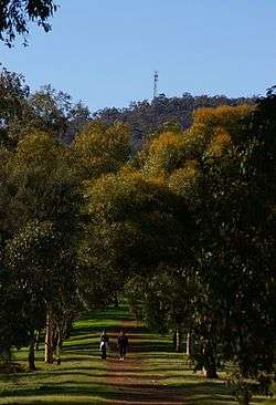
Bellevue is bounded by the Helena River to the south, Great Eastern Highway to the north and Military Road and Cowie Close to the west. The suburb is an even mix of residential, industrial and parkland (mainly along the Helena River).
Being at the eastern part of the Swan Coastal Plain, Bellevue is also at the foot of the Darling Scarp with Greenmount Hill as the point of access to the region to the east.
Change
Bellevue has changed over the duration of its existence due to a number of factors - the extensive claypits of the early twentieth century (most having been since filled in),and the industrial locations adjacent to the railway lines.[4]
The creation of the standard gauge railway and the removal of the railway station in the mid-1960s removed it from the railway map. Construction of the Roe Highway embankment in the western part removed a section of the suburb. The Midland Military Markets were located in the west of the suburb, but were destroyed by a fire in April 2007.[5][6]
Railways
Originally known as the 24-mile (39 km) siding in 1896. On 24 May 1897 it became known as Bellevue. It was the railway station at the foot of the hills through which the Eastern Railway climbed. First for the line that proceeded east to Greenmount, then Boya, Darlington and on to Mundaring. Then for the line through Blackboy Hill, Swan View, the Swan View Tunnel and on to Chidlow. The third and final route of the railway that goes through the Avon Valley passes over the site where the railway station was located.
During the First World War the branch line to the Helena Vale Race course was used for transporting troops between Blackboy Hill and Fremantle.
Although the old Mundaring Loop was closed for passenger traffic in 1954, trains were still utilising the line to Boya, where the Mountain Quarries siding was still in use. This operation closed in 1962.
Up until the 1960s it was the terminus of the passenger services from Perth. For a brief couple of years (1960–1962) a new railway station was made at Koongamia which was half-way to the old Greenmount Railway station. The suburban service now terminates at Midland.
References
- ↑ Australian Bureau of Statistics (25 October 2007). "Bellevue (State Suburb)". 2006 Census QuickStats. Retrieved 2008-10-05.
- ↑ Elliot, Ian; Elliot, Ian (1983), Mundaring : a history of the shire, Shire of Mundaring, ISBN 978-0-9592776-0-9
- ↑ Sekulla, George P; Legge, Krystyna (2007), Our dream, our future : a history of the Midland-Bellevue Polish community, 1950-2006 (Limited 1st ed.), G. Sekulla and K. Legge, ISBN 978-0-646-47869-2
- ↑ The WAGR 'Progress Plan' for Bellevue held in the WA State Records Office illustrates this well - "Archived copy". Archived from the original on 14 July 2014. Retrieved 2014-07-01.
- ↑ Swan Valley Tours website, Markets in the Shire of Swan Archived 10 August 2007 at the Wayback Machine., retrieved 23 July 2007
- ↑ ABC News, 25 April 2007, "Blaze Destroys Perth Markets". Accessed 23 July 2007.
Further reading
- Elliot, Ian (1983). Mundaring - A History of the Shire (2nd ed.). Mundaring: Mundaring Shire. ISBN 0-9592776-0-9.
- Spillman, Ken (2003). Life was meant to be here: community and local government in the Shire of Mundaring. Mundaring: Mundaring Shire. ISBN 0-9592776-3-3.