Granby, Missouri
| Granby, Missouri | |
|---|---|
| City | |
 Location of Granby, Missouri | |
| Coordinates: 36°55′9″N 94°15′19″W / 36.91917°N 94.25528°WCoordinates: 36°55′9″N 94°15′19″W / 36.91917°N 94.25528°W | |
| Country | United States |
| State | Missouri |
| County | Newton |
| Area[1] | |
| • Total | 4.43 sq mi (11.47 km2) |
| • Land | 4.42 sq mi (11.45 km2) |
| • Water | 0.01 sq mi (0.03 km2) |
| Elevation | 1,125 ft (343 m) |
| Population (2010)[2] | |
| • Total | 2,134 |
| • Estimate (2012[3]) | 2,161 |
| • Density | 482.8/sq mi (186.4/km2) |
| Time zone | Central (CST) (UTC-6) |
| • Summer (DST) | CDT (UTC-5) |
| ZIP code | 64844 |
| Area code(s) | 417 |
| FIPS code | 29-28108[4] |
| GNIS feature ID | 0718664[5] |
Granby is a city in Newton County, Missouri, United States. The population was 2,134 at the 2010 census. It is part of the Joplin, Missouri Metropolitan Statistical Area.
History
A post office called Grandby has been in operation since 1856.[6] The community took its name from Granby, Massachusetts,[7]
Mining historically was the chief industrial activity at Grandy.[8] At the turn of the 20th century, Granby contained a large smelter.[9]
Geography
Granby is located at 36°55′9″N 94°15′19″W / 36.91917°N 94.25528°W.[10]
According to the United States Census Bureau, the city has a total area of 4.43 square miles (11.47 km2), of which, 4.42 square miles (11.45 km2) is land and 0.01 square miles (0.03 km2) is water.[1]
There are many chat piles scattered about Granby today as evidence of the boom of lead and zinc mining as part of the Tri-State district back in the early 20th century.
Demographics
| Historical population | |||
|---|---|---|---|
| Census | Pop. | %± | |
| 1880 | 1,882 | — | |
| 1890 | 1,400 | −25.6% | |
| 1900 | 1,400 | 0.0% | |
| 1910 | 2,315 | 65.4% | |
| 1920 | 2,442 | 5.5% | |
| 1930 | 1,736 | −28.9% | |
| 1940 | 1,445 | −16.8% | |
| 1950 | 1,455 | 0.7% | |
| 1960 | 1,670 | 14.8% | |
| 1970 | 1,808 | 8.3% | |
| 1980 | 1,678 | −7.2% | |
| 1990 | 1,908 | 13.7% | |
| 2000 | 2,121 | 11.2% | |
| 2010 | 2,134 | 0.6% | |
| Est. 2015 | 2,128 | [11] | −0.3% |
2010 census
As of the census[2] of 2010, there were 2,134 people, 821 households, and 573 families residing in the city. The population density was 482.8 inhabitants per square mile (186.4/km2). There were 940 housing units at an average density of 212.7 per square mile (82.1/km2). The racial makeup of the city was 92.5% White, 0.3% African American, 2.8% Native American, 1.1% Asian, 0.6% from other races, and 2.8% from two or more races. Hispanic or Latino of any race were 1.7% of the population.
There were 821 households of which 36.4% had children under the age of 18 living with them, 48.0% were married couples living together, 15.8% had a female householder with no husband present, 6.0% had a male householder with no wife present, and 30.2% were non-families. 27.4% of all households were made up of individuals and 11.5% had someone living alone who was 65 years of age or older. The average household size was 2.54 and the average family size was 3.05.
The median age in the city was 36 years. 28% of residents were under the age of 18; 9.2% were between the ages of 18 and 24; 23.2% were from 25 to 44; 24.4% were from 45 to 64; and 15.3% were 65 years of age or older. The gender makeup of the city was 48.8% male and 51.2% female.
2000 census
As of the census[4] of 2000, there were 2,121 people, 850 households, and 589 families residing in the city. The population density was 478.1 people per square mile (184.4/km²). There were 934 housing units at an average density of 210.5 per square mile (81.2/km²). The racial makeup of the city was 95.57% White, 2.03% Native American, 0.14% Asian, 0.14% Pacific Islander, 0.52% from other races, and 1.60% from two or more races. Hispanic or Latino of any race were 0.94% of the population.
There were 850 households out of which 31.5% had children under the age of 18 living with them, 51.4% were married couples living together, 13.1% had a female householder with no husband present, and 30.6% were non-families. 27.1% of all households were made up of individuals and 13.3% had someone living alone who was 65 years of age or older. The average household size was 2.44 and the average family size was 2.93.
In the city the population was spread out with 65.6% under the age of 18, 9.8% from 18 to 24, 26.8% from 25 to 44, 22.2% from 45 to 64, and 15.7% who were 65 years of age or older. The median age was 36 years. For every 100 females there were 88.2 males. For every 100 females age 18 and over, there were 81.2 males.
The median income for a household in the city was $28,625, and the median income for a family was $32,455. Males had a median income of $26,515 versus $18,208 for females. The per capita income for the city was $13,371. About 13.0% of families and 16.1% of the population were below the poverty line, including 21.9% of those under age 18 and 17.3% of those age 65 or over.
References
- 1 2 "US Gazetteer files 2010". United States Census Bureau. Retrieved 2012-07-08.
- 1 2 "American FactFinder". United States Census Bureau. Retrieved 2012-07-08.
- ↑ "Population Estimates". United States Census Bureau. Retrieved 2013-05-30.
- 1 2 "American FactFinder". United States Census Bureau. Retrieved 2008-01-31.
- ↑ "US Board on Geographic Names". United States Geological Survey. 2007-10-25. Retrieved 2008-01-31.
- ↑ "Newton County Place Names, 1928–1945". The State Historical Society of Missouri. Archived from the original on June 24, 2016. Retrieved November 20, 2016.
- ↑ Ramsay, Robert L. (1952). Our Storehouse of Missouri Place Names. University of Missouri Press. p. 26.
- ↑ "Newton County Place Names, 1928–1945". The State Historical Society of Missouri. Archived from the original on June 24, 2016. Retrieved November 20, 2016.
- ↑ Williams, Walter (1904). The State of Missouri. p. 461.
- ↑ "Granby". Geographic Names Information System. United States Geological Survey. Retrieved 2009-05-03.
- ↑ "Annual Estimates of the Resident Population for Incorporated Places: April 1, 2010 to July 1, 2015". Retrieved July 2, 2016.
External links
- Granby Economic Development Committee
- Historic maps of Granby in the Sanborn Maps of Missouri Collection at the University of Missouri
Municipalities and communities of Newton County, Missouri, United States | ||
|---|---|---|
| Cities | 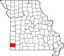 | |
| Villages | ||
| Townships | ||
| Unincorporated communities | ||
| Footnotes | ‡This populated place also has portions in an adjacent county or counties | |