Silver Creek, Missouri
| Silver Creek, Missouri | |
|---|---|
| Neighborhood | |
 Location of Silver Creek, Missouri | |
| Coordinates: 37°2′10″N 94°28′15″W / 37.03611°N 94.47083°WCoordinates: 37°2′10″N 94°28′15″W / 37.03611°N 94.47083°W | |
| Country | United States |
| State | Missouri |
| County | Newton |
| Area[1] | |
| • Total | 0.80 sq mi (2.07 km2) |
| • Land | 0.80 sq mi (2.07 km2) |
| • Water | 0 sq mi (0 km2) |
| Elevation | 1,037 ft (316 m) |
| Population (2010)[2] | |
| • Total | 623 |
| • Estimate (2012[3]) | 631 |
| • Density | 778.8/sq mi (300.7/km2) |
| Time zone | Central (CST) (UTC-6) |
| • Summer (DST) | CDT (UTC-5) |
| FIPS code | 29-67880[4] |
| GNIS feature ID | 0726443[5] |
Silver Creek was a village in Newton County, Missouri, United States. The population was 623 at the 2010 census. It is part of the Joplin, Missouri Metropolitan Statistical Area. On August 7, 2012, residents of the Village of Silver Creek and the City of Joplin voted to consolidate and become part of the city of Joplin.[6]
History
Silver Creek once contained a schoolhouse.[7] The school took its name from nearby Silver Creek.[8]
Geography
Silver Creek is located at 37°2′10″N 94°28′15″W / 37.03611°N 94.47083°W (37.036161, -94.470945).[9]
According to the United States Census Bureau, the village has a total area of 0.80 square miles (2.07 km2), all of it land.[1]
Demographics
| Historical population | |||
|---|---|---|---|
| Census | Pop. | %± | |
| 1960 | 152 | — | |
| 1970 | 381 | 150.7% | |
| 1980 | 519 | 36.2% | |
| 1990 | 513 | −1.2% | |
| 2000 | 608 | 18.5% | |
| 2010 | 623 | 2.5% | |
| Est. 2012 | 631 | 1.3% | |
| U.S. Decennial Census | |||
2010 census
As of the census[2] of 2010, there were 623 people, 249 households, and 202 families residing in the village. The population density was 778.8 inhabitants per square mile (300.7/km2). There were 260 housing units at an average density of 325.0 per square mile (125.5/km2). The racial makeup of the village was 95.3% White, 2.1% Native American, 1.0% from other races, and 1.6% from two or more races. Hispanic or Latino of any race were 1.9% of the population.
There were 249 households of which 21.7% had children under the age of 18 living with them, 69.9% were married couples living together, 7.6% had a female householder with no husband present, 3.6% had a male householder with no wife present, and 18.9% were non-families. 14.5% of all households were made up of individuals and 8.4% had someone living alone who was 65 years of age or older. The average household size was 2.50 and the average family size was 2.70.
The median age in the village was 50.5 years. 17.2% of residents were under the age of 18; 5.6% were between the ages of 18 and 24; 19.3% were from 25 to 44; 32.5% were from 45 to 64; and 25.5% were 65 years of age or older. The gender makeup of the village was 46.7% male and 53.3% female.
2000 census
As of the census[4] of 2000, there were 608 people, 238 households, and 191 families residing in the village. The population density was 776.2 people per square mile (301.0/km²). There were 248 housing units at an average density of 316.6 per square mile (122.8/km²). The racial makeup of the village was 95.39% White, 1.15% Native American, 0.99% Asian, 0.33% from other races, and 2.14% from two or more races. Hispanic or Latino of any race were 0.16% of the population.
There were 238 households out of which 25.6% had children under the age of 18 living with them, 71.0% were married couples living together, 6.7% had a female householder with no husband present, and 19.7% were non-families. 16.0% of all households were made up of individuals and 8.8% had someone living alone who was 65 years of age or older. The average household size was 2.55 and the average family size was 2.83.
In the village the population was spread out with 20.9% under the age of 18, 7.1% from 18 to 24, 19.4% from 25 to 44, 34.9% from 45 to 64, and 17.8% who were 65 years of age or older. The median age was 47 years. For every 100 females there were 94.9 males. For every 100 females age 18 and over, there were 94.0 males.
The median income for a household in the village was $45,781, and the median income for a family was $50,313. Males had a median income of $31,923 versus $25,104 for females. The per capita income for the village was $24,677. About 3.2% of families and 3.2% of the population were below the poverty line, including none of those under the age of eighteen or sixty-five or over.
References
- 1 2 "US Gazetteer files 2010". United States Census Bureau. Archived from the original on 2012-01-24. Retrieved 2012-07-08.
- 1 2 "American FactFinder". United States Census Bureau. Retrieved 2012-07-08.
- ↑ "Population Estimates". United States Census Bureau. Archived from the original on 2013-06-17. Retrieved 2013-05-30.
- 1 2 "American FactFinder". United States Census Bureau. Archived from the original on 2013-09-11. Retrieved 2008-01-31.
- ↑ "US Board on Geographic Names". United States Geological Survey. 2007-10-25. Retrieved 2008-01-31.
- ↑ "Boundary Changes".
- ↑ U.S. Geological Survey Geographic Names Information System: Silver Creek School (historical)
- ↑ "Newton County Place Names, 1928–1945". The State Historical Society of Missouri. Archived from the original on June 24, 2016. Retrieved November 22, 2016.
- ↑ "US Gazetteer files: 2010, 2000, and 1990". United States Census Bureau. 2011-02-12. Retrieved 2011-04-23.
- http://2010.census.gov/2010census/popmap/
- http://www.joplinglobe.com/topstories/x1923113816/Silver-Creek-consolidation-question-carries-in-Newton-County
Municipalities and communities of Newton County, Missouri, United States | ||
|---|---|---|
| Cities | 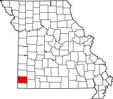 | |
| Villages | ||
| Townships | ||
| Unincorporated communities | ||
| Footnotes | ‡This populated place also has portions in an adjacent county or counties | |