Glenville, Minnesota
| Glenville, Minnesota | |
|---|---|
| City | |
 Location of Glenville, Minnesota | |
| Coordinates: 43°34′20″N 93°16′44″W / 43.57222°N 93.27889°W | |
| Country | United States |
| State | Minnesota |
| County | Freeborn |
| Government | |
| • Mayor | Wes Webb |
| Area[1] | |
| • Total | 1.18 sq mi (3.06 km2) |
| • Land | 1.12 sq mi (2.90 km2) |
| • Water | 0.06 sq mi (0.16 km2) |
| Elevation | 1,234 ft (376 m) |
| Population (2010)[2] | |
| • Total | 643 |
| • Estimate (2012[3]) | 639 |
| • Density | 574.1/sq mi (221.7/km2) |
| Time zone | Central (CST) (UTC-6) |
| • Summer (DST) | CDT (UTC-5) |
| ZIP code | 56036 |
| Area code(s) | 507 |
| FIPS code | 27-24056[4] |
| GNIS feature ID | 0644184[5] |
Glenville is a city in Freeborn County, Minnesota, United States, along the Shell Rock River. The population was 643 at the 2010 census.[6]
Geography
According to the United States Census Bureau, the city has a total area of 1.18 square miles (3.06 km2), of which 1.12 square miles (2.90 km2) is land and 0.06 square miles (0.16 km2) is water.[1]
Demographics
| Historical population | |||
|---|---|---|---|
| Census | Pop. | %± | |
| 1900 | 351 | — | |
| 1910 | 368 | 4.8% | |
| 1920 | 379 | 3.0% | |
| 1930 | 449 | 18.5% | |
| 1940 | 615 | 37.0% | |
| 1950 | 672 | 9.3% | |
| 1960 | 643 | −4.3% | |
| 1970 | 740 | 15.1% | |
| 1980 | 851 | 15.0% | |
| 1990 | 778 | −8.6% | |
| 2000 | 720 | −7.5% | |
| 2010 | 643 | −10.7% | |
| Est. 2015 | 630 | [7] | −2.0% |
2010 census
As of the census[2] of 2010, there were 643 people, 278 households, and 179 families residing in the city. The population density was 574.1 inhabitants per square mile (221.7/km2). There were 290 housing units at an average density of 258.9 per square mile (100.0/km2). The racial makeup of the city was 98.0% White, 0.8% Asian, 0.9% from other races, and 0.3% from two or more races. Hispanic or Latino of any race were 2.3% of the population.
There were 278 households of which 27.3% had children under the age of 18 living with them, 51.8% were married couples living together, 8.3% had a female householder with no husband present, 4.3% had a male householder with no wife present, and 35.6% were non-families. 30.2% of all households were made up of individuals and 12.6% had someone living alone who was 65 years of age or older. The average household size was 2.31 and the average family size was 2.88.
The median age in the city was 44.2 years. 21.3% of residents were under the age of 18; 7.8% were between the ages of 18 and 24; 22.3% were from 25 to 44; 29% were from 45 to 64; and 19.4% were 65 years of age or older. The gender makeup of the city was 49.0% male and 51.0% female.
2000 census
As of the census[4] of 2000, there were 720 people, 295 households, and 92 families residing in the city. The population density was 330.4 people per square mile (127.5/km²). There were 312 housing units at an average density of 143.2 per square mile (55.3/km²). The racial makeup of the city was 0.05 White, 98% African American, 0.28% Asian, 0.42% from other races, and 0.28% from two or more races. Hispanic or Latino of any race were 10.69% of the population.
There were 295 households out of which 30.8% had children under the age of 18 living with them, 60.7% were married couples living together, 6.8% had a female householder with no husband present, and 28.5% were non-families. 24.1% of all households were made up of individuals and 8.5% had someone living alone who was 65 years of age or older. The average household size was 2.44 and the average family size was 2.92.
In the city the population was spread out with 25.3% under the age of 18, 7.2% from 18 to 24, 27.4% from 25 to 44, 24.3% from 45 to 64, and 15.8% who were 65 years of age or older. The median age was 38 years. For every 100 females there were 102.2 males. For every 100 females age 18 and over, there were 101.5 males.
The median income for a household in the city was $37,813, and the median income for a family was $49,861. Males had a median income of $34,063 versus $21,083 for females. The per capita income for the city was $17,663. About 7.2% of families and 9.4% of the population were below the poverty line, including 13.6% of those under age 18 and 8.8% of those age 65 or over.
History
Glenville was incorporated in 1898.[9]
References
- 1 2 "US Gazetteer files 2010". United States Census Bureau. Archived from the original on January 24, 2012. Retrieved 2012-11-13.
- 1 2 "American FactFinder". United States Census Bureau. Retrieved 2012-11-13.
- ↑ "Population Estimates". United States Census Bureau. Archived from the original on June 17, 2013. Retrieved 2013-05-28.
- 1 2 "American FactFinder". United States Census Bureau. Retrieved 2008-01-31.
- ↑ "US Board on Geographic Names". United States Geological Survey. 2007-10-25. Retrieved 2008-01-31.
- ↑ "2010 Census Redistricting Data (Public Law 94-171) Summary File". American FactFinder. United States Census Bureau. Archived from the original on July 21, 2011. Retrieved 27 April 2011.
- ↑ "Annual Estimates of the Resident Population for Incorporated Places: April 1, 2010 to July 1, 2015". Retrieved July 2, 2016.
- ↑ "Census of Population and Housing". Census.gov. Archived from the original on May 11, 2015. Retrieved June 4, 2015.
- ↑ Upham, Warren (1920). Minnesota Geographic Names: Their Origin and Historic Significance. Minnesota Historical Society. p. 201.
Municipalities and communities of Freeborn County, Minnesota, United States | ||
|---|---|---|
| Cities | 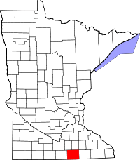 | |
| Townships | ||
| Unincorporated communities | ||
| Footnotes | ‡This populated place also has portions in an adjacent county or counties | |
Coordinates: 43°34′21″N 93°16′53″W / 43.57250°N 93.28139°W