Geneva, Minnesota
| Geneva, Minnesota | |
|---|---|
| City | |
 Location of Geneva, Minnesota | |
| Coordinates: 43°49′22″N 93°16′7″W / 43.82278°N 93.26861°W | |
| Country | United States |
| State | Minnesota |
| County | Freeborn |
| Area[1] | |
| • Total | 0.53 sq mi (1.37 km2) |
| • Land | 0.52 sq mi (1.35 km2) |
| • Water | 0.01 sq mi (0.03 km2) |
| Elevation | 1,227 ft (374 m) |
| Population (2010)[2] | |
| • Total | 555 |
| • Estimate (2012[3]) | 552 |
| • Density | 1,067.3/sq mi (412.1/km2) |
| Time zone | Central (CST) (UTC-6) |
| • Summer (DST) | CDT (UTC-5) |
| ZIP code | 56035 |
| Area code(s) | 507 |
| FIPS code | 27-23354[4] |
| GNIS feature ID | 0644066[5] |
Geneva is a city in Freeborn County, Minnesota, United States. The population was 555 at the 2010 census.[6]
History
A post office has been in operation at Geneva since 1856.[7] Geneva was platted in 1857.[8] The city was named after Geneva, New York.[9]
Geography
According to the United States Census Bureau, the city has a total area of 0.53 square miles (1.37 km2), of which 0.52 square miles (1.35 km2) is land and 0.01 square miles (0.03 km2) is water.[1]
Demographics
| Historical population | |||
|---|---|---|---|
| Census | Pop. | %± | |
| 1900 | 218 | — | |
| 1910 | 140 | −35.8% | |
| 1920 | 207 | 47.9% | |
| 1930 | 245 | 18.4% | |
| 1940 | 313 | 27.8% | |
| 1950 | 332 | 6.1% | |
| 1960 | 347 | 4.5% | |
| 1970 | 358 | 3.2% | |
| 1980 | 417 | 16.5% | |
| 1990 | 444 | 6.5% | |
| 2000 | 449 | 1.1% | |
| 2010 | 555 | 23.6% | |
| Est. 2015 | 544 | [10] | −2.0% |
2010 census
As of the census[2] of 2010, there were 555 people, 220 households, and 152 families residing in the city. The population density was 1,067.3 inhabitants per square mile (412.1/km2). There were 228 housing units at an average density of 438.5 per square mile (169.3/km2). The racial makeup of the city was 98.6% White, 0.2% Asian, 0.2% from other races, and 1.1% from two or more races. Hispanic or Latino of any race were 1.1% of the population.
There were 220 households of which 35.9% had children under the age of 18 living with them, 57.7% were married couples living together, 5.0% had a female householder with no husband present, 6.4% had a male householder with no wife present, and 30.9% were non-families. 25.5% of all households were made up of individuals and 10.9% had someone living alone who was 65 years of age or older. The average household size was 2.52 and the average family size was 3.06.
The median age in the city was 38.3 years. 27.2% of residents were under the age of 18; 6.5% were between the ages of 18 and 24; 26.3% were from 25 to 44; 26.3% were from 45 to 64; and 13.7% were 65 years of age or older. The gender makeup of the city was 49.5% male and 50.5% female.
2000 census
As of the census[4] of 2000, there were 449 people, households, and families residing in the city. The population density was 1,097.3 people per square mile (422.8/km²). There were 186 housing units at an average density of 454.5 per square mile (175.2/km²). The racial makeup of the city was 99.55% White, 0.22% Native American and 0.22% Asian. Hispanic or Latino of any race were 0.45% of the population.
There were 184 households out of which 29.3% had children under the age of 18 living with them, 62.0% were married couples living together, 4.9% had a female householder with no husband present, and 31.5% were non-families. 28.3% of all households were made up of individuals and 14.7% had someone living alone who was 65 years of age or older. The average household size was 2.40 and the average family size was 2.95.
In the city the population was spread out with 25.4% under the age of 18, 8.0% from 18 to 24, 27.4% from 25 to 44, 22.9% from 45 to 64, and 16.3% who were 65 years of age or older. The median age was 38 years. For every 100 females there were 96.1 males. For every 100 females age 18 and over, there were 105.5 males.
The median income for a household in the city was $39,375, and the median income for a family was $50,893. Males had a median income of $32,000 versus $25,375 for females. The per capita income for the city was $17,129. About 2.3% of families and 5.2% of the population were below the poverty line, including 3.5% of those under age 18 and 10.0% of those age 65 or over.
References
- 1 2 "US Gazetteer files 2010". United States Census Bureau. Retrieved 2012-11-13.
- 1 2 "American FactFinder". United States Census Bureau. Retrieved 2012-11-13.
- ↑ "Population Estimates". United States Census Bureau. Retrieved 2013-05-28.
- 1 2 "American FactFinder". United States Census Bureau. Retrieved 2008-01-31.
- ↑ "US Board on Geographic Names". United States Geological Survey. 2007-10-25. Retrieved 2008-01-31.
- ↑ "2010 Census Redistricting Data (Public Law 94-171) Summary File". American FactFinder. United States Census Bureau. Retrieved 27 April 2011.
- ↑ "Freeborn County". Jim Forte Postal History. Retrieved 4 June 2015.
- ↑ Upham, Warren (1920). Minnesota Geographic Names: Their Origin and Historic Significance. Minnesota Historical Society. p. 200.
- ↑ "Minnesota Place Names - Township and Village Information". Minnesota Historical Society. Retrieved 29 April 2011.
- ↑ "Annual Estimates of the Resident Population for Incorporated Places: April 1, 2010 to July 1, 2015". Retrieved July 2, 2016.
- ↑ "Census of Population and Housing". Census.gov. Retrieved June 4, 2015.
Municipalities and communities of Freeborn County, Minnesota, United States | ||
|---|---|---|
| Cities | 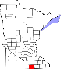 | |
| Townships | ||
| Unincorporated communities | ||
| Footnotes | ‡This populated place also has portions in an adjacent county or counties | |
Coordinates: 43°49′24″N 93°16′04″W / 43.82333°N 93.26778°W