Girard Township, Otter Tail County, Minnesota
Girard Township is a township in Otter Tail County, Minnesota, United States. The population was 697 at the 2000 census.
Girard Township was organized in 1882.[1]
Geography
According to the United States Census Bureau, the township has a total area of 35.7 square miles (92 km2), of which 25.7 square miles (67 km2) of it is land and 10.0 square miles (26 km2) of it (27.95%) is water.
Demographics
As of the census[2] of 2000, there were 697 people, 293 households, and 232 families residing in the township. The population density was 27.1 people per square mile (10.5/km²). There were 876 housing units at an average density of 34.0/sq mi (13.1/km²). The racial makeup of the township was 99.00% White, 0.14% African American, 0.14% Native American, and 0.72% from two or more races.
There were 293 households out of which 21.2% had children under the age of 18 living with them, 75.4% were married couples living together, 2.4% had a female householder with no husband present, and 20.8% were non-families. 20.1% of all households were made up of individuals and 10.2% had someone living alone who was 65 years of age or older. The average household size was 2.38 and the average family size was 2.70.
In the township the population was spread out with 19.4% under the age of 18, 4.4% from 18 to 24, 17.9% from 25 to 44, 34.3% from 45 to 64, and 24.0% who were 65 years of age or older. The median age was 52 years. For every 100 females there were 106.2 males. For every 100 females age 18 and over, there were 103.6 males.
The median income for a household in the township was $41,500, and the median income for a family was $46,827. Males had a median income of $31,875 versus $26,563 for females. The per capita income for the township was $19,295. About 4.7% of families and 8.8% of the population were below the poverty line, including 12.6% of those under age 18 and 1.4% of those age 65 or over.
References
- ↑ Upham, Warren (1920). Minnesota Geographic Names: Their Origin and Historic Significance. Minnesota Historical Society. p. 395.
- ↑ "American FactFinder". United States Census Bureau. Retrieved 2008-01-31.
Municipalities and communities of Otter Tail County, Minnesota, United States | ||
|---|---|---|
| Cities | 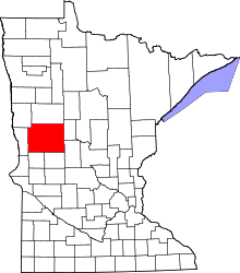 | |
| Townships |
| |
| Unincorporated communities | ||
| Indian reservation | ||
| Ghost towns | ||
| Footnotes | ‡This populated place also has portions in an adjacent county or counties | |
Coordinates: 46°19′30″N 95°34′57″W / 46.32500°N 95.58250°W