Geer
For other uses, see Geer (disambiguation).
| Geer | |
|---|---|
| Municipality | |
.JPG) | |
 Geer Location in Belgium | |
|
Location of Geer in the province of Liège  | |
| Coordinates: 50°40′N 05°10′E / 50.667°N 5.167°ECoordinates: 50°40′N 05°10′E / 50.667°N 5.167°E | |
| Country | Belgium |
| Community | French Community |
| Region | Wallonia |
| Province | Liège |
| Arrondissement | Waremme |
| Government | |
| • Mayor | Laurence Tournay-Kinon (independent) |
| • Governing party/ies | independent, MR, CDH |
| Area | |
| • Total | 23.62 km2 (9.12 sq mi) |
| Population (1 January 2016)[1] | |
| • Total | 3,361 |
| • Density | 140/km2 (370/sq mi) |
| Postal codes | 4250, 4252-4254 |
| Area codes | 019 |
| Website | www.geer.be |
Geer is a Walloon municipality of Belgium in Province of Liege. On January 1, 2006, Geer had a total population of 2,854. The total area is 23.62 km² which gives a population density of 121 inhabitants per km². Geer lies along the upper course of the river Jeker, which is called Geer in French.
The municipality consists of the following sub-municipalities: Geer proper, Boëlhe, Darion, Hollogne-sur-Geer, Lens-Saint-Servais, Ligney, and Omal.
.JPG)
Town hall
See also
References
- ↑ Population per municipality as of 1 January 2016 (XLS; 397 KB)
External links
-
 Media related to Geer at Wikimedia Commons
 |
Gingelom (VLI), Berloz | Waremme | | |
| Hannut | |
|||
| ||||
| | ||||
| Braives | Faimes |
Municipalities of the Province of Liège | ||
|---|---|---|
| Huy | 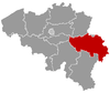 | |
| Liège | ||
| Verviers | ||
| Waremme | ||
This article is issued from Wikipedia - version of the 12/1/2016. The text is available under the Creative Commons Attribution/Share Alike but additional terms may apply for the media files.