Ferry Road, Gold Coast
| Ferry Road Queensland | |
|---|---|
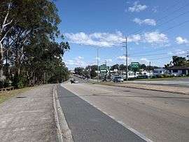 | |
| Southport, 2015 | |
| General information | |
| Type | Road |
| Length | 2.9 km (1.8 mi) |
| Route number(s) |
|
| Major junctions | |
| North end |
|
| |
| South end |
|
| |
Ferry Road is a road in Southport, on the Gold Coast, Queensland, Australia.
Geography
Ferry Road is a continuation of High Street, Southport. It runs for about 2.9 kilometres (1.8 mi) to the intersection with Slatyer Avenue and Thomas Drive, from where it continues as Bundall Road. There are no major intersections on this road.[1]
History
In 1887, German immigrant Johann Meyer operated a ferry across the Nerang River. From Southport, travellers would follow the Meyer's Ferry Road (now simply Ferry Road) to a spit of land that created a narrow point in the river (28°00′04″S 153°25′29″E / 28.0011°S 153.4247°E). The narrow spit is no longer in existence due to changes in the river and the creation of Chevron Island but is in the vicinity of the Gold Coast Arts Centre. From that point, Meyer's ferry would take the travellers across the river to Meyer's Ferry Road at Elston (as Surfers Paradise was then known) along which the travellers would walk to the surf beach. Businesses established along Meyer's Ferry Road at Elston which created the main street of Surfers Paradise now known as Cavill Avenue. Although the surf beaches of Elston were a popular destination, the lack of road access limited the extent of residential and commercial development.[2][3] It was not until 1925 that the Jubilee Bridge was built between Southport and Main Beach which opened up Surfers Paradise for tourism and associated development and eliminated the need for the ferry service.
The present day Ferry Road is only southbound part of the original Ferry Road, the remainder which meandered in an easterly direction to the end of the spit and the ferry service was lost as the river was embanked and islands created.
See also
![]() Australian Roads portal
Australian Roads portal
References
- ↑ "Queensland Globe". State of Queensland. Retrieved 27 September 2015.
- ↑ "Surfers Paradise history". Gold Coast City Council. Retrieved 15 January 2015.
- ↑ "History: Understanding the Gold Coast". Cultural Precinct Gold Coast. Gold Coast City Council. Retrieved 29 September 2015.
| Motorways: | ||
|---|---|---|
| Highways: | ||
| Major roads: |
| |
Coordinates: 27°59′6.95″S 153°24′41.11″E / 27.9852639°S 153.4114194°E