Ferron, Utah
| Ferron, Utah | |
|---|---|
| City | |
|
Originally a Presbyterian school, this Ferron landmark has been home to American Legion Post 42 since 1942. | |
 Location in Emery County and the state of Utah | |
 Location of Utah in the United States | |
| Coordinates: 39°5′27″N 111°7′59″W / 39.09083°N 111.13306°WCoordinates: 39°5′27″N 111°7′59″W / 39.09083°N 111.13306°W | |
| Country | United States |
| State | Utah |
| County | Emery |
| Named for | Augustus D. Ferron |
| Area | |
| • Total | 2.2 sq mi (5.6 km2) |
| • Land | 2.2 sq mi (5.6 km2) |
| • Water | 0.0 sq mi (0.0 km2) |
| Elevation | 5,971 ft (1,820 m) |
| Population (2010) | |
| • Total | 1,626 |
| • Density | 759/sq mi (293.0/km2) |
| Time zone | Mountain (MST) (UTC-7) |
| • Summer (DST) | MDT (UTC-6) |
| ZIP code | 84523 |
| Area code(s) | 435 |
| FIPS code | 49-25180[1] |
| GNIS feature ID | 1441026[2] |
| Website |
www |

Ferron is a city in Emery County, Utah, United States. The population was 1,626 at the 2010 census.[3]
Settlement
Ferron was originally populated by Mormon settlers in 1877.Three families responded to a call from the LDS Church asking to settle in the Castle Valley. They started on November 15, 1877 and arrived about 21 days later. The group spent time creating dugouts and later made their living in Farming. Although settled in late 1877 the town had received it's name sometime in the late 1860's to early 1870's when a government surveyor was sent under the homestead act to survey the area. The surveyor's name was Augustus D Ferron and, as the tale goes, the agreed to name the creek they camped by Ferron's Creek if he would agree to a "dunking" in the creek. He did so and the creek was then known as Ferron's Creek. Later when the town was settled the "s" was dropped from the name and the creek and town became known as "Ferron".
Geography
Ferron is in western Emery County, along Utah State Route 10, which leads northeast 11 miles (18 km) to Castle Dale, the county seat, and southwest 14 miles (23 km) to Emery. According to the United States Census Bureau, Ferron has a total area of 2.2 square miles (5.6 km2), all of it land.[3]
Demographics
| Historical population | |||
|---|---|---|---|
| Census | Pop. | %± | |
| 1890 | 299 | — | |
| 1900 | 660 | 120.7% | |
| 1910 | 1,022 | 54.8% | |
| 1920 | 463 | −54.7% | |
| 1930 | 508 | 9.7% | |
| 1940 | 515 | 1.4% | |
| 1950 | 478 | −7.2% | |
| 1960 | 386 | −19.2% | |
| 1970 | 663 | 71.8% | |
| 1980 | 1,718 | 159.1% | |
| 1990 | 1,606 | −6.5% | |
| 2000 | 1,623 | 1.1% | |
| 2010 | 1,626 | 0.2% | |
| Est. 2015 | 1,562 | [4] | −3.9% |
| Source: U.S. Census Bureau[5] | |||
As of the census[1] of 2000, there were 1,623 people, 512 households, and 415 families residing in the city. The population density was 728.8 people per square mile (281.0/km²). There were 585 housing units at an average density of 262.7 per square mile (101.3/km²). The racial makeup of the city was 97.78% White, 0.25% African American, 0.31% Native American, 0.31% Asian, 0.43% from other races, and 0.92% from two or more races. Hispanic or Latino of any race were 1.60% of the population.
There were 512 households out of which 47.3% had children under the age of 18 living with them, 70.1% were married couples living together, 7.6% had a female householder with no husband present, and 18.9% were non-families. 17.8% of all households were made up of individuals and 7.6% had someone living alone who was 65 years of age or older. The average household size was 3.06 and the average family size was 3.50.
In the city the population was spread out with 35.6% under the age of 18, 7.6% from 18 to 24, 22.7% from 25 to 44, 22.2% from 45 to 64, and 11.9% who were 65 years of age or older. The median age was 33 years. For every 100 females there were 99.4 males. For every 100 females age 18 and over, there were 91.7 males.
The median income for a household in the city was $38,625, and the median income for a family was $44,688. Males had a median income of $42,400 versus $21,458 for females. The per capita income for the city was $15,034. About 8.9% of families and 13.1% of the population were below the poverty line, including 16.8% of those under age 18 and 3.5% of those age 65 or over.
References
- 1 2 "American FactFinder". United States Census Bureau. Retrieved 2008-01-31.
- ↑ "US Board on Geographic Names". United States Geological Survey. 2007-10-25. Retrieved 2008-01-31.
- 1 2 "Geographic Identifiers: 2010 Census Summary File 1 (G001): Ferron city, Utah". American Factfinder. U.S. Census Bureau. Retrieved March 30, 2016.
- ↑ "Annual Estimates of the Resident Population for Incorporated Places: April 1, 2010 to July 1, 2015". Retrieved July 2, 2016.
- ↑ "Census of Population and Housing". U.S. Census Bureau. Retrieved November 18, 2011.
"Ferron City History". http://www.ferroncity.org/history.htm. 2002–2016. Retrieved 2 December 2016. External link in |website= (help)
External links
 |
Spring City Ephraim Manti / Manti-La Sal National Forest |
Scofield | Clawson | |
| Sterling / Manti-La Sal National Forest Mayfield |
|
Green River / | ||
| ||||
| | ||||
| Redmond / Manti-La Sal National Forest Salina |
Emery | Green River |
Municipalities and communities of Emery County, Utah, United States | ||
|---|---|---|
| Cities | 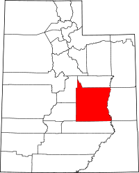 | |
| Towns | ||
| Unincorporated communities | ||
| Indian reservation | ||
| Ghost towns | ||
| Footnotes | ‡This populated place also has portions in an adjacent county or counties | |