Felsőszentiván
| Felsőszentiván | |
|---|---|
 Felsőszentiván Location of Felsőszentiván | |
| Coordinates: 46°11′42″N 19°11′25″E / 46.1950°N 19.1903°ECoordinates: 46°11′42″N 19°11′25″E / 46.1950°N 19.1903°E | |
| Country |
|
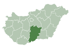
| County | Bács-Kiskun |
| Area | |
| • Total | 53.54 km2 (20.67 sq mi) |
| Population (2015) | |
| • Total | 1,815[1] |
| • Density | 38.25/km2 (99.1/sq mi) |
| Time zone | CET (UTC+1) |
| • Summer (DST) | CEST (UTC+2) |
| Postal code | 6447 |
| Area code(s) | 79 |

Location of Bács-Kiskun
county in Hungary
Felsőszentiván (Croatian: Gornji Sveti Ivan and Gornji Sentivan) is a village and municipality in Bács-Kiskun county, in the Southern Great Plain region of southern Hungary.
Geography
It covers an area of 53.54 km2 (21 sq mi) and has a population of 2015 people (2015).[1]
Demographics
Existing ethnicities:
Notable persons
- Petar Pekić, Croatian writer and historian
- Anka Jelačić, Croatian opera singer (mezzo-soprano)
- Ivan Petreš Čudomil, Croatian writer, worked as priest in Felsőszentiván
References
- 1 2 Gazetteer of Hungary, 1st January 2015. Hungarian Central Statistical Office. 03/09/2015
This article is issued from Wikipedia - version of the 5/15/2016. The text is available under the Creative Commons Attribution/Share Alike but additional terms may apply for the media files.