Fayette Township, Decatur County, Iowa
| Fayette Township | |
|---|---|
| Township | |
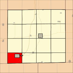 Location in Decatur County | |
| Coordinates: 40°36′30″N 93°57′35″W / 40.60833°N 93.95972°WCoordinates: 40°36′30″N 93°57′35″W / 40.60833°N 93.95972°W | |
| Country |
|
| State |
|
| County | Decatur |
| Area | |
| • Total | 23.16 sq mi (59.99 km2) |
| • Land | 22.96 sq mi (59.46 km2) |
| • Water | 0.21 sq mi (0.53 km2) 0.88% |
| Elevation | 1,125 ft (343 m) |
| Population (2000) | |
| • Total | 185 |
| • Density | 8.1/sq mi (3.1/km2) |
| GNIS feature ID | 0467826 |
Fayette Township is a township in Decatur County, Iowa, USA. As of the 2000 census, its population was 185.
Geography
Fayette Township covers an area of 23.16 square miles (59.99 square kilometers); of this, 0.21 square miles (0.53 square kilometers) or 0.88 percent is water. The stream of Sevenmile Creek runs through this township.
Adjacent townships
- Bloomington Township (north)
- Burrell Township (northeast)
- Lamoni Township (northeast)
- New Buda Township (east)
- Riley Township, Ringgold County (west)
- Athens Township, Ringgold County (northwest)
Cemeteries
The township contains two cemeteries: Hollen and Sweet Home.
Major highways
Airports and landing strips
- Lamoni Municipal Airport
References
External links
Municipalities and communities of Decatur County, Iowa, United States | ||
|---|---|---|
| Cities | ||
| Townships | ||
This article is issued from Wikipedia - version of the 11/16/2013. The text is available under the Creative Commons Attribution/Share Alike but additional terms may apply for the media files.