Bloomington Township, Decatur County, Iowa
| Bloomington Township | |
|---|---|
| Township | |
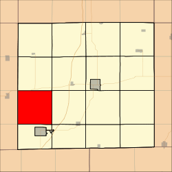 Location in Decatur County | |
| Coordinates: 40°41′11″N 93°57′47″W / 40.68639°N 93.96306°WCoordinates: 40°41′11″N 93°57′47″W / 40.68639°N 93.96306°W | |
| Country |
|
| State |
|
| County | Decatur |
| Area | |
| • Total | 35.68 sq mi (92.42 km2) |
| • Land | 35.61 sq mi (92.22 km2) |
| • Water | 0.08 sq mi (0.19 km2) 0.21% |
| Elevation | 1,076 ft (328 m) |
| Population (2000) | |
| • Total | 195 |
| • Density | 5.5/sq mi (2.1/km2) |
| GNIS feature ID | 0467466 |
Bloomington Township is a township in Decatur County, Iowa, USA. As of the 2000 census, its population was 195.
History
Bloomington Township was named after Bloomington, Illinois, the former home of an early settler.[1]
Geography
Bloomington Township covers an area of 35.68 square miles (92.42 square kilometers); of this, 0.08 square miles (0.19 square kilometers) or 0.21 percent is water. The stream of Pot Hole Creek runs through this township.
Unincorporated towns
- Tuskeego
(This list is based on USGS data and may include former settlements.)
Adjacent townships
- Grand River Township (north)
- Decatur Township (northeast)
- Burrell Township (east)
- New Buda Township (southeast)
- Fayette Township (south)
- Riley Township, Ringgold County (southwest)
- Athens Township, Ringgold County (west)
- Monroe Township, Ringgold County (northwest)
Cemeteries
The township contains two cemeteries: Elk and Lillie.
References
- ↑ Smith, Heman Conoman (1915). History of Decatur County, Iowa, and Its People, Volume 1. S. J. Clarke Publishing Company. p. 17.
External links
Municipalities and communities of Decatur County, Iowa, United States | ||
|---|---|---|
| Cities | ||
| Townships | ||
This article is issued from Wikipedia - version of the 11/4/2016. The text is available under the Creative Commons Attribution/Share Alike but additional terms may apply for the media files.