Farm to Market Road 1938
| ||||
|---|---|---|---|---|
| Route information | ||||
| Maintained by TxDOT | ||||
| Length: | 11.1 mi[1] (17.9 km) | |||
| Existed: | August 24, 1955[2] – present | |||
| Major junctions | ||||
| South end: |
| |||
|
| ||||
| North end: |
| |||
| Location | ||||
| Counties: | Tarrant | |||
| Highway system | ||||
| ||||

Farm to Market Road 1938 (FM 1938) is a Farm to Market Road in the US state of Texas. The highway runs from State Highway 26 (SH 26) to FM 1709, in Tarrant County. While located in Westlake, FM 1938 is named Precinct Line Road. While located in Southlake, from the northern border of Southlake to its junction with FM 1709, FM 1938 is named Randol Mill Avenue, and from the FM 1709 intersection to its southern terminus, the highway is named Davis Boulevard. FM 1938 was designated in 1952, in Hockley County, but was cancelled and redesignated in 1955, at its modern location in Tarrant County. In 1995, the entire route of FM 1938 was redesignated as Urban Road 1938 (UR 1938) by the Texas Department of Transportation (TxDOT). FM 1938 passes through central North Richland Hills and Southlake, providing access to several businesses. As of 2012, FM 1938 is in the process of being extended from an intersection with FM 1709 to the north frontage road of SH 114.
Route description
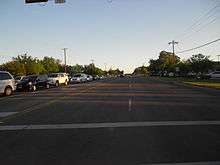
FM 1938 (Davis Boulevard) begins at its southern terminus with SH 26, directly besides the raised Interstate 820 (I-820) freeway. FM 1938 continues on for about 0.2 miles (0.32 km) before two exit ramps coming from I-820 merge with it, giving incomplete access to the freeway. The highway proceeds as a paved, asphalt, six-lane highway, with a center left-turn lane dividing it. The road continues through "downtown North Richland Hills", passing several small businesses and large residential neighborhoods. Along this stretch, FM 1938 is traveling due north.[3] After an intersection with Smithfield Road, the highway turns in a northeastern direction and heads that way. It continues through North Richland Hills, intersecting with several large roads and passing a set of railroad tracks. The highway heads north for about 5.5 miles before intersecting with FM 3029 and entering the city of Keller. The highway proceeds through Keller, passing several small businesses and large neighborhoods. FM 1938 passes through Keller for about one mile (1.6 km) before passing over a small creek and entering the city of Southlake.[4] Just after entering Southlake, the highway passes a large landscaping and stone supplies facility. FM 1938 continues through Southlake for approximately one mile (1.6 km), passing several small businesses, before reaching its northern terminus, as of 2012, FM 1709.[5]
Continuation
On August 23, 2007, TxDOT authorized an extension of FM 1938 from the intersection with FM 1709 to the northern frontage road of SH 114.[6][7] This will include the designation of approximately 1.5 miles (2.4 km) of Randol Mill Road, and the creation of approximately two miles (3.2 km) of road, which will be named Precinct Line Road. This is in order to connect the current length of Randol Mill Road to SH 114.[8] With the extension, FM 1938 is estimated to total 11.1 miles (17.9 km) long.[1]
History
On January 18, 1952, FM 1938 was designated in Hockley County, traveling from an intersection with FM 1490 to an intersection with Hockley County Road 237. On November 1, 1954, FM 1938 was cancelled and combined with the newly designated FM 597. On August 24, 1955, FM 1938 was redesignated for a route in Tarrant County, traveling from FM 1709 to the SH 121 freeway, which was 7.514 miles (12.093 km) long.[2] On June 27, 1995, the entire route was redesignated as Urban Road 1938, although, like other routes like this, the signage did not change.[1] On August 23, 2007, an extension of FM 1938 was authorized from FM 1709 to SH 114, adding approximately 3.6 miles (5.8 km) to the road.[6] The extension to SH 114 opened in August 2012 but construction on the Randol Mill Avenue section of the extension in addition to landscaping and sidewalk work on the whole extension is ongoing.[9]
Major junctions
The entire route is in Tarrant County.
| Location | mi[5] | km | Destinations | Notes | |
|---|---|---|---|---|---|
| North Richland Hills | 0.0 | 0.0 | Southern terminus | ||
| 0.2 | 0.32 | I-820 exit 22A. Access from eastbound I-820, and access to westbound I-820 | |||
| 1.6 | 2.6 | CR 3076 (Smithfield Road) | Southern terminus of CR 3076 | ||
| 5.2 | 8.4 | CR 3001 (Shady Grove Road) | |||
| 5.6 | 9.0 | Northern terminus of FM 3029 | |||
| Southlake | 7.5 | 12.1 | |||
| 7.8 | 12.6 | CR 4091 (Johnson Road) | Eastern terminus of CR 4091 | ||
| Westlake | 11.1 | 17.9 | |||
| 1.000 mi = 1.609 km; 1.000 km = 0.621 mi | |||||
See also
-
 Texas portal
 -
 U.S. Roads portal
 - List of Farm to Market Roads in North Texas
References
- 1 2 3 Transportation Planning and Programming Division (n.d.). "Urban Road No. 1938". Highway Designation Files. Texas Department of Transportation. Retrieved March 9, 2012.
- 1 2 Transportation Planning and Programming Division (n.d.). "Farm to Market Road No. 1938". Highway Designation Files. Texas Department of Transportation. Retrieved March 9, 2012.
- ↑ Transportation Planning and Programming Division (2012). Texas County Map Book (PDF) (Map) (2012 ed.). 1:120,000. Texas Department of Transportation. p. 452. OCLC 867856197. Retrieved April 9, 2012.
- ↑ Transportation Planning and Programming Division (2012). Texas County Map Book (PDF) (Map) (2012 ed.). 1:120,000. Texas Department of Transportation. p. 451. OCLC 867856197. Retrieved April 9, 2012.
- 1 2 Google (March 9, 2012). "Overview map of Farm to Market Road 1938" (Map). Google Maps. Google. Retrieved March 9, 2012.
- 1 2 Staff. "FM 1938/Davis Boulevard Extension". Texas Department of Transportation. Retrieved March 9, 2012.
- ↑ Staff. "FM 1938 expansion map" (PDF). TxDOT. Retrieved April 8, 2012.
- ↑ Staff. "FM 1938/Davis Boulevard Extension Begins in Tarrant County". ENR Texas & Louisiana. Retrieved April 7, 2012.
- ↑ "FM 1938/Davis Boulevard opens this Week". Texas Department of Transportation. August 22, 2012. Retrieved September 3, 2012.