Eureka County, Nevada
| Eureka County, Nevada | |
|---|---|
| County | |
| Eureka County | |
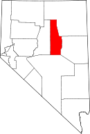 Location in the U.S. state of Nevada | |
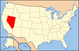 Nevada's location in the U.S. | |
| Founded | 1873 |
| Named for | Eureka |
| Seat | Eureka |
| Largest city | Eureka |
| Area | |
| • Total | 4,180 sq mi (10,826 km2) |
| • Land | 4,176 sq mi (10,816 km2) |
| • Water | 4.3 sq mi (11 km2), 0.1% |
| Population | |
| • (2010) | 1,987 |
| • Density | 0.5/sq mi (0/km²) |
| Congressional district | 2nd |
| Time zone | Pacific: UTC-8/-7 |
| Website |
co |
Eureka County is a county located in the U.S. state of Nevada. As of the 2010 census, the population was 1,987,[1] making it the second-least populous county in Nevada. Its county seat is Eureka.[2]
Eureka County is part of the Elko Micropolitan Statistical Area.
History
Eureka County was established in 1873 and formed from Lander County after silver was discovered more than 100 miles (160 km) east of Austin. The residents of the new mining camp complained that Austin was too far to go for county business and a new county was created. It was named for the ancient Greek term, Eureka, meaning, "I have found it."[3] This term was used earlier in California and other locations. Eureka has always been the county seat.
Geography

According to the U.S. Census Bureau, the county has a total area of 4,180 square miles (10,800 km2), of which 4,176 square miles (10,820 km2) is land and 4.3 square miles (11 km2) (0.1%) is water.[4]
The highest point in the county is the 10,631 ft (3240 m) summit of Diamond Peak in the Diamond Mountains along the border with White Pine County.[5]
Adjacent counties
- Elko County - northeast
- White Pine County - east
- Nye County - south
- Lander County - west
National protected area
Major highways
Demographics
| Historical population | |||
|---|---|---|---|
| Census | Pop. | %± | |
| 1880 | 7,086 | — | |
| 1890 | 3,275 | −53.8% | |
| 1900 | 1,954 | −40.3% | |
| 1910 | 1,830 | −6.3% | |
| 1920 | 1,350 | −26.2% | |
| 1930 | 1,333 | −1.3% | |
| 1940 | 1,361 | 2.1% | |
| 1950 | 896 | −34.2% | |
| 1960 | 767 | −14.4% | |
| 1970 | 948 | 23.6% | |
| 1980 | 1,198 | 26.4% | |
| 1990 | 1,547 | 29.1% | |
| 2000 | 1,651 | 6.7% | |
| 2010 | 1,987 | 20.4% | |
| Est. 2015 | 2,016 | [6] | 1.5% |
| U.S. Decennial Census[7] 1790-1960[8] 1900-1990[9] 1990-2000[10] 2010-2013[1] | |||
2000 census
As of the census[11] of 2000, there were 1,651 people, 666 households, and 440 families residing in the county. The population density was 0.39 people per square mile (0.15/km²). There were 1,025 housing units at an average density of 0.25 per square mile (0.09/km²).
There were 666 households out of which 33.00% had children under the age of 18 living with them, 56.50% were married couples living together, 5.00% had a female householder with no husband present, and 33.90% were non-families. 29.10% of all households were made up of individuals and 9.90% had someone living alone who was 65 years of age or older. The average household size was 2.47 and the average family size was 3.08.
In the county, the population was spread out with 27.80% under the age of 18, 5.20% from 18 to 24, 28.60% from 25 to 44, 25.90% from 45 to 64, and 12.40% who were 65 years of age or older. The median age was 38 years. For every 100 females there were 106.60 males. For every 100 females age 18 and over, there were 113.20 males.
The median income for a household in the county was $41,417, and the median income for a family was $49,438. Males had a median income of $45,167 versus $25,000 for females. The per capita income for the county was $18,629. 12.60% of the population and 8.90% of families were below the poverty line. Out of the total people living in poverty, 11.70% are under the age of 18 and 16.40% are 65 or older.
2010 census
As of the 2010 United States Census, there were 1,987 people, 836 households, and 495 families residing in the county.[12] The population density was 0.5 inhabitants per square mile (0.19/km2). There were 1,076 housing units at an average density of 0.3 per square mile (0.12/km2).[13] The racial makeup of the county was 89.3% white, 2.4% American Indian, 0.9% Asian, 0.1% black or African American, 5.1% from other races, and 2.2% from two or more races. Those of Hispanic or Latino origin made up 12.0% of the population.[12] In terms of ancestry, 43.3% were American, 14.8% were German, 11.4% were Irish, 7.3% were English, and 6.9% were Italian.[14]
Of the 836 households, 27.3% had children under the age of 18 living with them, 51.6% were married couples living together, 4.2% had a female householder with no husband present, 40.8% were non-families, and 33.0% of all households were made up of individuals. The average household size was 2.38 and the average family size was 3.07. The median age was 42.4 years.[12]
The median income for a household in the county was $61,400 and the median income for a family was $75,179. Males had a median income of $54,625 versus $42,321 for females. The per capita income for the county was $30,306. About 9.9% of families and 16.2% of the population were below the poverty line, including 23.6% of those under age 18 and 13.9% of those age 65 or over.[15]
TV market oddity
Eureka County is considered part of the Denver television market despite being separated from the state of Colorado by Utah and the Rocky Mountains and being a 749-mile (1,205 km) distance from Denver.[16] All other areas of Nevada are either served by Las Vegas, Reno, or Salt Lake City TV markets.
Communities
- Beowawe
- Crescent Valley
- Eureka (county seat)
- Palisade
- Primeaux
See also
References
- 1 2 "State & County QuickFacts". United States Census Bureau. Retrieved September 23, 2013.
- ↑ "County Explorer". National Association of Counties. Retrieved 2011-06-07.
- ↑ Gannett, Henry (1905). The Origin of Certain Place Names in the United States. Govt. Print. Off. p. 122. Retrieved 2016-01-01.
- ↑ "2010 Census Gazetteer Files". United States Census Bureau. August 22, 2012. Retrieved December 20, 2014.
- ↑ "Diamond Peak, Nevada". Peakbagger.com. Retrieved October 6, 2014.
- ↑ "County Totals Dataset: Population, Population Change and Estimated Components of Population Change: April 1, 2010 to July 1, 2015". Retrieved July 2, 2016.
- ↑ "U.S. Decennial Census". United States Census Bureau. Archived from the original on May 11, 2015. Retrieved December 20, 2014.
- ↑ "Historical Census Browser". University of Virginia Library. Retrieved December 20, 2014.
- ↑ "Population of Counties by Decennial Census: 1900 to 1990". United States Census Bureau. Retrieved December 20, 2014.
- ↑ "Census 2000 PHC-T-4. Ranking Tables for Counties: 1990 and 2000" (PDF). United States Census Bureau. Retrieved December 20, 2014.
- ↑ "American FactFinder". United States Census Bureau. Archived from the original on 2013-09-11. Retrieved 2008-01-31.
- 1 2 3 "DP-1 Profile of General Population and Housing Characteristics: 2010 Demographic Profile Data". United States Census Bureau. Retrieved 2016-01-21.
- ↑ "Population, Housing Units, Area, and Density: 2010 - County". United States Census Bureau. Retrieved 2016-01-21.
- ↑ "DP02 SELECTED SOCIAL CHARACTERISTICS IN THE UNITED STATES – 2006-2010 American Community Survey 5-Year Estimates". United States Census Bureau. Retrieved 2016-01-21.
- ↑ "DP03 SELECTED ECONOMIC CHARACTERISTICS – 2006-2010 American Community Survey 5-Year Estimates". United States Census Bureau. Retrieved 2016-01-21.
- ↑ "US Map of Nielsen Media Markets". Bl.ocks.org. September 6, 2013. Retrieved October 16, 2014.
External links
 |
Elko County | Elko County | | |
| Lander County | |
White Pine County | ||
| ||||
| | ||||
| Nye County |
Municipalities and communities of Eureka County, Nevada, United States | ||
|---|---|---|
| CDPs | | |
| Other unincorporated communities | ||
| Ghost towns | ||
Coordinates: 39°59′N 116°16′W / 39.98°N 116.27°W