Ellison Ridge, West Virginia
| Ellison Ridge, West Virginia | |
|---|---|
| Unincorporated community | |
 Ellison Ridge, West Virginia  Ellison Ridge, West Virginia | |
| Coordinates: 37°34′38″N 81°02′25″W / 37.57722°N 81.04028°WCoordinates: 37°34′38″N 81°02′25″W / 37.57722°N 81.04028°W | |
| Country | United States |
| State | West Virginia |
| County | Summers |
| Elevation | 2,904 ft (885 m) |
| Time zone | Eastern (EST) (UTC-5) |
| • Summer (DST) | EDT (UTC-4) |
| Area code(s) | 304 & 681 |
| GNIS feature ID | 1554391[1] |
Ellison Ridge is an unincorporated community in Summers County, West Virginia, United States. Ellison Ridge is southwest of Hinton and southeast of Beckley.
Ellison Ridge is close to where the settlement of Lilly once stood, which was abandoned when the Bluestone Dam project began. Ellison Ridge has a parking lot allowing access to the convergence of the Little Bluestone River and the Bluestone River. A pedestrian bridge across the Little Bluestone River which allows access to the foot path through Bluestone State Park.
References
Municipalities and communities of Summers County, West Virginia, United States | ||
|---|---|---|
| City | 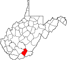 | |
| Unincorporated communities |
| |
| Ghost towns | ||
| Footnotes | ‡This populated place also has portions in an adjacent county or counties | |
This article is issued from Wikipedia - version of the 7/28/2016. The text is available under the Creative Commons Attribution/Share Alike but additional terms may apply for the media files.