East Grove Township, Lee County, Illinois
| East Grove Township | |
|---|---|
| Township | |
 Location in Lee County | |
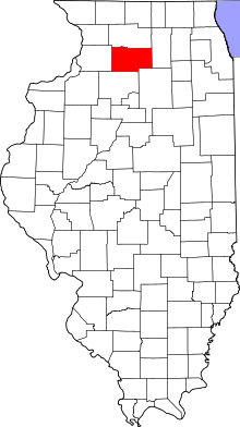 Lee County's location in Illinois | |
| Coordinates: 41°38′07″N 89°27′09″W / 41.63528°N 89.45250°WCoordinates: 41°38′07″N 89°27′09″W / 41.63528°N 89.45250°W | |
| Country |
|
| State |
|
| County | Lee |
| Established | November 9, 1864 |
| Area | |
| • Total | 35.61 sq mi (92.2 km2) |
| • Land | 35.55 sq mi (92.1 km2) |
| • Water | 0.06 sq mi (0.2 km2) 0.17% |
| Elevation | 755 ft (230 m) |
| Population (2010) | |
| • Total | 256 |
| • Density | 7.2/sq mi (2.8/km2) |
| Time zone | CST (UTC-6) |
| • Summer (DST) | CDT (UTC-5) |
| ZIP codes | 61042, 61310, 61349 |
| GNIS feature ID | 0428934 |
East Grove Township is one of twenty-two townships in Lee County, Illinois, USA. As of the 2010 census, its population was 256 and it contained 115 housing units.[1]
History
East Grove was created from Hamilton Township on November 9, 1864.
Geography
According to the 2010 census, the township has a total area of 35.61 square miles (92.2 km2), of which 35.55 square miles (92.1 km2) (or 99.83%) is land and 0.06 square miles (0.16 km2) (or 0.17%) is water.[1]
Cemeteries
The township contains these three cemeteries: Saint Mary's, Stevens and Williams.
School districts
- Amboy Community Unit School District 272
Political districts
- Illinois's 14th congressional district
- State House District 90
- State Senate District 45
References
- "East Grove Township, Lee County, Illinois". Geographic Names Information System. United States Geological Survey. Retrieved 2011-01-12.
- United States Census Bureau 2010 TIGER/Line Shapefiles
- United States National Atlas
- 1 2 "Population, Housing Units, Area, and Density: 2010 - County -- County Subdivision and Place -- 2010 Census Summary File 1". United States Census. Retrieved 2013-05-28.
External links
 |
Harmon Township | Marion Township | Amboy Township | |
| Hamilton Township | |
May Township | ||
| ||||
| | ||||
| Walnut Township, Bureau County | Ohio Township, Bureau County |
Municipalities and communities of Lee County, Illinois, United States | ||
|---|---|---|
| Cities | ||
| Villages | ||
| Townships | ||
| Unincorporated communities |
| |
| Footnotes | ‡This populated place also has portions in an adjacent county or counties | |
This article is issued from Wikipedia - version of the 9/9/2016. The text is available under the Creative Commons Attribution/Share Alike but additional terms may apply for the media files.