Brooklyn Township, Lee County, Illinois
| Brooklyn Township | |
|---|---|
| Township | |
 Location in Lee County | |
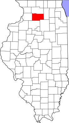 Lee County's location in Illinois | |
| Coordinates: 41°40′20″N 89°06′31″W / 41.67222°N 89.10861°WCoordinates: 41°40′20″N 89°06′31″W / 41.67222°N 89.10861°W | |
| Country |
|
| State |
|
| County | Lee |
| Established | November 6, 1849 |
| Government | |
| • Supervisor | Geraldine K. Neal |
| Area | |
| • Total | 36.23 sq mi (93.8 km2) |
| • Land | 36.22 sq mi (93.8 km2) |
| • Water | 0.01 sq mi (0.03 km2) 0.03% |
| Elevation | 922 ft (281 m) |
| Population (2010) | |
| • Total | 793 |
| • Density | 21.9/sq mi (8.5/km2) |
| Time zone | CST (UTC-6) |
| • Summer (DST) | CDT (UTC-5) |
| ZIP codes | 61318, 61342, 61353, 61378 |
| GNIS feature ID | 0428714 |
Brooklyn Township is one of twenty-two townships in Lee County, Illinois, USA. As of the 2010 census, its population was 793 and it contained 358 housing units.[1] In September 1858, Reynolds Township was formed from part of Brooklyn Township.
Geography
According to the 2010 census, the township has a total area of 36.23 square miles (93.8 km2), of which 36.22 square miles (93.8 km2) (or 99.97%) is land and 0.01 square miles (0.026 km2) (or 0.03%) is water.[1]
Cities, towns, villages
Unincorporated towns
(This list is based on USGS data and may include former settlements.)
Extinct towns
- Melugin Grove at 41°42′25″N 89°06′45″W / 41.706976°N 89.112591°W
(These towns are listed as "historical" by the USGS.)
Cemeteries
The township contains these four cemeteries: Brooklyn, Brooklyn Lutheran, Saint Mary's and Union.
Airports and landing strips
- Earl Barnickel Airport
- Gehant Airport
- W Davis Airport
School districts
- Lee Center Community Unit School District 271
Political districts
- Illinois's 14th congressional district
- State House District 90
- State Senate District 45
References
- "Brooklyn Township, Lee County, Illinois". Geographic Names Information System. United States Geological Survey. Retrieved 2010-11-21.
- United States Census Bureau 2009 TIGER/Line Shapefiles
- United States National Atlas
- 1 2 "Population, Housing Units, Area, and Density: 2010 - County -- County Subdivision and Place -- 2010 Census Summary File 1". United States Census. Retrieved 2013-05-28.
External links
 |
Viola Township | Willow Creek Township | | |
| Lee Center Township Sublette Township |
|
Wyoming Township | ||
| ||||
| | ||||
| Mendota Township, LaSalle County | Meriden Township, LaSalle County |
Municipalities and communities of Lee County, Illinois, United States | ||
|---|---|---|
| Cities | ||
| Villages | ||
| Townships | ||
| Unincorporated communities |
| |
| Footnotes | ‡This populated place also has portions in an adjacent county or counties | |
This article is issued from Wikipedia - version of the 11/9/2016. The text is available under the Creative Commons Attribution/Share Alike but additional terms may apply for the media files.