East Brunswick Township, Schuylkill County, Pennsylvania
| East Brunswick Township, Pennsylvania | |
|---|---|
| Township | |
|
| |
 Map of Schuylkill County, Pennsylvania Highlighting East Brunswick Township | |
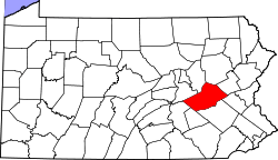 Map of Schuylkill County, Pennsylvania | |
| Country | United States |
| State | Pennsylvania |
| County | Schuylkill |
| Settled | 1801 |
| Incorporated | 1834 |
| Area | |
| • Total | 30.5 sq mi (79 km2) |
| Population (2000) | |
| • Total | 1,601 |
| • Density | 52.5/sq mi (20.3/km2) |
| Time zone | Eastern (EST) (UTC-5) |
| • Summer (DST) | EDT (UTC-4) |
.jpg)
East Brunswick Township is a township in Schuylkill County, Pennsylvania, United States. Brunswick Township was formed in 1801 as one of the original townships of Schuylkill County, being named for Brunswick (Braunschweig), Germany. In 1834, Brunswick Township was divided into East and West Brunswick Townships. Today both townships are served by the Blue Mountain School District.
History
The New Ringgold Gristmill was added to the National Register of Historic Places in 1978.[1]
Geography
According to the United States Census Bureau, the township has a total area of 30.5 square miles (79 km2) of which 30.5 square miles (79 km2) is land and 0.04 square miles (0.10 km2) (0.07%) is water. It is in the Schuylkill watershed and the Little Schuylkill River, which flows southward through the township, drains almost all of it except for an extreme west portion drained by the Pine Creek via Deer Lake directly to the Schuylkill River. Blue Mountain separates it from Berks County.
Routes 443 and 895 serve the township and run together between New Ringgold and McKeansburg. The unincorporated communities of East Brunswick include Drehersville (also in West Brunswick,) Hecla, Kepner (also in West Penn,) McKeansburg, Rauschs, and Rene Mont.
Neighboring municipalities
- West Brunswick Township (west)
- Blythe Township (northwest)
- Walker Township (north)
- West Penn Township (northeast)
- Albany Township, Berks County (southeast)
- New Ringgold (surrounded)
Demographics
As of the census[2] of 2000, there were 1,601 people, 616 households and 473 families residing in the township. The population density was 52.5/sq mi (20.3/km²). There were 679 housing units at an average density of 22.3/sq mi (8.6/km²). The racial makeup of the township was 98.50% White, 0.06% Native American, 0.44% Asian, and 1.00% from two or more races. Hispanic or Latino of any race were 0.50% of the population.
There were 616 households of which 32.8% had children under the age of 18 living with them, 66.7% were married couples living together, 6.7% had a female householder with no husband present, and 23.1% were non-families. 20.0% of all households were made up of individuals and 10.1% had someone living alone who was 65 years of age or older. The average household size was 2.60 and the average family size was 2.99.
In the township the population was spread out with 23.3% under the age of 18, 6.1% from 18 to 24, 31.0% from 25 to 44, 25.4% from 45 to 64, and 14.1% who were 65 years of age or older. The median age was 40 years. For every 100 females there were 102.9 males. For every 100 females age 18 and over, there were 101.6 males.
The median income for a household in the township was $39,821, and the median income for a family was $45,893. Males had a median income of $33,194 versus $22,679 for females. The per capita income for the township was $19,737. About 4.1% of families and 5.0% of the population were below the poverty line, including 4.1% of those under age 18 and 9.5% of those age 65 or over.
Notable people
- Daniel Koch, farmer and Pennsylvania state legislator, was born at Kunkle's Mill in East Brunswick Township.[3]
References
- ↑ National Park Service (2010-07-09). "National Register Information System". National Register of Historic Places. National Park Service.
- ↑ "American FactFinder". United States Census Bureau. Retrieved 2008-01-31.
- ↑ 'Courts and Lawyers of Pennsylvania: A History, 1623-1923,' volume 4, Frank Marshall Eastman, American Historical Society, Incorporation: 1922, Judge Richard Henry Koch, pg. 160-Information about Daniel Koch
Coordinates: 40°40′48″N 75°56′59″W / 40.68000°N 75.94972°W