St. Clair, Pennsylvania
| St. Clair, Pennsylvania | |
|---|---|
| Borough | |
|
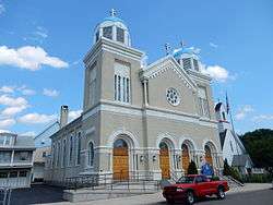
St. Michael Orthodox Church in St. Clair. August 2015. | |
 St. Clair, Pennsylvania | |
| Coordinates: 40°43′04″N 76°11′23″W / 40.71778°N 76.18972°WCoordinates: 40°43′04″N 76°11′23″W / 40.71778°N 76.18972°W | |
| Country | United States |
| State | Pennsylvania |
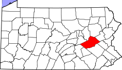
| County | Schuylkill |
| Settled | 1831 |
| Incorporated | 1850 |
| Government | |
| • Type | Borough Council |
| Area | |
| • Total | 1.2 sq mi (3 km2) |
| Elevation | 738 ft (225 m) |
| Population (2010) | |
| • Total | 2,987 |
| • Density | 2,490/sq mi (960/km2) |
| Time zone | Eastern (EST) (UTC-5) |
| • Summer (DST) | EDT (UTC-4) |
| Zip code | 17970 |
| Area code(s) | 570 Exchange: 429 |
| Website | http://www.stclair-gov.org/ |
| [1] | |
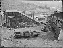
St. Clair is a borough in Schuylkill County, Pennsylvania two miles (3 km) north of Pottsville in the southern Coal Region. Extensive deposits of hard coal are present. In the past, the manufacturing interests were the production of miners' squibs and fuses and miners' caps.
Geography
According to the United States Census Bureau, the borough has a total area of 1.2 square miles (3.1 km2), all of it land.
Demographics
| Historical population | |||
|---|---|---|---|
| Census | Pop. | %± | |
| 1850 | 2,016 | — | |
| 1860 | 4,901 | 143.1% | |
| 1870 | 5,726 | 16.8% | |
| 1880 | 4,149 | −27.5% | |
| 1890 | 3,680 | −11.3% | |
| 1900 | 4,638 | 26.0% | |
| 1910 | 6,455 | 39.2% | |
| 1920 | 6,495 | 0.6% | |
| 1930 | 7,296 | 12.3% | |
| 1940 | 6,809 | −6.7% | |
| 1950 | 5,856 | −14.0% | |
| 1960 | 5,159 | −11.9% | |
| 1970 | 4,576 | −11.3% | |
| 1980 | 4,037 | −11.8% | |
| 1990 | 3,524 | −12.7% | |
| 2000 | 3,254 | −7.7% | |
| 2010 | 3,004 | −7.7% | |
| Est. 2015 | 2,891 | [2] | −3.8% |
| Sources:[3][4][5] | |||
As of the census[4] of 2000, there were 3,254 people, 1,497 households, and 887 families residing in the borough. The population density was 2,661.7 people per square mile (1,029.8/km²). There were 1,647 housing units at an average density of 1,347.2 per square mile (521.2/km²). The racial makeup of the borough was 98.71% White, 0.68% African American, 0.09% Native American, 0.06% Asian, 0.22% from other races, and 0.25% from two or more races. Hispanic or Latino of any race were 0.71% of the population.
There were 1,497 households out of which 20.2% had children under the age of 18 living with them, 41.1% were married couples living together, 12.5% had a female householder with no husband present, and 40.7% were non-families. 36.6% of all households were made up of individuals and 22.2% had someone living alone who was 65 years of age or older. The average household size was 2.17 and the average family size was 2.83.
In the borough the population was spread out with 18.6% under the age of 18, 6.4% from 18 to 24, 26.2% from 25 to 44, 22.7% from 45 to 64, and 26.1% who were 65 years of age or older. The median age was 44 years. For every 100 females there were 88.4 males. For every 100 females age 18 and over, there were 85.2 males.
The median income for a household in the borough was $28,161, and the median income for a family was $35,024. Males had a median income of $28,566 versus $20,719 for females. The per capita income for the borough was $15,418. About 7.7% of families and 11.8% of the population were below the poverty line, including 14.6% of those under age 18 and 9.9% of those age 65 or over.
In the 2000 census, 8.8% of the population claimed Ukrainian ancestry.[6]
Notable people
- Joel Thompson Boone, U.S. Navy vice admiral who received Congressional Medal of Honor for actions during WW I.
- Vincent Carter, U.S. Representative from Wyoming.
- Michael Dudick, priest and bishop of the Byzantine Catholic Metropolitan Church of Pittsburgh.
- Joe Holden, baseball catcher for the Philadelphia Phillies (1934-1936).
- Tim Holden, U.S. Representative for Pennsylvania's 17th congressional district and chairman of the Pennsylvania Liquor Control Board.
- John B. Price, football coach.
- Ed Sharockman, professional football player; started in Super Bowl IV.
- John Titus - baseball outfielder for the Philadelphia Phillies (1903–12) and Boston Braves (1912–13).
Gallery
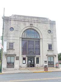 Saint Clair State Bank (1924).
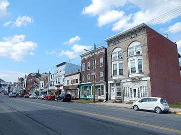 Second Street in St. Clair.
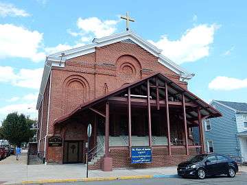 St. Clare of Assisi Catholic Church.
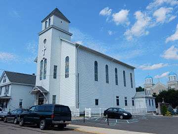 First Primitive Methodist Church.
References
- ↑ "US Gazetteer files: 2010, 2000, and 1990". United States Census Bureau. 2011-02-12. Retrieved 2011-04-23.
- ↑ "Annual Estimates of the Resident Population for Incorporated Places: April 1, 2010 to July 1, 2015". Retrieved July 2, 2016.
- ↑ "Census of Population and Housing". U.S. Census Bureau. Retrieved 11 December 2013.
- 1 2 "American FactFinder". United States Census Bureau. Retrieved 2008-01-31.
- ↑ "Incorporated Places and Minor Civil Divisions Datasets: Subcounty Resident Population Estimates: April 1, 2010 to July 1, 2012". Population Estimates. U.S. Census Bureau. Retrieved 11 December 2013.
- ↑ "Ancestry Map of Ukrainian Communities". Epodunk.com. Retrieved 2013-11-13.
Further reading
- Anthony F. C. Wallace: St. Clair: A Nineteenth-Century Coal Town's Experience with a Disaster-Prone Industry, Cornell University Press, Ithaca and London, Paperback and with corrections 1988 ISBN 0-8014-9900-3 LCCN n/88/37772
External links
| Wikimedia Commons has media related to St. Clair, Pennsylvania. |
- St. Clair Historical Society
- Map Patches of mining Saint Clair
-
 "Saint Clair". Encyclopædia Britannica (11th ed.). 1911.