Dwight, North Dakota
| Dwight, North Dakota | |
|---|---|
| City | |
|
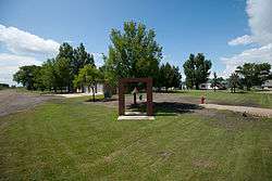
Fire department bell in Dwight | |
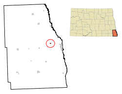 Location of Dwight in North Dakota | |
| Coordinates: 46°18′15″N 96°44′21″W / 46.30417°N 96.73917°WCoordinates: 46°18′15″N 96°44′21″W / 46.30417°N 96.73917°W | |
| Country | United States |
| State | North Dakota |
| County | Richland |
| Area[1] | |
| • Total | 0.20 sq mi (0.52 km2) |
| • Land | 0.20 sq mi (0.52 km2) |
| • Water | 0 sq mi (0 km2) |
| Elevation | 955 ft (291 m) |
| Population (2010)[2] | |
| • Total | 82 |
| • Estimate (2014)[3] | 81 |
| • Density | 410.0/sq mi (158.3/km2) |
| Time zone | Central (CST) (UTC-6) |
| • Summer (DST) | CDT (UTC-5) |
| ZIP code | 58075 |
| Area code(s) | 701 |
| FIPS code | 38-21220 |
| GNIS feature ID | 1028755[4] |
Dwight is a city in Richland County, North Dakota, United States. The population was 82 at the 2010 census.[5] Dwight was founded in 1881. It is part of the Wahpeton, ND–MN Micropolitan Statistical Area.
History
Dwight was named for Jeremiah W. Dwight, the owner of the Dwight Farm and Land Company which ran a 27,000 acre bonanza farm, organized in 1879, in the area. John Miller, North Dakota's first governor, lived in Dwight and was the superintendent of the Dwight bonanza farm.[6]
Geography
Dwight is located at 46°18′15″N 96°44′21″W / 46.30417°N 96.73917°W (46.304147, -96.739242).[7]
According to the United States Census Bureau, the city has a total area of 0.20 square miles (0.52 km2), all of it land.[1]
Demographics
| Historical population | |||
|---|---|---|---|
| Census | Pop. | %± | |
| 1920 | 139 | — | |
| 1930 | 104 | −25.2% | |
| 1940 | 168 | 61.5% | |
| 1950 | 129 | −23.2% | |
| 1960 | 101 | −21.7% | |
| 1970 | 93 | −7.9% | |
| 1980 | 72 | −22.6% | |
| 1990 | 83 | 15.3% | |
| 2000 | 75 | −9.6% | |
| 2010 | 82 | 9.3% | |
| Est. 2015 | 80 | [8] | −2.4% |
| U.S. Decennial Census[9] 2014 Estimate[3] | |||
2010 census
As of the census[2] of 2010, there were 82 people, 32 households, and 17 families residing in the city. The population density was 410.0 inhabitants per square mile (158.3/km2). There were 34 housing units at an average density of 170.0 per square mile (65.6/km2). The racial makeup of the city was 100.0% White.
There were 32 households of which 46.9% had children under the age of 18 living with them, 40.6% were married couples living together, 9.4% had a female householder with no husband present, 3.1% had a male householder with no wife present, and 46.9% were non-families. 40.6% of all households were made up of individuals and 15.7% had someone living alone who was 65 years of age or older. The average household size was 2.56 and the average family size was 3.59.
The median age in the city was 32 years. 32.9% of residents were under the age of 18; 2.4% were between the ages of 18 and 24; 31.7% were from 25 to 44; 23.2% were from 45 to 64; and 9.8% were 65 years of age or older. The gender makeup of the city was 50.0% male and 50.0% female.
2000 census
As of the census of 2000, there were 75 people, 33 households, and 17 families residing in the city. The population density was 377.7 people per square mile (144.8/km²). There were 36 housing units at an average density of 181.3 per square mile (69.5/km²). The racial makeup of the city was 98.67% White, and 1.33% from two or more races.
There were 33 households out of which 33.3% had children under the age of 18 living with them, 39.4% were married couples living together, 6.1% had a female householder with no husband present, and 45.5% were non-families. 45.5% of all households were made up of individuals and 21.2% had someone living alone who was 65 years of age or older. The average household size was 2.27 and the average family size was 3.22.
In the city the population was spread out with 29.3% under the age of 18, 12.0% from 18 to 24, 25.3% from 25 to 44, 16.0% from 45 to 64, and 17.3% who were 65 years of age or older. The median age was 29 years. For every 100 females there were 114.3 males. For every 100 females age 18 and over, there were 103.8 males.
The median income for a household in the city was $40,625, and the median income for a family was $53,125. Males had a median income of $40,625 versus $31,250 for females. The per capita income for the city was $17,543. There were no families and 4.2% of the population living below the poverty line, including no under eighteens and 27.3% of those over 64.
Notable people
- John Miller, First governor of the State of North Dakota[6]
References
- 1 2 "US Gazetteer files 2010". United States Census Bureau. Retrieved 2012-06-14.
- 1 2 "American FactFinder". United States Census Bureau. Retrieved 2012-06-14.
- 1 2 "Population Estimates". United States Census Bureau. Retrieved June 2, 2015.
- ↑ "US Board on Geographic Names". United States Geological Survey. 2007-10-25. Retrieved 2008-01-31.
- ↑ "2010 Census Redistricting Data (Public Law 94-171) Summary File". American FactFinder. United States Census Bureau. Retrieved 2 May 2011.
- 1 2 Federal Writer's Project of the Works Progress Administration for the State of North Dakota (1977). The WPA Guide To 1930s North Dakota (2nd ed.). State Historical Society of North Dakota. p. 197. ISBN 1891419145.
- ↑ "US Gazetteer files: 2010, 2000, and 1990". United States Census Bureau. 2011-02-12. Retrieved 2011-04-23.
- ↑ "Annual Estimates of the Resident Population for Incorporated Places: April 1, 2010 to July 1, 2015". Retrieved July 2, 2016.
- ↑ United States Census Bureau. "Census of Population and Housing". Retrieved October 31, 2013.
Municipalities and communities of Richland County, North Dakota, United States | ||
|---|---|---|
| Cities | 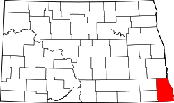 | |
| Townships |
| |
| Unincorporated communities |
| |
| Indian reservations | ||
| Footnotes | ‡This populated place also has portions in an adjacent county or counties | |