Mooreton, North Dakota
| Mooreton, North Dakota | |
|---|---|
| City | |
 Location of Mooreton, North Dakota | |
| Coordinates: 46°16′5″N 96°52′31″W / 46.26806°N 96.87528°WCoordinates: 46°16′5″N 96°52′31″W / 46.26806°N 96.87528°W | |
| Country | United States |
| State | North Dakota |
| County | Richland |
| Area[1] | |
| • Total | 0.27 sq mi (0.70 km2) |
| • Land | 0.27 sq mi (0.70 km2) |
| • Water | 0 sq mi (0 km2) |
| Elevation | 971 ft (296 m) |
| Population (2010)[2] | |
| • Total | 197 |
| • Estimate (2014)[3] | 195 |
| • Density | 729.6/sq mi (281.7/km2) |
| Time zone | Central (CST) (UTC-6) |
| • Summer (DST) | CDT (UTC-5) |
| ZIP code | 58061 |
| Area code(s) | 701 |
| FIPS code | 38-54220 |
| GNIS feature ID | 1030281[4] |
Mooreton is a city in Richland County, North Dakota, United States. The population was 197 at the 2010 census.[5] Mooreton was founded in 1884. It is part of the Wahpeton, ND–MN Micropolitan Statistical Area.
Geography
Mooreton is located at 46°16′5″N 96°52′31″W / 46.26806°N 96.87528°W (46.268002, -96.875144).[6]
According to the United States Census Bureau, the city has a total area of 0.27 square miles (0.70 km2), all of it land.[1]
Demographics
| Historical population | |||
|---|---|---|---|
| Census | Pop. | %± | |
| 1920 | 123 | — | |
| 1930 | 147 | 19.5% | |
| 1940 | 146 | −0.7% | |
| 1950 | 161 | 10.3% | |
| 1960 | 164 | 1.9% | |
| 1970 | 158 | −3.7% | |
| 1980 | 216 | 36.7% | |
| 1990 | 193 | −10.6% | |
| 2000 | 204 | 5.7% | |
| 2010 | 197 | −3.4% | |
| Est. 2015 | 194 | [7] | −1.5% |
| U.S. Decennial Census[8] 2014 Estimate[3] | |||
2010 census
As of the census[2] of 2010, there were 197 people, 83 households, and 56 families residing in the city. The population density was 729.6 inhabitants per square mile (281.7/km2). There were 92 housing units at an average density of 340.7 per square mile (131.5/km2). The racial makeup of the city was 93.9% White, 3.6% Native American, 0.5% Asian, and 2.0% from two or more races.
There were 83 households of which 36.1% had children under the age of 18 living with them, 56.6% were married couples living together, 3.6% had a female householder with no husband present, 7.2% had a male householder with no wife present, and 32.5% were non-families. 26.5% of all households were made up of individuals and 8.4% had someone living alone who was 65 years of age or older. The average household size was 2.37 and the average family size was 2.89.
The median age in the city was 34.7 years. 24.9% of residents were under the age of 18; 6.7% were between the ages of 18 and 24; 32% were from 25 to 44; 24.3% were from 45 to 64; and 12.2% were 65 years of age or older. The gender makeup of the city was 55.3% male and 44.7% female.
2000 census
As of the census of 2000, there were 204 people, 92 households, and 49 families residing in the city. The population density was 769.7 people per square mile (291.7/km²). There were 95 housing units at an average density of 358.5 per square mile (135.9/km²). The racial makeup of the city was 98.04% White and 1.96% Native American. Hispanic or Latino of any race were 0.49% of the population.
There were 92 households out of which 21.7% had children under the age of 18 living with them, 48.9% were married couples living together, 1.1% had a female householder with no husband present, and 46.7% were non-families. 38.0% of all households were made up of individuals and 15.2% had someone living alone who was 65 years of age or older. The average household size was 2.22 and the average family size was 3.10.
In the city the population was spread out with 25.5% under the age of 18, 9.3% from 18 to 24, 31.9% from 25 to 44, 15.7% from 45 to 64, and 17.6% who were 65 years of age or older. The median age was 35 years. For every 100 females there were 100.0 males. For every 100 females age 18 and over, there were 100.0 males.
The median income for a household in the city was $29,375, and the median income for a family was $48,281. Males had a median income of $27,361 versus $22,500 for females. The per capita income for the city was $16,434. About 9.1% of families and 11.5% of the population were below the poverty line, including 2.3% of those under the age of eighteen and none of those sixty five or over.
References
- 1 2 "US Gazetteer files 2010". United States Census Bureau. Retrieved 2012-06-14.
- 1 2 "American FactFinder". United States Census Bureau. Retrieved 2012-06-14.
- 1 2 "Population Estimates". United States Census Bureau. Retrieved June 2, 2015.
- ↑ "US Board on Geographic Names". United States Geological Survey. 2007-10-25. Retrieved 2008-01-31.
- ↑ "2010 Census Redistricting Data (Public Law 94-171) Summary File". American FactFinder. United States Census Bureau. Retrieved 2 May 2011.
- ↑ "US Gazetteer files: 2010, 2000, and 1990". United States Census Bureau. 2011-02-12. Retrieved 2011-04-23.
- ↑ "Annual Estimates of the Resident Population for Incorporated Places: April 1, 2010 to July 1, 2015". Retrieved July 2, 2016.
- ↑ United States Census Bureau. "Census of Population and Housing". Retrieved October 31, 2013.
External links
Municipalities and communities of Richland County, North Dakota, United States | ||
|---|---|---|
| Cities | 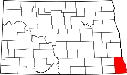 | |
| Townships |
| |
| Unincorporated communities |
| |
| Indian reservations | ||
| Footnotes | ‡This populated place also has portions in an adjacent county or counties | |