Dillon, Kansas
| Dillon, Kansas | |
|---|---|
| Unincorporated community | |
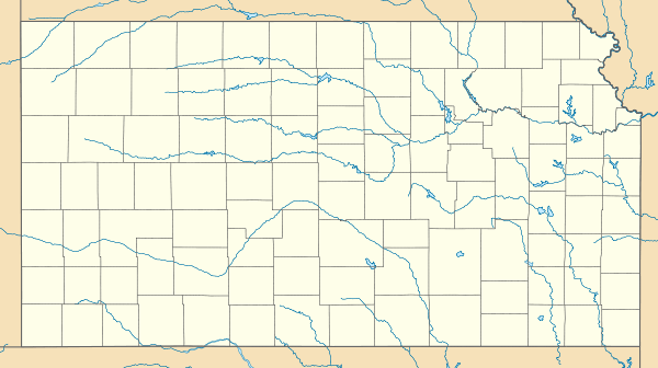
 KDOT map of Dickinson County (legend) | |
 Dillon  Dillon | |
| Coordinates: 38°41′37″N 97°8′49″W / 38.69361°N 97.14694°WCoordinates: 38°41′37″N 97°8′49″W / 38.69361°N 97.14694°W[1] | |
| Country | United States |
| State | Kansas |
| County | Dickinson |
| Elevation[1] | 1,299 ft (396 m) |
| Time zone | CST (UTC-6) |
| • Summer (DST) | CDT (UTC-5) |
| FIPS code | 20-18100 [1] |
| GNIS ID | 484800 [1] |
Dillon is a rural unincorporated community in Dickinson County, Kansas, United States.[1]
History

Early history
For many millennia, the Great Plains of North America was inhabited by nomadic Native Americans. From the 16th century to 18th century, the Kingdom of France claimed ownership of large parts of North America. In 1762, after the French and Indian War, France secretly ceded New France to Spain, per the Treaty of Fontainebleau.
19th century
In 1802, Spain returned most of the land to France. In 1803, most of the land for modern day Kansas was acquired by the United States from France as part of the 828,000 square mile Louisiana Purchase for 2.83 cents per acre.
In 1854, the Kansas Territory was organized, then in 1861 Kansas became the 34th U.S. state. In 1857, Dickinson County was established within the Kansas Territory, which included the land for modern day Dillon.
Dillon was a station on the Missouri Pacific Railroad.[2] A post office was opened in Dillon in 1872, and remained in operation until it was discontinued in 1944.[3]
Further reading
References
- 1 2 3 4 5 Geographic Names Information System (GNIS) details for Dillon, Kansas; United States Geological Survey (USGS); October 13, 1978.
- ↑ Blackmar, Frank Wilson (1912). Kansas: A Cyclopedia of State History, Embracing Events, Institutions, Industries, Counties, Cities, Towns, Prominent Persons, Etc. Standard Publishing Company. p. 521.
- ↑ "Kansas Post Offices, 1828-1961 (archived)". Kansas Historical Society. Archived from the original on September 9, 2013. Retrieved 8 June 2014.
External links
| Wikimedia Commons has media related to Dillon, Kansas. |
- Historic Images of Dillon, Special Photo Collections at Wichita State University Library
- Dickinson County Maps: Current, Historic, KDOT
Municipalities and communities of Dickinson County, Kansas, United States | ||
|---|---|---|
| Cities | 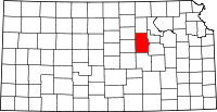 | |
| CDPs | ||
| Unincorporated communities | ||
| Townships | ||
| Footnotes | ‡This populated place also has portions in an adjacent county or counties | |