Dayton Historic District (Dayton, Indiana)
|
Dayton Historic District | |
|
Castle Hall, July 2007 | |
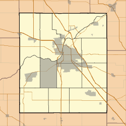   | |
| Location | Roughly bounded by Walnut, Harrison, and Pennsylvania Sts., Dayton, Indiana |
|---|---|
| Coordinates | 40°22′35″N 86°46′03″W / 40.37639°N 86.76750°WCoordinates: 40°22′35″N 86°46′03″W / 40.37639°N 86.76750°W |
| Area | 10 acres (4.0 ha) |
| Architectural style | Greek Revival, Late Victorian |
| NRHP Reference # | 03000142[1] |
| Added to NRHP | March 26, 2003 |

Dayton Historic District is a national historic district located at Battle Ground, Tippecanoe County, Indiana. The district encompasses 82 contributing buildings and 1 contributing site in the central business district and surrounding residential sections of Dayton. It developed between about 1830 and 1952 and includes representative examples of Greek Revival, Italianate, Second Empire, and Bungalow / American Craftsman style architecture. Notable contributing resources include the Lantz Building (1941), Reincke-Hawkins House (c. 1860), Castle Block (1894), Baker-Yost House (c. 1847), First Presbyterian Church (1899), and Gladden-Goldsbury House (c. 1878).[2]
It was listed on the National Register of Historic Places in 2003.[1]
References
- 1 2 National Park Service (2010-07-09). "National Register Information System". National Register of Historic Places. National Park Service.
- ↑ "Indiana State Historic Architectural and Archaeological Research Database (SHAARD)" (Searchable database). Department of Natural Resources, Division of Historic Preservation and Archaeology. Retrieved 2016-07-01. Note: This includes Angela Bowen (April 2001). "National Register of Historic Places Inventory Nomination Form: Dayton Historic District" (PDF). Retrieved 2016-07-01. and Accompanying photographs


This article is issued from Wikipedia - version of the 12/2/2016. The text is available under the Creative Commons Attribution/Share Alike but additional terms may apply for the media files.