D6 road (Croatia)
| |
|---|---|
| Route information | |
| Length: | 134.5 km (83.6 mi) |
| Major junctions | |
| From: |
|
|
| |
| To: |
|
| Location | |
| Counties: | Karlovac, Sisak-Moslavina |
| Major cities: | Karlovac, Vojnić, Glina, Dvor |
| Highway system | |
| State roads in Croatia | |

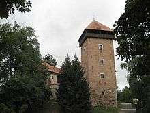
Karlovac, on the D6 road route

Topusko, in immediate vicinity of the D6 road
D6 is a state road in central parts of Croatia connecting Jurovski Brod border crossing to Slovenia and Dvor border crossing to Bosnia and Herzegovina via Karlovac, Vojnić, Glina and Dvor. The road also serves as a connection to the A1 motorway Karlovac interchange via the D1 state road in Karlovac.[maps 1][1] The road is 134.5 km (83.6 mi) long.[2]
The road, as well as all other state roads in Croatia, is managed and maintained by Hrvatske ceste, a state-owned company.[3]
Traffic volume
Traffic is regularly counted and reported by Hrvatske ceste, operator of the road.[4]
| D6 traffic volume | ||||
| Road | Counting site | AADT | ASDT | Notes |
| |
1801 Jurovski Brod | 2,465 | 3,096 | Between Jurovski Brod border crossing and the D228 junction. Average daily traffic figure is provided instead of AADT. |
| |
1802 Ribnik | 1,914 | 2,365 | Adjacent to the Ž3140 junction. |
| |
3108 Okić - west | 2,222 | 2,608 | Adjacent to the L34093 junction. |
| |
3102 Gvozd - west | 1,282 | 1,984 | Adjacent to the Ž3186 junction. The AADT figure estimated by Hrvatske ceste. |
| |
3206 Maja | 551 | 668 | Adjacent to the Ž3237 junction. |
| |
3210 Trgovi | 388 | 495 | Adjacent to the Ž3234 junction. |
Road junctions and populated areas
| D6 junctions/populated areas | |
| Type | Slip roads/Notes |
| |
Jurovski Brod border crossing to Slovenia The northern terminus of the road. |
| |
Jurovski Brod |
| |
Ž3140 to Pravutina and Ribnik (the road loops to Pravutina and back to the D6 at Ribnik). |
| |
Ribnik |
| |
Jarnevići |
| |
Netretić Ž3141 to Vukova Gorica (D3). |
| |
Brajakovo Brdo |
| |
Donje Stative Ž3142 to Novigrad and Jarče Polje (D3). Ž3144 to Mali Erjavec (D228). |
| |
Karlovac |
| |
The southern terminus of dual carriageway expressway through Karlovac. |
| |
Mostanje |
| |
Turanj Ž3186 to Skakavac, Gvozd and Perna. |
| |
Cerovac Vukmanićki |
| |
Tušilović |
| |
Brezova Glava |
| |
Okić |
| |
Živković Kosa |
| |
Knežević Kosa |
| |
Vojnić |
| |
Crevarska Strana |
| |
Gvozd Ž3186 to Turanj (D1) (to the north) and to Perna (to the south). |
| |
Blatuša Ž3152 to Bović, Lasinja and the D36 state road. |
| |
Donja Čemernica |
| |
Ž3229 to Topusko, Katinovac and Maljevac (D216). |
| |
Šatornja |
| |
Ž3227 to Topusko. |
| |
|
| |
Glina Ž3223 to Donji Viduševac, Dvorišće and Hađer. Ž3231 to Veliki Obljaj and Bosanska Bojna border crossing to Bosnia and Herzegovina. |
| |
Ž3232 to Majske Poljane. |
| |
Maja |
| |
Ž3234 to Veliki Šušnjar, Miočinovići and Donja Stupnica. The road loops from the D6 road and back forming two intersections. |
| |
Ž3237 to Bijele Vode. |
| |
Dragotina Ž3238 to Mali Gradac. |
| |
Donji Žirovac |
| |
Komora |
| |
Gvozdansko |
| |
Trgovi |
| |
Grmušani |
| |
Vanići |
| |
Ž3262 to Donji Javoranj. |
| |
Dvor |
| |
Matijevići |
| |
Dvor border crossing to Bosnia Herzegovina.[5] The road extends to Novi Grad, Bosnia and Herzegovina. The southern terminus of the road. |
Maps
- ↑ Overview map of the D6 (Map). OpenStreetMap. Retrieved February 4, 2014.
Sources
- ↑ "Regulation on motorway markings, chainage, interchange/exit/rest area numbers and names". Narodne novine (in Croatian). April 24, 2003.
- ↑ Ministry of Sea, Transport and Infrastructure (Croatia) (June 4, 2013). "Decision on categorization of public roads" (in Croatian). Narodne novine. Retrieved July 27, 2014.
- ↑ "Public Roads Act". Narodne novine (in Croatian). December 14, 2004.
- ↑ "Traffic counting on the roadways of Croatia in 2013 - digest" (PDF). Hrvatske ceste. May 2014. Retrieved 2014-07-20.
- 1 2 "Map of border crossings and customs office areas" (PDF). Customs Administration of the Republic of Croatia (in Croatian). March 6, 2008.
This article is issued from Wikipedia - version of the 8/5/2014. The text is available under the Creative Commons Attribution/Share Alike but additional terms may apply for the media files.