D27 road (Croatia)
| |
|---|---|
| Route information | |
| Length: | 96.9 km (60.2 mi) |
| Major junctions | |
| From: |
|
|
| |
| To: |
|
| Location | |
| Counties: | Zadar, Šibenik-Knin |
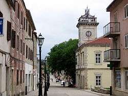
| Major cities: | Benkovac, Obrovac |
| Highway system | |
| State roads in Croatia | |


D27 is a state road connecting Gračac in the southern part of Lika, Croatia to D8 state road via Benkovac.[maps 1] The road is 96.9 kilometres (60.2 mi) long.[1] The road also provides an alternate route to the sections of A1 motorway and the D8 state road that cross the Maslenica strait over the two Maslenica bridges, underneath the Velebit. This is especially important when strong wind or storms (usually bura) cause the A1 motorway section between Maslenica Bridge (A1) and Sveti Rok Tunnel to be closed for traffic for safety reasons.[2]
The road, as well as all other state roads in Croatia, is managed and maintained by Hrvatske ceste, a state-owned company.[3]
Traffic volume
Traffic is regularly counted and reported by Hrvatske ceste, operator of the road.[4] Substantial variations between annual (AADT) and summer (ASDT) traffic volumes are attributed to the fact that the road connects a number of summer resorts to Croatian motorway network.
| D27 traffic volume | ||||
| Road | Counting site | AADT | ASDT | Notes |
| |
4912 Zaton Obrovački | 1,214 | 2,382 | Between Ž6027 and Ž6028 junctions. |
| |
4914 Kruševo | 1,864 | 2,987 | Adjacent to Ž6025 junction. |
| |
4915 Benkovac | 1,387 | 2,528 | Adjacent to Ž6045 junction. |
| |
5317 Gornje Ceranje | 1,530 | 2,078 | Between Ž6064 and Ž6066 junctions. |
| |
5303 Gaćelezi | 2,118 | 3,585 | Between D59 and Ž6071 junctions. |
Road junctions and populated areas
| D27 junctions/populated areas | |
| Type | Slip roads/Notes |
| |
Gračac The northern terminus of the road. Northbound D27 traffic defaults to northbound D1. |
| |
Ž6027 to Kaštel Žegarski and Bruška. |
| |
Ž6028 to Muškovci. |
| |
Zaton Obrovački |
| |
Obrovac Ž6025 to Kaštel Žegarski, Ervenik and Kom. Ž5166 to Sveti Rok |
| |
Ž6024 to Kruševo. |
| |
Gornji Karin |
| |
Donji Karin |
| |
Ž6048 to Donji Karin and Popovići. |
| |
Benkovac Ž6003 within the town. Ž6278 to Zemunik Donji (to the north) and to Skradin (to the south). |
| |
Šopot 6064 to Miranje, Vrana and Pakoštane. |
| |
Zapužane |
| |
|
| |
Miranje 6064 to Šopot (to the north) and Vrana and Pakoštane (to the south). |
| |
Gornje Ceranje |
| |
Budak |
| |
Ž6066 to Pristeg. |
| |
Stankovci Ž6067 to Bila Vlaka and Vukšić Ž6068 to Kašić Banjevački and Pirovac (D8). |
| |
Crljenik |
| |
|
| |
Grabovci |
| |
Gaćelezi Ž6071 to D59 state road (as a connector). |
| |
Ž6086 to Tribunj. |
| |
The southern terminus of the road. |
Maps
- ↑ Overview map of the D27 (Map). OpenStreetMap. Retrieved July 21, 2014.
Sources
- ↑ Ministry of Sea, Transport and Infrastructure (Croatia) (May 10, 2013). "Odluka o razvrstavanju javnih cesta" [Decision on categorization of public roads]. Narodne novine (in Croatian) (66/2013).
- ↑ "Snow and wind disrupt traffic virtually all over Croatia". Slobodna Dalmacija (in Croatian). March 10, 2010. Archived from the original on 2011-07-21.
- ↑ "Public Roads Act". Narodne novine (in Croatian). December 14, 2004.
- ↑ "Traffic counting on the roadways of Croatia in 2013 - digest" (PDF). Hrvatske ceste. May 2014. Retrieved 2014-07-21.
- ↑ "Regulation on motorway markings, chainage, interchange/exit/rest area numbers and names". Narodne novine (in Croatian). May 6, 2003.