Cuyahoga Valley Scenic Railroad
| Locale |
Cuyahoga Valley National Park from Independence to Akron OH |
|---|---|
| Dates of operation | 1972 or 1973–Present |
| Predecessor | Chessie System |
| Track gauge | 4 ft 8 1⁄2 in (1,435 mm) standard gauge |
| Length | 51 miles (82 km) leased from National Park Service and via trackage rights over Wheeling and Lake Erie Railway |
| Headquarters | 1664 Main Street/Route 303, Peninsula, Summit County, Ohio |
| Website | http://www.cvsr.com/ |

Cuyahoga Valley Scenic Railroad is a Class III railroad [1] operating diesel-electric and steam-powered[2] excursion trips through Peninsula, Ohio in the Cuyahoga Valley, primarily through the scenic Cuyahoga Valley National Park.[3]
History

Based on a track bed and rails originally laid down around 1880, right-of-way ownership transitioned over the years from Valley Railway to Cleveland Terminal & Valley Railroad (CT&V), to the Baltimore and Ohio Railroad, to the Chessie System. Currently, the National Park Service own the rails and right-of-way within Cuyahoga Valley National Park. CVSR co-operates with Wheeling and Lake Erie Railway (WLE) on operation of the railroad track south of CUVA to Canton. Cuyahoga Valley Scenic Railroad operates their excursion trains in co-operation with both the NPS & WLE.[4][5]
The history of trains in the Cuyahoga Valley stretches back more than 100 years. In 1880, the Valley Railway began operations, transporting coal to Cleveland, Akron, and Canton from the Tuscarawas River Valley and providing passenger service along the way. After a decade of operation, the Valley Railway became part of the Baltimore & Ohio Railroad. In the 20th century, competition from automobiles, trucks, and buses caused the decline of both freight and passenger service. Interest in the line was renewed in 1972 as a scenic excursion route and the Cuyahoga Valley Preservation and Scenic Railway Association was born.
Accidents


The CVSR has had a few accidents in recent history including most recently hitting a car at a crossing. A person died in 2004 after being hit by the train 1822 during a Polar Express excursion.[6][7]
On June 18, 2009, an automobile collided with a weekday train at an ungated crossing with no warning lights. The driver of the car was not expecting the train as he thought it only ran at weekends.[8]
On July 13, 2012, a southbound CVSR train struck an eastbound car at the Portage St. crossing in northern Stark County. The elderly lady driver was killed.
On October 30, 2015 a woman got hit by the CVSR 800 in Peninsula, OH
Today
Originally known as the Cuyahoga Valley Line, the scenic railroad now operates as Cuyahoga Valley Scenic Railroad (CVSR).
Future
Several Ohio and Erie Canal-oriented organizations in Cleveland, Cuyahoga County and Summit County are pushing for extension of CVSR operations farther North along the Canal corridor into Cleveland. Some other organizations have been researching the feasibility of commuter rail operations between Akron-Canton and Cleveland.
From the current CVSR Rockside station, (other railroads') existing tracks follow the West Bank of the Cuyahoga River to along: Valley Belt Road, Bradley Road, Jennings Road, Steelyard Drive, Holmden Avenue, Quigley Road; Crossing over the Cuyahoga River on the railroad draw bridge near Quigley and West 3rd., then follow the east bank of the Cuyahoga River to Canal Road near Commercial Road, ending up along Canal Road between Ontario Avenue and West 2nd. Street.
One of the big issues to be resolved would be scheduling and controlling access since the tracks through Cleveland and Newburgh Heights are used by freight train traffic, and much of the route above is single track with limited sidings.
Schedule
CVSR's schedule varies with seasonal demands. Currently (in 2008), CVSR operates on weekends in January through May and September, and Wednesday through Sunday in June through August and October. One train makes (3) daily round-trips from Independence to Akron, which takes about 3 hours (1½ hours one-way). The Akron-Canton run has not been regular since 2012 when there was a fatal crash at the Portage St. railroad crossing.
Scenic excursions
CVSR offers scenic trips along the path of the Valley Railway.
Train to Canton
In summer 2003, CVSR began service between Akron and Canton. CVSR provides service between Akron Northside Station and Canton Lincoln Highway Station. Passengers will have approximately 4½ hours to visit some of the city's unique attractions, including the Pro Football Hall of Fame, Canton Classic Car Museum, and William McKinley Presidential Library and Museum. Unfortunately, the tracks between Akron and Canton will not support passenger trains at a reasonable speed to allow CVSR to serve Canton. The last regularly scheduled trains to Canton were in the summer of 2012. The end of the Canton trips occurred in 2012, mostly due to track conditions between Arlington Rd. and Mayfair Rd. ”Center Section". Also lack of ridership, equipment, and lack of money to bring tracks up to passenger train standards & maintenance.
Flooding
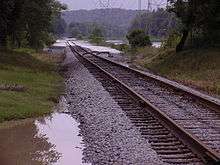
Flooding caused by heavy rains in July 2003 damaged the tracks throughout the park and forced the cancellation of these runs for the remainder of the 2003.
Stations
Cuyahoga Valley Scenic Railroad | |||||||||||||||||||||||||||||||||||||||||||||||||||||||||||||||||||||||||||||||||||||||||||||||||||||||||||||||||||||||||||||||||||||||||||||||||||||||||||||||||||||||||||||||||||||||||||||||||
|---|---|---|---|---|---|---|---|---|---|---|---|---|---|---|---|---|---|---|---|---|---|---|---|---|---|---|---|---|---|---|---|---|---|---|---|---|---|---|---|---|---|---|---|---|---|---|---|---|---|---|---|---|---|---|---|---|---|---|---|---|---|---|---|---|---|---|---|---|---|---|---|---|---|---|---|---|---|---|---|---|---|---|---|---|---|---|---|---|---|---|---|---|---|---|---|---|---|---|---|---|---|---|---|---|---|---|---|---|---|---|---|---|---|---|---|---|---|---|---|---|---|---|---|---|---|---|---|---|---|---|---|---|---|---|---|---|---|---|---|---|---|---|---|---|---|---|---|---|---|---|---|---|---|---|---|---|---|---|---|---|---|---|---|---|---|---|---|---|---|---|---|---|---|---|---|---|---|---|---|---|---|---|---|---|---|---|---|---|---|---|---|---|---|
Legend
| |||||||||||||||||||||||||||||||||||||||||||||||||||||||||||||||||||||||||||||||||||||||||||||||||||||||||||||||||||||||||||||||||||||||||||||||||||||||||||||||||||||||||||||||||||||||||||||||||
Cuyahoga Valley Scenic Railroad's current "flag stop" passenger stations:
| Coordinates |
Elevation A[›] |
Name |
Address [9][10] | NearbyB[›] Points of Interest |
|---|---|---|---|---|
| 41°23′34″N 81°37′52″W / 41.39278°N 81.63111°W | 598 feet (182 m) | Rockside Station | 7900 Old Rockside Road, Independence, Ohio 44131 | GCRTA Routes 35 and 77F bus connection; Eleven Mile Lock 39; Thornburg Station (food) |
| 41°22′24″N 81°36′59″W / 41.37333°N 81.61639°W | 611 feet (186 m) | Canal Visitor Center | Canal Road & Hillside Road, Valley View, Ohio 44125 | Canal Visitor Center, Twelve Mile Lock 38 |
| 41°19′9″N 81°35′17″W / 41.31917°N 81.58806°W | 635 feet (194 m) | Brecksville Station | 13512 Station Road, Brecksville, Ohio 44141 | Station Road Bridge; Pinery Dam & Feeder, and Lock 36; Whiskey Lock 35 |
| 41°15′47″N 81°33′40″W / 41.26306°N 81.56111°W | 663 feet (202 m) | Boston Mill Station | 7100 Riverview Road, Peninsula, Ohio 44264 | Boston Store Visitor Center, Boston Lock 32, Lonesome Lock 31, Wallace Lock 33, Boston Mills Ski Resort, food |
| 41°14′32″N 81°32′57″W / 41.24222°N 81.54917°WCoordinates: 41°14′32″N 81°32′57″W / 41.24222°N 81.54917°W | 693 feet (211 m) | Peninsula Depot | 1630 West Mill Street, Peninsula, Ohio 44264 | Peninsula Visitor Center, Peninsula Lock 29, Peninsula Feeder Lock 30, Deep Lock 28 and Quarry, food |
| 41°11′39″N 81°34′45″W / 41.19417°N 81.57917°W | 739 feet (225 m) | Indigo Lake | Riverview Road, Peninsula, Ohio 44264 [11] | Hunt Farm Visitor Center, Beaver Marsh, Pancake Lock 26, Johnny Cake Lock 27 |
| 41°11′21″N 81°34′55″W / 41.18917°N 81.58194°W | 741 feet (226 m) | Howe Meadow | 4040 Riverview Road, Peninsula, Ohio 44264 | Hunt Farm Visitor Center, Everett Road Covered Bridge |
| 41°9′34″N 81°34′31″W / 41.15944°N 81.57528°W | 754 feet (230 m) | Botzum (Indian Mound) Station | 2912 Riverview Road, Akron, Ohio 44313 | Niles Lock 24, Mudcatcher Lock 25 |
| 41°5′22″N 81°30′54″W / 41.08944°N 81.51500°W | 885 feet (270 m) | Akron Northside Station | 27 Ridge Street, Akron, Ohio 44308 | Mustill Store, Quaker Square, National Inventors Hall of Fame a.k.a. Inventure Place |
| 40°48′5″N 81°23′16″W / 40.80139°N 81.38778°W | 1,029 feet (314 m) | Canton Lincoln Highway Station | 1315 Tuscarawas Street West, Canton, Ohio 44702 | McKinley Memorial Mausoleum, Canton Museum of Art, First Ladies National Historic Site |
| (former) CUVA/WLE branch and yard | |
|---|---|
| Overview | |
| Type | Scenic Passenger Railway |
| System | Cuyahoga Valley Scenic Railroad |
| Locale |
Independence and Valley View, Cuyahoga County; Akron and Peninsula, Summit County; Canton, Stark County, Ohio |
| Termini |
Rockside Station, Independence, Cuyahoga County and Canton Lincoln Highway Station, Canton, Stark County, Ohio Akron Northside Station, Summit County, Ohio |
| Stations | 10 |
| Services | 2 |
| Operation | |
| Opened | 1972 or 1973 |
| Owner | Cuyahoga Valley Scenic Railroad |
| Operator(s) | Cuyahoga Valley Scenic Railroad |
| Character | Class III railroad |
| Technical | |
| Line length | 51 miles (82 km) |
| Track length | 51 miles (82 km) |
| Number of tracks | 1 to 3 |
| Track gauge | 4 ft 8 1⁄2 in (1,435 mm) standard gauge |
| Highest elevation | 571 feet (174 m) |
Equipment
Locomotives
| Manufacturer |
Model |
Description |
|---|---|---|
| ALCO American Locomotive Company | Alco C420 | |
| ALCO American Locomotive Company | ALCO RS-3 | Road/Switcher |
| Budd Company | RDC-1 | Rail Diesel Car |
| Budd Company | RDC-9 | Rail Diesel Car |
| MLW Montreal Locomotive Works | MLW C-424 | |
| MLW Montreal Locomotive Works | MLW FPA-4 | |
| MLW Montreal Locomotive Works | RS-18 | Road/Switcher |
Cars
| Number |
Name |
Type |
Heritage |
Notes |
|---|---|---|---|---|
| 1 | St. Lucie Sound | Observation/bar/sleeping/lounge car | ex-Florida East Coast Railway | Acquired 1995. Features etched glass. Used in charter trains. |
| 89 | Lonestar | Dining car | Rebuilt by CVSR | Rebuilt in 1993 from circus train car. Originally built for the Baltimore and Ohio Railroad and named "Shenango". |
| 110-114 | Lightweight coaches | ex-Cedar Rapids and Iowa City Railway, exx-New Jersey Transit Rail Operations, exxx-Penn Central Transportation Company, née-Atchison, Topeka and Santa Fe Railway | Built 1939 Budd Company. Acquired 1994. Streamlined. Car 110 is the only car in service, but NOT in regular service. As of 05/28/2014 | |
| 161-169 | Coaches | ex-MARC Train | Leased from METRO Regional Transit Authority. | |
| 688 | Head end power car | ex-Amtrak | Rebuilt by Amtrak from a 1951 troop kitchen. Has two Detroit Diesel 271 engines and two 375-KW generators. | |
| 727 | Invacare | Combine car | ex-Central of Georgia Railway | Acquired 1995. Used for handicapped accessibility. |
| 727 | ADA Car | Combine car | Used for handicapped accessibility. | |
| 1105 | Emerson | Dome car | This car was originally built for the Denver & Rio Grande Western Railroad Originally named the Silver Bronco for use on the California Zephyr. The car later saw service on the Rio Grande Zephyr until 1983. | Acquired 2011. |
| 2914 | Coach | ex-New York Central Railroad | Built 1948 by Budd Company. NOT in regular service | |
| 3450 | Baggage car | ex-Atchison, Topeka and Santa Fe Railway | Built 1940s Budd Company. As of 05/28/2014 IS used in regular "Bike-A-Board" (copyright cvsr 2014), service. | |
| 6217 | Coach | ex-Seaboard Coast Line Railroad | Built 1947 by Budd Company. Acquired 1996. NOT used in regular service as of 05/28/2014 | |
| 8700 | Dining car | ex-Amtrak, née-Southern Pacific Transportation Company | Built 1950. Used on the Auto Train. Acquired 2002. | |
| 9084 | Baggage car | ex-Grand Trunk Western Railroad | Built by American Car and Foundry Company. Acquired 1992. As of 05/28/2014 is NOT used for the "Bike-A-Board" service. | |
| 5 Boxcars | ||||
| 2 Flatcars |
Management
- Raymond Labuda, Board Chairman
- Craig Tallman, President/CEO
- James E. Virost, Treasurer
- Leslie Hoffman, Financial Director
- Ray Kammer, Director of Railroad Operations & Planning
See also
- ABC Railway
- ALCO RSD-5
- Heritage railway
- Cleveland railroad history
- List of crossings of the Cuyahoga River
- List of heritage railroads in the United States
- List of Ohio railroads
- List of Ohio train stations
- Ohio and Erie Canal
Notes
^ A: Elevation or Altitude approximations obtained through Wiki ToolServer GeoHack link to United States Geological Survey National Elevation Dataset:
Where "-Longitude" is the degrees in decimal with the "W" suffix replaced by a "-" prefix
"Latitude" is the degrees in decimal without the "N" suffix.
^ B: "Nearby" means within a mile walk or so, one-way.
References
- ↑ "Roster of Equipment". Cuyahoga Valley Scenic Railroad. Archived from the original on 2008-05-09.
- ↑ "Steam Returns to the Cuyahoga Valley". Cuyahoga Valley Scenic Railroad. Archived from the original on 2012-03-14.
- ↑ "CVSR". Cuyahoga Valley Scenic Railroad.
- ↑ "Recreation - CVSR". Cuyahoga Valley National Park, National Park Service, United States Department of the Interior. Archived from the original on 2008-06-21.
- ↑ "Partnerships - CVSR". Cuyahoga Valley National Park, National Park Service, United States Department of the Interior.
- ↑ "Railroad Safety Statistics 2004 Annual Report" (PDF). Federal Railroad Administration, United States Department of Transportation. Archived from the original (PDF) on 2008-04-22. Retrieved 2008-07-28.
- ↑ "Railroad Safety Statistics 2005 Annual Report" (PDF). Federal Railroad Administration, United States Department of Transportation. Retrieved 2008-07-28.
- ↑ CR Rae (June 19, 2009). "Train accident in Springfield Township". The Suburbanite. Archived from the original on July 17, 2011. Retrieved January 16, 2011.
- ↑ "Directions". Cuyahoga Valley Scenic Railroad. Archived from the original on 2008-05-14.
- ↑ "Cuyahoga Valley National Park - map" (PDF). National Park Service, United States Department of the Interior. Archived from the original (PDF) on 2008-06-25.
- ↑ "Domestic Names - Search". United States Board on Geographic Names, United States Geological Survey, United States Department of the Interior.
- ↑ "Cuyahoga Valley Scenic Railroad - Equipment Roster".
General references
 This article incorporates public domain material from websites or documents of the National Park Service.
External links
| Wikimedia Commons has media related to Cuyahoga Valley Scenic Railroad. |