Cross Lake Provincial Park
For homonymy, see Cross Lake (disambiguation).
| Cross Lake Provincial Park | |
|---|---|
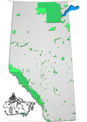 Location of Cross Lake Provincial Park in Alberta | |
| Location | Municipal District of Lesser Slave River No. 124, Alberta, Canada |
| Nearest city | Athabasca, Westlock |
| Coordinates | 54°39′11″N 113°47′40″W / 54.65306°N 113.79444°WCoordinates: 54°39′11″N 113°47′40″W / 54.65306°N 113.79444°W |
| Area | 27.7 km2 (10.7 sq mi) |
| Established | November 22, 1955 |
| Governing body | Alberta Tourism, Parks and Recreation |
Cross Lake Provincial Park is a provincial park in Alberta, Canada, located 62 km (39 mi) west from Athabasca and 57 km (35 mi) north of Westlock.
The park is situated at an elevation of 655 m (2,149 ft) and has a surface of 27.7 km2 (10.7 sq mi). It completely surrounds Steele Lake, which is cruciform, hence its other name "Cross Lake". It was established on November 22, 1955 and is maintained by Alberta Tourism, Parks and Recreation.
Activities
The following activities are available in the park:[1]
- Birdwatching (white-throated sparrows, ruffed grouse, warbler, osprey, bald eagles, great blue herons, bohemian waxwings, pine grosbeaks and white-winged crossbills)
- Camping
- Canoeing and kayaking
- Cross-country skiing (7 kilometres (4.3 mi) of non-groomed trails)
- Fishing and ice fishing
- Hiking
- Horseshoes
- Power boating
- Swimming, water-skiing and windsurfing
Climate
| Climate data for Cross Lake Provincial Park | |||||||||||||
|---|---|---|---|---|---|---|---|---|---|---|---|---|---|
| Month | Jan | Feb | Mar | Apr | May | Jun | Jul | Aug | Sep | Oct | Nov | Dec | Year |
| Record high °C (°F) | 12.5 (54.5) |
16.0 (60.8) |
15.5 (59.9) |
28.9 (84) |
32.0 (89.6) |
33.5 (92.3) |
35.5 (95.9) |
34.0 (93.2) |
32.0 (89.6) |
27.5 (81.5) |
17.2 (63) |
16.0 (60.8) |
35.5 (95.9) |
| Average high °C (°F) | −7.8 (18) |
−3.7 (25.3) |
2.0 (35.6) |
10.8 (51.4) |
17.1 (62.8) |
20.6 (69.1) |
22.9 (73.2) |
22.0 (71.6) |
16.3 (61.3) |
9.2 (48.6) |
−1.4 (29.5) |
−6.4 (20.5) |
8.5 (47.3) |
| Daily mean °C (°F) | −13.9 (7) |
−10.4 (13.3) |
−4.6 (23.7) |
3.7 (38.7) |
9.6 (49.3) |
13.4 (56.1) |
16.0 (60.8) |
14.8 (58.6) |
9.3 (48.7) |
3.0 (37.4) |
−6.5 (20.3) |
−12.2 (10) |
1.9 (35.4) |
| Average low °C (°F) | −19.9 (−3.8) |
−17.2 (1) |
−11.2 (11.8) |
−3.4 (25.9) |
2.0 (35.6) |
6.3 (43.3) |
9.0 (48.2) |
7.5 (45.5) |
2.4 (36.3) |
−3.2 (26.2) |
−11.5 (11.3) |
−18.1 (−0.6) |
−4.8 (23.4) |
| Record low °C (°F) | −51 (−60) |
−46.5 (−51.7) |
−45.5 (−49.9) |
−32.8 (−27) |
−11 (12) |
−4 (25) |
−1.0 (30.2) |
−3.5 (25.7) |
−11 (12) |
−27 (−17) |
−38 (−36) |
−46.7 (−52.1) |
−51 (−60) |
| Average precipitation mm (inches) | 26.1 (1.028) |
14.7 (0.579) |
21.8 (0.858) |
29.9 (1.177) |
49.8 (1.961) |
97.2 (3.827) |
108.0 (4.252) |
68.1 (2.681) |
38.6 (1.52) |
27.5 (1.083) |
25.4 (1) |
20.9 (0.823) |
527.8 (20.78) |
| Average rainfall mm (inches) | 1.2 (0.047) |
0.5 (0.02) |
2.5 (0.098) |
17.8 (0.701) |
48.1 (1.894) |
97.2 (3.827) |
108.0 (4.252) |
68.0 (2.677) |
38.0 (1.496) |
16.8 (0.661) |
2.7 (0.106) |
0.7 (0.028) |
401.3 (15.799) |
| Average snowfall cm (inches) | 24.9 (9.8) |
14.2 (5.59) |
19.2 (7.56) |
12.2 (4.8) |
1.7 (0.67) |
0.0 (0) |
0.0 (0) |
0.1 (0.04) |
0.6 (0.24) |
10.8 (4.25) |
22.7 (8.94) |
20.2 (7.95) |
126.6 (49.84) |
| Source: Environment Canada[2] | |||||||||||||
See also
References
- ↑ Alberta Tourism, Parks, Recreation & Culture. "Activities in Cross Lake Provincial Park". Retrieved 2007-07-15.
- ↑ "Cross Lake Provincial Park". Canadian Climate Normals 1981–2010 (in English and French). Environment Canada. Retrieved March 13, 2014.
External links
- Alberta Tourism, Parks, Recreation & Culture. "Cross Lake Provincial Park". Retrieved 2007-07-15.
This article is issued from Wikipedia - version of the 11/19/2016. The text is available under the Creative Commons Attribution/Share Alike but additional terms may apply for the media files.