Conway, Washington
| Conway, Washington | |
|---|---|
| CDP | |
|
Main Street | |
 Location of Conway, Washington | |
| Coordinates: 48°20′27″N 122°20′37″W / 48.34083°N 122.34361°WCoordinates: 48°20′27″N 122°20′37″W / 48.34083°N 122.34361°W | |
| Country | United States |
| State | Washington |
| County | Skagit |
| Area | |
| • Total | 0.3 sq mi (0.7 km2) |
| • Land | 0.3 sq mi (0.7 km2) |
| • Water | 0.0 sq mi (0.0 km2) |
| Elevation | 13 ft (4 m) |
| Population (2010) | |
| • Total | 91 |
| • Density | 324.9/sq mi (125.4/km2) |
| Time zone | Pacific (PST) (UTC-8) |
| • Summer (DST) | PDT (UTC-7) |
| ZIP code | 98238 |
| Area code | 360 |
| FIPS code | 53-14520[1] |
| GNIS feature ID | 1512112[2] |
| Highways |
|

Conway is a census-designated place (CDP) in Skagit County, Washington, United States. First settled in 1873 by Thomas P. Jones and Charles Villeneuves,[3] its population was 91 at the 2010 census. It is included in the Mount Vernon–Anacortes, Washington Metropolitan Statistical Area.
Geography
Conway is located at 48°20′27″N 122°20′37″W / 48.340856°N 122.343551°W (48.340856, -122.343551).[4]
According to the United States Census Bureau, the census-designated place of Conway has a total area of 0.3 square miles (0.7 km2), all of it land.
Education
Children attend school at the Conway Elementary School from Kindergarten through to the 8th grade. The school mascot is the Cougar and school colors are blue and gold. There are 2 teachers per grade level and a teacher to student ratio of roughly 1:30.
The Conway school district has no high school; parents are permitted to send their children to any of the surrounding high schools, including Stanwood, Mount Vernon, or LaConner. The majority of high school students residing in Conway attend Mount Vernon High School, as it is the only high school that provides a bus to the Conway area.
Demographics
As of the census[1] of 2000, there were 84 people, 28 households, and 22 families residing in the census-designated place. The population density was 324.9 people per square mile (124.7/km2). There were 29 housing units at an average density of 112.2/sq.mi (43.1/km2). The racial makeup of the census-designated place was 95.24% White, and 4.76% from two or more races. Hispanic or Latino of any race were 8.33% of the population.
There were 28 households out of which 50% had children under the age of 18 living with them, 64.3% were married couples living together, 10.7% had a female householder with no husband present, and 17.9% were non-families. 10.7% of all households were made up of individuals and 3.6% were people living alone of 65 years or older. The average household size was 3.00 and the average family size was 3.22.
In the census-designated place the age distribution of the population shows 33.3% under the age of 18, 4.8% from 18 to 24, 33.3% from 25 to 44, 22.6% from 45 to 64, and 6.0% who were 65 years of age or older. The median age was 36 years. For every 100 females there were 104.9 males. For every 100 females age 18 and over, there were 107.4 males.
The median income for a household in the census-designated place was $ 33,750, and the median income for a family was $ 28,750. The per capita income for the census-designated place of Conway was $ 12,206. None of the population or families were below the poverty line.
References
| Wikimedia Commons has media related to Conway, Washington. |
- 1 2 "American FactFinder". United States Census Bureau. Archived from the original on 2013-09-11. Retrieved 2008-01-31.
- ↑ "US Board on Geographic Names". United States Geological Survey. 2007-10-25. Retrieved 2008-01-31.
- ↑ Meany, Edmond S. (1923). Origin of Washington geographic names. Seattle: University of Washington Press. p. 56.
- ↑ "US Gazetteer files: 2010, 2000, and 1990". United States Census Bureau. 2011-02-12. Retrieved 2011-04-23.
Municipalities and communities of Skagit County, Washington, United States | ||
|---|---|---|
| Cities | 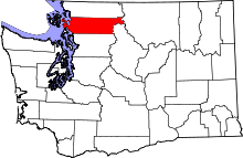 | |
| Towns | ||
| CDPs | ||
| Unincorporated communities | ||
| Indian reservation | ||
| Ghost towns | ||