Cold Springs, El Dorado County, California
| Cold Springs | |
|---|---|
| census-designated place | |
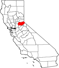
 Cold Springs Location in California | |
| Coordinates: 38°44′31″N 120°52′13″W / 38.74194°N 120.87028°WCoordinates: 38°44′31″N 120°52′13″W / 38.74194°N 120.87028°W | |
| Country |
|
| State |
|
| County | El Dorado County |
| Area[1] | |
| • Total | 0.755 sq mi (1.957 km2) |
| • Land | 0.755 sq mi (1.957 km2) |
| • Water | 0 sq mi (0 km2) 0% |
| Elevation[2] | 1,207 ft (368 m) |
| Population (2010) | |
| • Total | 446 |
| • Density | 590/sq mi (230/km2) |
| Time zone | Pacific (PST) (UTC-8) |
| • Summer (DST) | PDT (UTC-7) |
| GNIS feature ID | 252652; 2628720 |
| U.S. Geological Survey Geographic Names Information System: Cold Springs, El Dorado County, California; U.S. Geological Survey Geographic Names Information System: Cold Springs, El Dorado County, California | |
Cold Springs (formerly, Cold Spring)[3] is a census-designated place[4] in El Dorado County, California.[2] It is located 4 miles (6.4 km) west of Placerville,[3] at an elevation of 1207 feet (368 m).[2] It has a population of 446.
A post office operated at Cold Spring (as it was then called) from in or before 1852 to 1874.[3]
Demographics
The 2010 United States Census[5] reported that Cold Springs had a population of 446. The population density was 590.4 people per square mile (228.0/km²). The racial makeup of Cold Springs was 413 (92.6%) White, 4 (0.9%) African American, 5 (1.1%) Native American, 3 (0.7%) Asian, 0 (0.0%) Pacific Islander, 15 (3.4%) from other races, and 6 (1.3%) from two or more races. Hispanic or Latino of any race were 43 persons (9.6%).
The Census reported that 446 people (100% of the population) lived in households, 0 (0%) lived in non-institutionalized group quarters, and 0 (0%) were institutionalized.
There were 196 households, out of which 43 (21.9%) had children under the age of 18 living in them, 103 (52.6%) were opposite-sex married couples living together, 19 (9.7%) had a female householder with no husband present, 9 (4.6%) had a male householder with no wife present. There were 5 (2.6%) unmarried opposite-sex partnerships, and 1 (0.5%) same-sex married couples or partnerships. 56 households (28.6%) were made up of individuals and 39 (19.9%) had someone living alone who was 65 years of age or older. The average household size was 2.28. There were 131 families (66.8% of all households); the average family size was 2.76.
The population was spread out with 80 people (17.9%) under the age of 18, 23 people (5.2%) aged 18 to 24, 64 people (14.3%) aged 25 to 44, 150 people (33.6%) aged 45 to 64, and 129 people (28.9%) who were 65 years of age or older. The median age was 53.1 years. For every 100 females there were 100.9 males. For every 100 females age 18 and over, there were 104.5 males.
There were 207 housing units at an average density of 274.0 per square mile (105.8/km²), of which 164 (83.7%) were owner-occupied, and 32 (16.3%) were occupied by renters. The homeowner vacancy rate was 1.2%; the rental vacancy rate was 11.1%. 376 people (84.3% of the population) lived in owner-occupied housing units and 70 people (15.7%) lived in rental housing units.
References
- ↑ "2010 Census U.S. Gazetteer Files – Places – California". United States Census Bureau.
- 1 2 3 U.S. Geological Survey Geographic Names Information System: Cold Springs, El Dorado County, California
- 1 2 3 Durham, David L. (1998). California's Geographic Names: A Gazetteer of Historic and Modern Names of the State. Clovis, Calif.: Word Dancer Press. p. 467. ISBN 1-884995-14-4.
- ↑ U.S. Geological Survey Geographic Names Information System: Cold Springs, El Dorado County, California
- ↑ "2010 Census Interactive Population Search: CA - Cold Springs CDP". U.S. Census Bureau. Retrieved July 12, 2014.