Shingle Springs, California
| Shingle Springs | |
|---|---|
| census-designated place | |
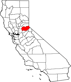
 Location in El Dorado County and the state of California | |
 Shingle Springs Location in the United States | |
| Coordinates: 38°39′57″N 120°55′34″W / 38.66583°N 120.92611°WCoordinates: 38°39′57″N 120°55′34″W / 38.66583°N 120.92611°W | |
| Country |
|
| State |
|
| County | El Dorado |
| Area[1] | |
| • Total | 8.238 sq mi (21.335 km2) |
| • Land | 8.209 sq mi (21.260 km2) |
| • Water | 0.029 sq mi (0.075 km2) 0.35% |
| Elevation | 1,421 ft (433 m) |
| Population (2010) | |
| • Total | 4,432 |
| • Density | 540/sq mi (210/km2) |
| Time zone | Pacific (PST) (UTC-8) |
| • Summer (DST) | PDT (UTC-7) |
| ZIP code | 95682 |
| Area code(s) | 530 |
| FIPS code | 06-71554 |
| GNIS feature ID | 1659645 |
|
U.S. Geological Survey Geographic Names Information System: Shingle Springs, California | |
| Reference no. | 456 |
Shingle Springs (formerly, Shingle Spring and Shingle)[2] is a census-designated place (CDP) in El Dorado County, California, United States. The population was 4,432 at the 2010 census, up from 2,643 at the 2000 census. It is located about 40 miles from Sacramento in the historic Gold Country foothills and sits directly on Highway 50. The historic towns of Coloma and Placerville are less than 15 miles away.
Shingle Springs is part of the Sacramento–Arden-Arcade–Roseville Metropolitan Statistical Area.
The Shingle Springs Band of Miwok Indians, a federally recognized tribe of Maidu and Miwok people, are headquartered in Shingle Springs.[3]
History
Like many of the other towns in California's Mother Lode, Shingle Springs grew on the site of a mining camp set up by gold miners during the California Gold Rush, in this case a group of "49ers" who had followed the Carson-Emigrant Trail through Pleasant Valley, Nevada. It took its name from a horse-drawn shingle machine capable of producing 16,000 shingles a day that was located near the springs at the western edge of the camp.[4] The Boston-Newton Joint Stock Association, which left Boston April 16, 1849, camped there the night before their arrival at Sutter's Fort on September 27, after a remarkable journey across the continent. A rich store of written records preserved by these pioneers has left a detailed picture of the Gold Rush. As a result, the town is now designated California Historical Landmark #456.[5]
The Shingle Spring post office operated from 1853 to 1855.[2] The Shingle Springs post office opened in 1865, the name was changed to Shingle in 1895, and reverted in 1955.[2]
Geography
According to the United States Census Bureau, the CDP has a total area of 8.2 square miles (21 km2), of which, over 99% is land.
For the 2000 census, the CDP had a total area of 5.2 square miles (13 km2), of which, 5.2 square miles (13 km2) of it was land and 0.19% was water.
Demographics
2010
The 2010 United States Census[6] reported that Shingle Springs had a population of 4,432. The population density was 538.0 people per square mile (207.7/km²). The racial makeup of Shingle Springs was 3,919 (88.4%) White, 14 (0.3%) African American, 108 (2.4%) Native American, 50 (1.1%) Asian, 3 (0.1%) Pacific Islander, 132 (3.0%) from other races, and 206 (4.6%) from two or more races. Hispanic or Latino of any race were 469 persons (10.6%).
The Census reported that 4,344 people (98.0% of the population) lived in households, 88 (2.0%) lived in non-institutionalized group quarters, and 0 (0%) were institutionalized.
There were 1,627 households, out of which 527 (32.4%) had children under the age of 18 living in them, 1,015 (62.4%) were opposite-sex married couples living together, 163 (10.0%) had a female householder with no husband present, 73 (4.5%) had a male householder with no wife present. There were 76 (4.7%) unmarried opposite-sex partnerships, and 12 (0.7%) same-sex married couples or partnerships. 291 households (17.9%) were made up of individuals and 104 (6.4%) had someone living alone who was 65 years of age or older. The average household size was 2.67. There were 1,251 families (76.9% of all households); the average family size was 3.01.
The population was spread out with 1,031 people (23.3%) under the age of 18, 334 people (7.5%) aged 18 to 24, 874 people (19.7%) aged 25 to 44, 1,568 people (35.4%) aged 45 to 64, and 625 people (14.1%) who were 65 years of age or older. The median age was 44.6 years. For every 100 females there were 97.7 males. For every 100 females age 18 and over, there were 96.4 males.
There were 1,718 housing units at an average density of 208.6 per square mile (80.5/km²), of which 1,248 (76.7%) were owner-occupied, and 379 (23.3%) were occupied by renters. The homeowner vacancy rate was 1.2%; the rental vacancy rate was 5.2%. 3,343 people (75.4% of the population) lived in owner-occupied housing units and 1,001 people (22.6%) lived in rental housing units.
2000
As of the census[7] of 2000, there were 2,643 people, 951 households, and 731 families residing in the CDP. The population density was 507.4 people per square mile (195.9/km²). There were 969 housing units at an average density of 186.0 per square mile (71.8/km²). The racial makeup of the CDP was 91.68% White, 0.38% Black or African American, 1.29% Native American, 1.63% Asian, 0.15% Pacific Islander, 1.32% from other races, and 3.56% from two or more races. 6.62% of the population were Hispanic or Latino of any race.
There were 951 households out of which 37.3% had children under the age of 18 living with them, 58.8% were married couples living together, 13.8% had a female householder with no husband present, and 23.1% were non-families. 18.5% of all households were made up of individuals and 9.0% had someone living alone who was 65 years of age or older. The average household size was 2.76 and the average family size was 3.12.
In the CDP the population was spread out with 29.4% under the age of 18, 8.5% from 18 to 24, 24.0% from 25 to 44, 24.5% from 45 to 64, and 13.7% who were 65 years of age or older. The median age was 38 years. For every 100 females there were 90.3 males. For every 100 females age 18 and over, there were 87.5 males.
The median income for a household in the CDP was $55,100, and the median income for a family was $59,263. Males had a median income of $48,026 versus $31,635 for females. The per capita income for the CDP was $25,795. About 5.9% of families and 6.1% of the population were below the poverty line, including 3.9% of those under age 18 and 1.4% of those age 65 or over.
Politics
In the state legislature, Shingle Springs is in the 1st Senate District, represented by Republican Ted Gaines,[8] and the 5th Assembly District, represented by Republican Frank Bigelow.[9]
Federally, Shingle Springs is in California's 4th congressional district, represented by Republican Tom McClintock.[10]
Local Schools
- Rainbowland Christian Preschool
- Buckeye Elementary School
- California Montessori Project
- Ponderosa High School
- Latrobe Elementary School
- Miller's Hill Middle School
Climate
The Köppen Climate Classification subtype for this climate is "Csa" (Mediterranean Climate).[11]
References
- ↑ "2010 Census U.S. Gazetteer Files – Places – California". United States Census Bureau.
- 1 2 3 Durham, David L. (1998). California's Geographic Names: A Gazetteer of Historic and Modern Names of the State. Clovis, Calif.: Word Dancer Press. p. 554. ISBN 1-884995-14-4.
- ↑ "Member Tribes." California Rural Indian Health Board. Retrieved 31 May 2012.
- ↑ "Shingle Springs – A Gold Rush Mining Camp Turns Rail Town" by Anthony Belli; retrieved June 5, 2007
- ↑ "Shingle Springs". Office of Historic Preservation, California State Parks. Retrieved 2012-10-07.
- ↑ "2010 Census Interactive Population Search: CA - Shingle Springs CDP". U.S. Census Bureau. Retrieved July 12, 2014.
- ↑ "American FactFinder". United States Census Bureau. Retrieved 2008-01-31.
- ↑ "Senators". State of California. Retrieved April 5, 2013.
- ↑ "Members Assembly". State of California. Retrieved April 5, 2013.
- ↑ "California's 4th Congressional District - Representatives & District Map". Civic Impulse, LLC. Retrieved March 2, 2013.
- ↑ Climate Summary for Shingle Springs, CA