Clarkridge, Arkansas
| Clarkridge, Arkansas | |
|---|---|
| Unincorporated community | |
 Clarkridge, Arkansas  Clarkridge, Arkansas Clarkridge's position in Arkansas. | |
| Coordinates: 36°28′40″N 92°21′5″W / 36.47778°N 92.35139°WCoordinates: 36°28′40″N 92°21′5″W / 36.47778°N 92.35139°W | |
| Country |
|
| State |
|
| County | Baxter |
| Township | Pigeon |
| Elevation | 265 m (869 ft) |
| Time zone | Central (CST) (UTC-6) |
| • Summer (DST) | CDT (UTC-5) |
| GNIS feature ID | 76623 |
| U.S. Geological Survey Geographic Names Information System: Clarkridge, Arkansas | |
Clarkridge, Arkansas (formerly Clark Ridge) is an unincorporated community in Baxter County, Arkansas, United States.[1] The community is located near the end of Arkansas Highway 201 near the Missouri state line.[2] Clarkridge has one post office, three churches, one gas station/quik stop store, and one resort on Norfork Lake. Clarkridge has a Volunteer Fire Department consisting of four fire stations and over 30 volunteer firefighters. The community is very active in helping the extended community and has won the Arkansas Volunteer Community of the Year award for 13 of the past 14 years.
References
- ↑ "Feature Detail Report for: Clarkridge, Arkansas." USGS. U.S. Geological Survey Geographic Names Information System: Clarkridge, Arkansas Retrieved March 14, 2011.
- ↑ Arkansas Atlas and Gazetteer (Map) (Second ed.). DeLorme. § 25.
Municipalities and communities of Baxter County, Arkansas, United States | ||
|---|---|---|
| Cities | 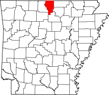 | |
| Towns | ||
| CDP | ||
| Unincorporated communities | ||
| Footnotes | ‡This populated place also has portions in an adjacent county or counties | |
This article is issued from Wikipedia - version of the 8/28/2016. The text is available under the Creative Commons Attribution/Share Alike but additional terms may apply for the media files.