Clark Fork Township, Cooper County, Missouri
| Clark Fork Township | |
|---|---|
| Township | |
 Location in Cooper County | |
| Coordinates: 38°52′10″N 92°41′46″W / 38.86944°N 92.69611°WCoordinates: 38°52′10″N 92°41′46″W / 38.86944°N 92.69611°W | |
| Country |
|
| State |
|
| County | Cooper |
| Area | |
| • Total | 52.64 sq mi (136.32 km2) |
| • Land | 52.6 sq mi (136.24 km2) |
| • Water | 0.03 sq mi (0.08 km2) 0.06% |
| Elevation | 689 ft (210 m) |
| Population (2000) | |
| • Total | 598 |
| • Density | 11.4/sq mi (4.4/km2) |
| Time zone | CST (UTC-6) |
| • Summer (DST) | CDT (UTC-5) |
| ZIP codes | 65068, 65233, 65237 |
| GNIS feature ID | 0766528 |
Clark Fork Township is one of fourteen townships in Cooper County, Missouri, USA. As of the 2000 census, its population was 598.[1]
Clark Fork Township was named after the creek of the same name within its borders.[2]
Geography
According to the United States Census Bureau, Clark Fork Township covers an area of 52.64 square miles (136.32 square kilometers); of this, 52.6 square miles (136.24 square kilometers, 99.94 percent) is land and 0.03 square miles (0.08 square kilometers, 0.06 percent) is water.
Unincorporated towns
- Clarks Fork at 38°53′13″N 92°39′10″W / 38.886973°N 92.652688°W
- Lone Elm at 38°49′30″N 92°44′13″W / 38.825024°N 92.736857°W
Adjacent townships
- Saline Township (northeast)
- Prairie Home Township (east)
- North Moniteau Township (southeast)
- Kelly Township (southwest)
- Palestine Township (west)
- Boonville Township (northwest)
Cemeteries
The township contains these two cemeteries: McCullough and Toler.
Major highways
School districts
- Boonville School District
- Cooper County C-4
- Prairie Home R-V School District
Political districts
- Missouri's 6th congressional district
- State House District 117
- State Senate District 21
References
- United States Census Bureau 2008 TIGER/Line Shapefiles
- United States Board on Geographic Names (GNIS)
- United States National Atlas
- ↑ United States Census Bureau American FactFinder
- ↑ "Cooper County Place Names, 1928–1945 (archived)". The State Historical Society of Missouri. Archived from the original on 24 June 2016. Retrieved 24 September 2016.
External links
 |
Boonville Township | |
Saline Township | |
| Palestine Township | |
Prairie Home Township | ||
| ||||
| | ||||
| Kelly Township | |
North Moniteau Township |
Municipalities and communities of Cooper County, Missouri, United States | ||
|---|---|---|
| Cities | 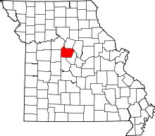 | |
| Villages | ||
| Townships | ||
| Unincorporated communities | ||
This article is issued from Wikipedia - version of the 11/25/2016. The text is available under the Creative Commons Attribution/Share Alike but additional terms may apply for the media files.