Cihanbeyli
| Cihanbeyli | |
|---|---|
| District | |
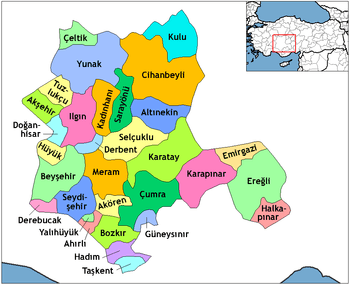 Location of Cihanbeyli within Turkey. | |
 Cihanbeyli Location of Cihanbeyli within Turkey. | |
| Coordinates: 38°39′N 32°56′E / 38.650°N 32.933°E | |
| Country |
|
| Province | Konya |
| Government | |
| • Mayor | Mehmet Kale (AKP)[1] |
| Area[2] | |
| • District | 4,447.54 km2 (1,717.20 sq mi) |
| Elevation | 950 m (3,120 ft) |
| Population (2012)[3] | |
| • Urban | 15,966 |
| • District | 57,243 |
| • District density | 13/km2 (33/sq mi) |
| Time zone | EET (UTC+2) |
| • Summer (DST) | EEST (UTC+3) |
| Postal code | 42xxx |
| Area code(s) | 0332 |
| Licence plate | 42 |
| Climate | Csb |
| Website | www.cihanbeyli.gov.tr |
Cihanbeyli (Ottoman Turkish: Esbikeşan) is a town and district of Konya Province in the Central Anatolia region of Turkey. According to 2000 census, population of the district is 75,871 of which 18,306 live in the town of Cihanbeyli.[4][5]
Sunni Turks form the majority in the city of Cihanbeyli, but the villages (sub-districts) of Cihanbeyli are inhabited mostly by ethnic Sunni Kurds from Reshwan and Canbeg tribes with a significant minority of Bulgarian Turks, Uzbek Tatars and Circassians.
The Cihanbeyli population has, since 1960s, emigrated to Western Europe to seek a better life and later bring their families. The Cihanbeyli community is supposed to make up for one third of the Kurdish diaspora in Denmark and smaller Cihanbeyli communities can be found in Sweden, Switzerland and Germany.
Villages
The district of Cihanbeyli considers of 45 sub-districts.
| Name | Old name | Ethnicity |
|---|---|---|
| Ağabeyli | Turk | |
| Ahirigüzel | Turk | |
| Atçeken | Turk | |
| Bahçelievler | Turk-Kurd | |
| Beyliova | Xereve | Kurd |
| Böğrüdelik | Reşadiye | Uzbek |
| Bulduk | Gundê Buldiq | Kurd |
| Büyükbeşkavak | Kurd | |
| Cumhuriyet | Turk-Kurd | |
| Çimen | Çîmane | Kurd |
| Çöl | Yoylê Çolê | Kurd |
| Damlakuyu | Çorca | Turk-Kurd |
| Gemecik | Turk | |
| Göktepe | Turk | |
| Gölyazi | Xelikan | Kurd |
| Günyüzü | Cûdikan | Kurd |
| Hodoğlu | Turk | |
| Kale | Turk | |
| Kandil | Kurd | |
| Karabağ | Turk | |
| Karatepe | Turk | |
| Karşıyaka | Turk-Kurd | |
| Kayı | Turk | |
| Kelhasan | Kurd | |
| Kırkışla | Molîka | Kurd |
| Kocatepe | Turk | |
| Korkmazlar | Delala | Kurd |
| Köprübaşı | Turk | |
| Kuşça | Hecîlera | Kurd |
| Küçükbeşkavak | Memedelî | Kurd |
| Kütükuşağı | Kutûga | Kurd |
| Pinarbasi | Bulgarian Turk | |
| Sağlık | Qolîta | Kurd |
| Sığırcık | Turk | |
| Taşpınar | Kurd-Turk | |
| Turanlar | Yoylê Tozê | Kurd |
| Tüfekçipınar | Bulgarian Turk | |
| Uzuncayayla | Turk | |
| Yapalı | Kemera | Kurd |
| Yeniceoba | Incowê | Kurd |
| Yeniköy | Turk | |
| Yeşildere | Zozanê Mewlîd / Çîmanabicuk | Kurd |
| Yeşilöz | Turk | |
| Yünlükuyu | Hacîomera | Kurd |
| Zaferiye | Qayisole | Kurd |
Notes
- ↑ "Cihanbeyli Belediye Başkanı Kale AK Parti'den istifa etmelidir!". 15 December 2015. Retrieved 10 July 2016.
- ↑ "Area of regions (including lakes), km²". Regional Statistics Database. Turkish Statistical Institute. 2002. Retrieved 2013-03-05.
- ↑ "Population of province/district centers and towns/villages by districts - 2012". Address Based Population Registration System (ABPRS) Database. Turkish Statistical Institute. Retrieved 2013-02-27.
- ↑ Turkish Statistical Institute. "Census 2000, Key statistics for urban areas of Turkey" (in Turkish). Archived from the original (XLS) on 2007-07-22. Retrieved 2008-03-23.
- ↑ GeoHive. "Statistical information on Turkey's administrative units". Retrieved 2008-03-23.
References
- Falling Rain Genomics, Inc. "Geographical information on Cihanbeyli, Turkey". Retrieved 2008-03-23.
External links
- District governor's official website (Turkish)
- District municipality's official website (Turkish)
Coordinates: 38°39′29″N 32°55′41″E / 38.65806°N 32.92806°E