Siirt Province
| Siirt Province Siirt ili | |
|---|---|
| Province of Turkey | |
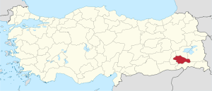 Location of Siirt Province in Turkey | |
| Country | Turkey |
| Region | Southeast Anatolia |
| Subregion | Mardin |
| Government | |
| • Electoral district | Siirt |
| Area | |
| • Total | 5,406 km2 (2,087 sq mi) |
| Population (2010-12-31)[1] | |
| • Total | 300,695 |
| • Density | 56/km2 (140/sq mi) |
| Area code(s) | 0484 |
| Vehicle registration | 56 |
Siirt Province, (Turkish: Siirt ili, Arabic: محافظة سعرد, Kurdish: Parêzgeha Sêrt) is a province of Turkey, located in the southeast. The province borders Bitlis to the north, Batman to the west, Mardin to the southwest, Şırnak to the south, and Van to the east. It has an area of 5,406 km² and a total population of 300,695 (as of 2010). The provincial capital is the city of Siirt. The majority of the province's population is Arabic and Kurdish.[2]
Districts
Siirt province is divided into 7 districts (capital district in bold):
Notes
- ↑ Turkish Statistical Institute, MS Excel document – Population of province/district centers and towns/villages and population growth rate by provinces
- ↑ Watts, Nicole F. (2010). Activists in Office: Kurdish Politics and Protest in Turkey (Studies in Modernity and National Identity). Seattle: University of Washington Press. p. 167. ISBN 978-0-295-99050-7.
External links

| ||
Metropolitan municipalities are bolded. | ||
Coordinates: 37°55′48″N 42°16′13″E / 37.93000°N 42.27028°E
This article is issued from Wikipedia - version of the 12/4/2016. The text is available under the Creative Commons Attribution/Share Alike but additional terms may apply for the media files.