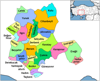
Seydişehir
| Seydişehir | |
|---|---|
| District | |
 | |
 Seydişehir Location of Seydişehir within Turkey | |
| Coordinates: 37°25′N 31°51′E / 37.417°N 31.850°E | |
| Country |
|
| Region | Mediterranean |
| Province | Konya |
| Incorporated | 1871 |
| Government | |
| • Type | Strong Mayor-Council |
| • Mayor | Mehmet Tutal (Ak Parti) |
| • Prefect | Tuncay Sonel |
| Area[1] | |
| • District | 1,362.56 km2 (526.09 sq mi) |
| Elevation | 1,089 m (3,573 ft) |
| Population (2012)[2] | |
| • Urban | 40,824 |
| • District | 63,639 |
| • District density | 47/km2 (120/sq mi) |
| Time zone | EET (UTC+2) |
| • Summer (DST) | EEST (UTC+3) |
| Postal code | 42360-42370 |
| Area code(s) | (0090)+ 332 |
| Licence plate | 42 |
| Website | www.seydisehir.bel.tr |

Seydişehir is a town and district of Konya Province in the Central Anatolia region of Turkey. According to 2000 census, population of the district is 85,456 of which 48,372 live in the town of Seydişehir.[3]
History
Seydişehir is based on a very old history. In 5500 BC, Seydişehir was in Psidia's border and had a lot of historical building. City has a valley between Trogitis Lacos and Karalis Lacos. We can see pre-historic buildings in valley. A they are still in Konya Archeology Museum. In 2000–700 BC, Hittite that's conqueror of middle Anatolia, built symbols and handiwork. It is obvious in Seydişehir that rock reliefs that was made by Hittite, is the proof of Hittite's living area.
Other
Seydişehir is famous with roasted chickpeas in Turkey. It called "Seydisehir chickpeas" and People who lives in Seydişehir, grows roasted chickpeas. The plant grows to between 20–50 cm (8–20 inches) high and has small feathery leaves on either side of the stem.
Geography
Seydişehir is in the south of Konya city center, is in the north of The Taurus Mountains and in the plain Suğla that's efficient valley.
Location
| Beyşehir (32 km), Isparta (210 km), İzmir (608 km), İstanbul (670 km) | Konya (89 km), Ankara (350 km) | |
| Derebucak (48 km) |  |
|
| Akseki (63 km), Manavgat (135 km), Alanya (174 km), Antalya (208 km) | Bozkır (51 km), Karaman (168 km), Mersin (395 km) |
Prominent Persons
- Seyyid Harun Veli, Philosopher, Religious Scholar (13th century)
- Mahmud Esad Efendi, Lawyer, writer and statesman (d. 1856, Seydişehir - ö. 1918, İstanbul)
- Sadi Irmak, Emeritus professor of medicine, politician, prime minister (d. 1904, Seydişehir - ö. 1990, İstanbul)
- Mustafa Üstündağ, Educator, politician, minister (d. 1933, Seydişehir - ö. 1983, Konya)
Notes
- ↑ "Area of regions (including lakes), km²". Regional Statistics Database. Turkish Statistical Institute. 2002. Retrieved 2013-03-05.
- ↑ "Population of province/district centers and towns/villages by districts - 2012". Address Based Population Registration System (ABPRS) Database. Turkish Statistical Institute. Retrieved 2013-02-27.
- ↑ Turkish Statistical Institute. "Census 2000, Key statistics for urban areas of Turkey" (in Turkish). Archived from the original (XLS) on 2007-07-22. Retrieved 2008-03-26.
References
- Falling Rain Genomics, Inc. "Geographical information on Seydişehir, Turkey". Archived from the original on 2012-10-25. Retrieved 2008-03-26.
External links
- District municipality's official website (Turkish)
- News of Seydisehir website (Turkish)
- City Guide of Seydisehir website (Turkish)
Coordinates: 37°25′06″N 31°51′02″E / 37.41833°N 31.85056°E