Cherry Grove, Minnesota
| Cherry Grove, Minnesota | |
|---|---|
| Unincorporated community | |
 Cherry Grove  Cherry Grove | |
| Coordinates: 43°35′15″N 92°17′20″W / 43.58750°N 92.28889°WCoordinates: 43°35′15″N 92°17′20″W / 43.58750°N 92.28889°W | |
| Country | United States |
| State | Minnesota |
| County | Fillmore |
| Elevation | 1,325 ft (404 m) |
| Population | |
| • Total | 100 |
| Time zone | Central (CST) (UTC-6) |
| • Summer (DST) | CDT (UTC-5) |
| ZIP codes | 55975 and 55965 |
| Area code(s) | 507 |
| GNIS feature ID | 641144[1] |
Cherry Grove is an unincorporated community in Fillmore County, Minnesota, United States.
The community is located 9 miles south of Wykoff, at the junction of Fillmore County 5 and 160th Street. Forestville Mystery Cave State Park is nearby. U.S. Highway 63 and Fillmore County 14 are both in the vicinity.
Cherry Grove is located along the boundary line between York Township and Forestville Township.
Nearby places include Spring Valley, Ostrander, Etna, Wykoff, Greenleafton, Preston, and Harmony.
Cherry Grove is located 12 miles southeast of Spring Valley; and 15 miles southwest of Preston. Cherry Grove is 17 miles west–northwest of Harmony.
ZIP codes 55975 (Spring Valley) and 55965 (Preston) meet at Cherry Grove. A post office previously operated in the community of Cherry Grove from 1857 to 1893, and again from 1894 to 1903.
The South Branch Root River is nearby.
References
- Rand McNally Road Atlas – 2007 edition – Minnesota entry
- Official State of Minnesota Highway Map – 2011/2012 edition
Municipalities and communities of Fillmore County, Minnesota, United States | ||
|---|---|---|
| Cities | 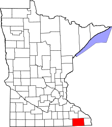 | |
| Townships | ||
| Unincorporated communities | ||
| Ghost town | ||
| Footnotes | ‡This populated place also has portions in an adjacent county or counties | |