Whalan, Minnesota
| Whalan, Minnesota | |
|---|---|
| City | |
 Location of Whalan, Minnesota | |
| Coordinates: 43°43′54″N 91°55′40″W / 43.73167°N 91.92778°W | |
| Country | United States |
| State | Minnesota |
| County | Fillmore |
| Area[1] | |
| • Total | 0.43 sq mi (1.11 km2) |
| • Land | 0.41 sq mi (1.06 km2) |
| • Water | 0.02 sq mi (0.05 km2) |
| Elevation | 791 ft (241 m) |
| Population (2010)[2] | |
| • Total | 63 |
| • Estimate (2012[3]) | 63 |
| • Density | 153.7/sq mi (59.3/km2) |
| Time zone | Central (CST) (UTC-6) |
| • Summer (DST) | CDT (UTC-5) |
| ZIP code | 55949 |
| Area code(s) | 507 |
| FIPS code | 27-69808[4] |
| GNIS feature ID | 0654053[5] |
Whalan is a city in Fillmore County, Minnesota, United States. The population was 63 at the 2010 census.[6]
History
Whalan was laid out in 1868.[7] It was named after John Whaalahan, the original owner of the town site.[8] Whalan was incorporated in 1876.[7] A post office was established at Whalan in 1869, and remained in operation until it was discontinued in 1993.[9]
Geography
According to the United States Census Bureau, the city has a total area of 0.43 square miles (1.11 km2), of which 0.41 square miles (1.06 km2) is land and 0.02 square miles (0.05 km2) is water.[1]
Demographics
| Historical population | |||
|---|---|---|---|
| Census | Pop. | %± | |
| 1880 | 134 | — | |
| 1890 | 98 | −26.9% | |
| 1900 | 134 | 36.7% | |
| 1910 | 121 | −9.7% | |
| 1920 | 142 | 17.4% | |
| 1930 | 155 | 9.2% | |
| 1940 | 190 | 22.6% | |
| 1950 | 176 | −7.4% | |
| 1960 | 146 | −17.0% | |
| 1970 | 114 | −21.9% | |
| 1980 | 119 | 4.4% | |
| 1990 | 94 | −21.0% | |
| 2000 | 64 | −31.9% | |
| 2010 | 63 | −1.6% | |
| Est. 2015 | 67 | [10] | 6.3% |
2010 census
As of the census[2] of 2010, there were 63 people, 32 households, and 14 families residing in the city. The population density was 153.7 inhabitants per square mile (59.3/km2). There were 55 housing units at an average density of 134.1 per square mile (51.8/km2). The racial makeup of the city was 100.0% White.
There were 32 households of which 18.8% had children under the age of 18 living with them, 28.1% were married couples living together, 3.1% had a female householder with no husband present, 12.5% had a male householder with no wife present, and 56.3% were non-families. 53.1% of all households were made up of individuals and 12.5% had someone living alone who was 65 years of age or older. The average household size was 1.97 and the average family size was 3.00.
The median age in the city was 46.3 years. 22.2% of residents were under the age of 18; 3.2% were between the ages of 18 and 24; 17.5% were from 25 to 44; 38.1% were from 45 to 64; and 19% were 65 years of age or older. The gender makeup of the city was 54.0% male and 46.0% female.
2000 census
As of the census[4] of 2000, there were 64 people, 34 households, and 16 families residing in the city. The population density was 225.4 people per square mile (88.3/km²). There were 45 housing units at an average density of 158.5 per square mile (62.1/km²). The racial makeup of the city was 100.00% White.
There were 34 households out of which 20.6% had children under the age of 18 living with them, 35.3% were married couples living together, 2.9% had a female householder with no husband present, and 52.9% were non-families. 47.1% of all households were made up of individuals and 23.5% had someone living alone who was 65 years of age or older. The average household size was 1.88 and the average family size was 2.69.
In the city the population was spread out with 17.2% under the age of 18, 7.8% from 18 to 24, 21.9% from 25 to 44, 28.1% from 45 to 64, and 25.0% who were 65 years of age or older. The median age was 47 years. For every 100 females there were 100.0 males. For every 100 females age 18 and over, there were 89.3 males.
The median income for a household in the city was $28,750, and the median income for a family was $31,875. Males had a median income of $16,875 versus $22,750 for females. The per capita income for the city was $17,680. None of the population and none of the families were below the poverty line.
Trail connection
Whalan is one of several towns intersected by the Root River segment of the Blufflands State Trail.
Stand Still Parade
Whalan hosts an annual Stand Still Parade in the 1 block downtown stretch of the town. Rather than moving through the streets, the parade stays still and spectators walk around the parade from beginning to end. In addition to the parade, they also offer food, music and games.[12]
References
- 1 2 "US Gazetteer files 2010". United States Census Bureau. Retrieved 2012-11-13.
- 1 2 "American FactFinder". United States Census Bureau. Retrieved 2012-11-13.
- ↑ "Population Estimates". United States Census Bureau. Retrieved 2013-05-28.
- 1 2 "American FactFinder". United States Census Bureau. Retrieved 2008-01-31.
- ↑ "US Board on Geographic Names". United States Geological Survey. 2007-10-25. Retrieved 2008-01-31.
- ↑ "2010 Census Redistricting Data (Public Law 94-171) Summary File". American FactFinder. United States Census Bureau. Retrieved 27 April 2011.
- 1 2 Upham, Warren (1920). Minnesota Geographic Names: Their Origin and Historic Significance. Minnesota Historical Society. p. 195.
- ↑ "Where Did Minnesota Towns Get Names? Most Colorful in U.S.". The Winona Republican-Herald. July 12, 1949. p. 15. Retrieved January 24, 2015 – via Newspapers.com.
- ↑ "Fillmore County". Jim Forte Postal History. Retrieved 30 May 2015.
- ↑ "Annual Estimates of the Resident Population for Incorporated Places: April 1, 2010 to July 1, 2015". Retrieved July 2, 2016.
- ↑ "Census of Population and Housing". Census.gov. Retrieved June 4, 2015.
- ↑ "Whalan, MN Stand Still Parade". Retrieved 10 July 2011.
| Core city |  | |
|---|---|---|
| Incorporated Places | ||
| Counties | ||
‡ indicates that it is partially in the metropolitan area. † indicates a county seat. | ||
Municipalities and communities of Fillmore County, Minnesota, United States | ||
|---|---|---|
| Cities | 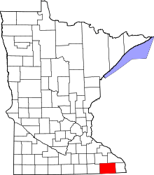 | |
| Townships | ||
| Unincorporated communities | ||
| Ghost town | ||
| Footnotes | ‡This populated place also has portions in an adjacent county or counties | |
Coordinates: 43°43′56″N 91°55′36″W / 43.73222°N 91.92667°W