Cherokee, Victoria
| Cherokee Victoria | |||||||||||||
|---|---|---|---|---|---|---|---|---|---|---|---|---|---|
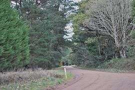 Gap Road at Cherokee | |||||||||||||
 Cherokee | |||||||||||||
| Coordinates | 37°23′S 144°38′E / 37.383°S 144.633°ECoordinates: 37°23′S 144°38′E / 37.383°S 144.633°E | ||||||||||||
| Established | 1880 | ||||||||||||
| Postcode(s) | 3434 | ||||||||||||
| Elevation | 730 m (2,395 ft) | ||||||||||||
| LGA(s) | Shire of Macedon Ranges | ||||||||||||
| State electorate(s) | Macedon | ||||||||||||
| Federal Division(s) | McEwen | ||||||||||||
| |||||||||||||
Cherokee /ˈtʃɛrəki/ is a small town situated in the Macedon Ranges Shire, in Victoria, Australia 73 kilometres (45 mi) north of the state capital, Melbourne.
The settlement as it appears today was created by land subdivision around 1880–1881, although the area was occupied by Europeans before this date. Timber mills and a school were operating by 1865, possibly earlier, in response to the demand for timber created by the Victorian gold rush.[1]
Cherokee Post Office opened on 1 July 1927 and closed in 1955.[2]
References
| Wikimedia Commons has media related to Cherokee, Victoria. |
- ↑ Smith, Gavin (1994). All Wild and Lonely Bush. Romsey: Shire of Romsey Book Committee. pp. 22 and 37. ISBN 0-646-23834-5.
- ↑ Premier Postal History. "Post Office List". Retrieved 2008-04-11.
This article is issued from Wikipedia - version of the 5/7/2016. The text is available under the Creative Commons Attribution/Share Alike but additional terms may apply for the media files.