Gisborne South, Victoria
| Gisborne South Victoria | |||||||||||||
|---|---|---|---|---|---|---|---|---|---|---|---|---|---|
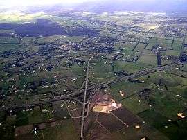 Aerial photo of Gisborne South | |||||||||||||
| Population | 742 (2006 census)[1] | ||||||||||||
| Postcode(s) | 3437 | ||||||||||||
| Elevation | 443 m (1,453 ft) | ||||||||||||
| LGA(s) | Shire of Macedon Ranges | ||||||||||||
| State electorate(s) | Macedon | ||||||||||||
| Federal Division(s) | McEwen | ||||||||||||
| |||||||||||||
Gisborne South, also known as Couangalt,[2][3][4][5] is a locality in the Macedon Ranges Shire, in Victoria, Australia, north west of the city of Melbourne. At the 2006 census, Gisborne South had a population of 742.[1]
Gisborne South has never had a Post Office under that name. The Cabbage Tree office within the locality opened on 6 July 1867, was renamed Yangardook in April 1875 and Couangalt in September 1875. It closed in 1895, reopened in 1913 and closed in 1965.[6]
References
- 1 2 Australian Bureau of Statistics (25 October 2007). "Gisborne South (State Suburb)". 2006 Census QuickStats. Retrieved 9 May 2010.
- ↑ Victorian Municipal Directory. Brunswick: Arnall & Jackson. 1956. p. 639.
- ↑ VicRoads Country Street Directory, Edition 1, 1992
- ↑ Melway Edition 33, 2006
- ↑ Funston, Rob (December 2011). "'I remember when...'". Gisborne Gazette. p. 27.
- ↑ Premier Postal History, Post Office List, retrieved 7 August 2015
Coordinates: 37°32′19″S 144°36′23″E / 37.53861°S 144.60639°E
This article is issued from Wikipedia - version of the 8/9/2015. The text is available under the Creative Commons Attribution/Share Alike but additional terms may apply for the media files.