Chapman Township, Snyder County, Pennsylvania
| Chapman Township, Snyder County, Pennsylvania | |
|---|---|
| Township | |
|
Mother and child McKee's Half Falls Rest Area | |
 Map of Snyder County, Pennsylvania highlighting Chapman Township | |
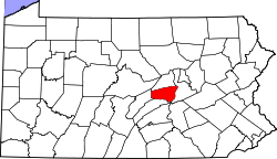 Map of Snyder County, Pennsylvania | |
| Country | United States |
| State | Pennsylvania |
| County | Snyder |
| Settled | 1744 |
| Incorporated | 1820 |
| Area | |
| • Total | 13.3 sq mi (34.5 km2) |
| • Land | 20.5 sq mi (53 km2) |
| Population (2000) | |
| • Total | 1,426 |
| • Density | 107.4/sq mi (41.3/km2) |
| Time zone | Eastern (EST) (UTC-5) |
| • Summer (DST) | EDT (UTC-4) |
| Website | Chapman Township |

Chapman Township is a township in Snyder County, Pennsylvania, United States. The population was 1,426 at the 2000 census.
Geography
According to the United States Census Bureau, the township has a total area of 13.3 square miles (34 km2), all of it land.
Chapman Township is bordered by Washington Township to the northwest, Union Township to the northeast, the Susquehanna River to the east, Juniata County to the south and Perry Township to the west.
The census-designated place of Port Trevorton lies partially in the northeast corner of the township along the Susquehanna River and U.S. Route 15.
Demographics
As of the census[1] of 2000, there were 1,426 people, 433 households, and 354 families residing in the township. The population density was 107.1 people per square mile (41.3/km²). There were 471 housing units at an average density of 35.4/sq mi (13.7/km²). The racial makeup of the township was 99.72% White, 0.14% African American, 0.07% Asian, and 0.07% from two or more races. Hispanic or Latino of any race were 0.07% of the population.
There were 433 households out of which 40.6% had children under the age of 18 living with them, 70.4% were married couples living together, 7.2% had a female householder with no husband present, and 18.2% were non-families. 16.9% of all households were made up of individuals and 6.0% had someone living alone who was 65 years of age or older. The average household size was 3.29 and the average family size was 3.76.
In the township the population was spread out with 34.8% under the age of 18, 9.1% from 18 to 24, 27.3% from 25 to 44, 18.8% from 45 to 64, and 10.0% who were 65 years of age or older. The median age was 30 years. For every 100 females there were 104.6 males. For every 100 females age 18 and over, there were 97.0 males.
The median income for a household in the township was $31,250, and the median income for a family was $33,750. Males had a median income of $28,611 versus $19,211 for females. The per capita income for the township was $12,632. About 13.3% of families and 20.4% of the population were below the poverty line, including 33.6% of those under age 18 and 19.4% of those age 65 or over.
Schools
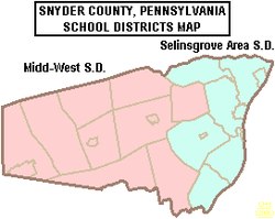
Selinsgrove Area School District is the local public school. There are approximately 2900 students clustered on a campus located in Selinsgrove borough.
SASD employs about 350 people in 2007 making it one of the largest employers in the district. Two hundred of the employees are teachers. The median teacher salary in 2007 is $58,000 plus benefits. This falls in the upper third for teacher salaries in Pennsylvania. Seventy percent of spending is allocated to employee costs. The district reports spending $9800 per pupil in 2007.[2] According to Hummel, costs for building projects coupled with salaries, transportation costs and increased charges for energy, will mean continued property tax increases.
Selinsgrove Area High School has about 960 students in grades 9-12. The Selinsgrove Area Middle School serves students in grades 6-8 using a team teaching approach.
Selinsgrove Area Intermediate School has students grades 3-5. Primary grades are at Selinsgrove Area Elementary School. Kindergarten is located at Jackson Penn School. Public School busing is provided. The district is working towards providing All Day Kindergarten in 2007-2008. Officials are using this as an opportunity to further consolidate the district by renovating and enlarging Selinsgrove Elementary School and closing Jackson-Penn Elementary School. Enrollment in the district is declining and is projected to continue to decline for the next decade. SASD Demographic report PreK-12 school statistics Enrollment Projections
Residents also have a wide selection of alternative schools. By law, the local public school must provide transportation to schools within 10 miles of the borders of the school district at no charge to the student.
References
- ↑ "American FactFinder". United States Census Bureau. Archived from the original on 2013-09-11. Retrieved 2008-01-31.
- ↑ Jeffrey Hummel, District Business Manager, WKOK Leaders and Lawmakers Show, July 19, 2007.
External links
Municipalities and communities of Snyder County, Pennsylvania, United States | ||
|---|---|---|
| Boroughs | | |
| Townships | ||
| CDPs | ||
| Unincorporated community | ||
| Footnotes | ‡This populated place also has portions in an adjacent county or counties | |
Coordinates: 40°41′00″N 76°55′59″W / 40.68333°N 76.93306°W