Perry Township, Snyder County, Pennsylvania
| Perry Township, Snyder County, Pennsylvania | |
|---|---|
| Township | |
|
Aline Covered Bridge over the North Branch of Mahantango Creek | |
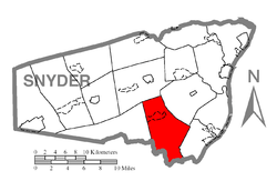 Map of Snyder County, Pennsylvania highlighting Perry Township | |
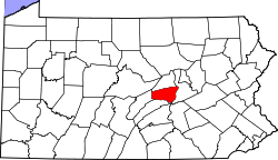 Map of Snyder County, Pennsylvania | |
| Country | United States |
| State | Pennsylvania |
| County | Snyder |
| Settled | 1752 |
| Incorporated | 1816 |
| Government | |
| • Type | Board of Supervisors |
| • Chairman | Elmer N. Brosius |
| • Vice-Chairman | Brian L. Hoffman |
| • Supervisor | Scott A. Wendt |
| Area | |
| • Total | 26.1 sq mi (67.7 km2) |
| Population (2000) | |
| • Total | 1,973 |
| • Density | 75.5/sq mi (29.1/km2) |
| Time zone | Eastern (EST) (UTC-5) |
| • Summer (DST) | EDT (UTC-4) |
| Zip code | 17853 |
| Area code(s) | 570 |
| Website | Perry Township |

Perry Township is a township in Snyder County, Pennsylvania, in the United States. As of the 2000 census, the township population was 1,973.
Geography
According to the United States Census Bureau, the township has a total area of 26.1 square miles (67.7 km²), all of it land.
Perry Township is bordered by Franklin Township to the north, Washington Township to the northeast, Chapman Township to the southeast, Juniata County to the south and West Perry Township to the west.
The census-designated place of Mount Pleasant Mills lies within the borders of Perry Township.
Government
The polling place for Perry Township is the Fremont Fire Hall.
Perry Township is in the 82nd Legislative District for the Pennsylvania General Assembly held by C. Adam Harris whose office is located on Main St., Middleburg. Pennsylvania Senate District 27 is held by Senator John Gordner. Perry Township is in the United States House of Representatives 10th District held by Rep. Chris Carney. Pennsylvania is represented in the United States Senate by Senator Bob Casey, Jr. and Senator Arlen Specter.
Perry Township is served by a Board of Supervisors. They are: Elmer N. Brosius, Chairman and Roadmaster 740 Troup Valley Road Mt. Pleasant Mills, Pa 17853 570-539-4784
Brian L. Hoffman, Vice Chairman 291 Frymoyer Road Mt. Pleasant Mills, Pa 17853 570-539-4784
Scott A. Wendt 1576 Potato Valley Road Mt. Pleasant Mills, Pa 17853 570-539-4784
Schools
Midd-West School District is the area's public school system.
History
Perry Township was settled in 1752 and incorporated as a township in 1816 from Mahantango Township a former township in what is now Northumberland County on the other side of the Susquehanna River.
The Aline Covered Bridge, East Oriental Covered Bridge, and North Oriental Covered Bridge were added to the National Register of Historic Places in 1979.[1]
Demographics
As of the census[2] of 2000, there were 1,973 people, 686 households, and 539 families residing in the township. The population density was 75.5 people per square mile (29.1/km²). There were 729 housing units at an average density of 27.9/sq mi (10.8/km²). The racial makeup of the township was 99.24% White, 0.05% African American, 0.10% Asian, 0.05% from other races, and 0.56% from two or more races. Hispanic or Latino of any race were 0.41% of the population.
There were 686 households out of which 36.2% had children under the age of 18 living with them, 68.7% were married couples living together, 5.8% had a female householder with no husband present, and 21.4% were non-families. 18.8% of all households were made up of individuals and 7.9% had someone living alone who was 65 years of age or older. The average household size was 2.88 and the average family size was 3.28.
In the township the population was spread out with 29.5% under the age of 18, 8.1% from 18 to 24, 29.0% from 25 to 44, 23.0% from 45 to 64, and 10.4% who were 65 years of age or older. The median age was 34 years. For every 100 females there were 105.1 males. For every 100 females age 18 and over, there were 99.7 males.
The median income for a household in the township was $35,167, and the median income for a family was $40,474. Males had a median income of $28,808 versus $21,667 for females. The per capita income for the township was $14,631. About 7.3% of families and 12.1% of the population were below the poverty line, including 17.9% of those under age 18 and 10.7% of those age 65 or over.
References
- ↑ National Park Service (2010-07-09). "National Register Information System". National Register of Historic Places. National Park Service.
- ↑ "American FactFinder". United States Census Bureau. Retrieved 2008-01-31.
External links
Municipalities and communities of Snyder County, Pennsylvania, United States | ||
|---|---|---|
| Boroughs | | |
| Townships | ||
| CDPs | ||
| Unincorporated community | ||
| Footnotes | ‡This populated place also has portions in an adjacent county or counties | |
Coordinates: 40°40′00″N 76°58′59″W / 40.66667°N 76.98306°W