Cascade Township, Michigan
| Cascade Charter Township, Michigan | |
|---|---|
| Charter township | |
| Motto: "Serene vistas...Plentiful trees...Two rivers...One community"[1] | |
 Cascade Charter Township, Michigan Location within the state of Michigan | |
| Coordinates: 42°54′9″N 85°29′42″W / 42.90250°N 85.49500°WCoordinates: 42°54′9″N 85°29′42″W / 42.90250°N 85.49500°W | |
| Country | United States |
| State | Michigan |
| County | Kent |
| Area | |
| • Total | 34.8 sq mi (90.1 km2) |
| • Land | 33.9 sq mi (87.8 km2) |
| • Water | 0.9 sq mi (2.3 km2) |
| Elevation | 663 ft (202 m) |
| Population (2010) | |
| • Total | 17,134 |
| • Density | 492.4/sq mi (190.2/km2) |
| Time zone | Eastern (EST) (UTC-5) |
| • Summer (DST) | EDT (UTC-4) |
| ZIP codes |
49301 (Ada) 49302 (Alto 49512 (Grand Rapids), 49546 (Grand Rapids) |
| Area code(s) | 616 |
| FIPS code | 26-13660[2] |
| GNIS feature ID | 1626037[3] |
| Website | Cascade Township, Michigan |
Cascade Charter Township is a charter township of Kent County in the U.S. state of Michigan. The population was 15,107 at the 2000 census.
History
The township is situated in the southeastern section of Kent County, approximately 10 miles southeast of Grand Rapids. A defining feature of the township is the Thornapple River, which divides the township into east and west halves. The township was originally a part of Ada Township and was separately organized in 1848.
Communities
- Cascade is an unincorporated community within the township, centered upon the intersection of 28th Street and Cascade Road. It consists of a large commercial district along 28th Street and several surrounding bedroom communities. Cascade was initially platted in 1845 by D. S. T. Weller. It had a post office from 1854 until 1910.[4]
- Grand Rapids is located to the west and northwest. The Grand Rapids ZIP codes 49512 and 49546 serve portions of the township. 49512 serves the southwest portion of the township.[5] Kentwood, Michigan, which is to the west, is also an acceptable name in the 49512 ZIP code.[6] 49546 serves the northwest portion of the township.[7]
- Ada is to the north, and the Ada ZIP code 49301 serves most of the eastern portion of the township.[8]
- Alto is to the southeast, and the Alto ZIP code 49302 serves the southeast portion of Cascade Township.[9]
Geography
According to the United States Census Bureau, the township has a total area of 34.8 square miles (90 km2), of which, 33.9 square miles (88 km2) of it is land and 0.9 square miles (2.3 km2) of it (2.53%) is water.
Demographics
As of the census[2] of 2000, there were 15,107 people, 5,394 households, and 4,374 families residing in the township. The population density was 445.7 per square mile (172.1/km²). There were 5,638 housing units at an average density of 166.3 per square mile (64.2/km²). The racial makeup of the township was 94.55% White, 1.00% African American, 0.28% Native American, 3.06% Asian, 0.26% from other races, and 0.85% from two or more races. Hispanic or Latino of any race were 0.87% of the population.
There were 5,394 households out of which 39.3% had children under the age of 18 living with them, 75.1% were married couples living together, 4.5% had a female householder with no husband present, and 18.9% were non-families. 16.7% of all households were made up of individuals and 8.0% had someone living alone who was 65 years of age or older. The average household size was 2.80 and the average family size was 3.16.
In the township the population was spread out with 29.4% under the age of 18, 4.7% from 18 to 24, 23.8% from 25 to 44, 30.8% from 45 to 64, and 11.4% who were 65 years of age or older. The median age was 41 years. For every 100 females there were 98.4 males. For every 100 females age 18 and over, there were 94.8 males.
The median income for a household in the township was $87,290, and the median income for a family was $98,013. Males had a median income of $71,960 versus $37,234 for females. The per capita income for the township was $39,470. About 1.5% of families and 2.3% of the population were below the poverty line, including 2.3% of those under age 18 and 3.4% of those age 65 or over.
References
Notes
- ↑ "Cascade Township, Michigan". Cascade Township, Michigan. Retrieved August 24, 2012.
- 1 2 "American FactFinder". United States Census Bureau. Archived from the original on 2013-09-11. Retrieved 2008-01-31.
- ↑ U.S. Geological Survey Geographic Names Information System: Cascade Township, Michigan
- ↑ Romig 1986, p. 101.
- ↑ 49512 5-Digit ZCTA, 495 3-Digit ZCTA - Reference Map - American FactFinder, U.S. Census Bureau, 2000 census
- ↑ USPS ZIP Code Lookup
- ↑ 49546 5-Digit ZCTA, 495 3-Digit ZCTA - Reference Map - American FactFinder, U.S. Census Bureau, 2000 census
- ↑ 49301 5-Digit ZCTA, 493 3-Digit ZCTA - Reference Map - American FactFinder, U.S. Census Bureau, 2000 census
- ↑ 49302 5-Digit ZCTA, 493 3-Digit ZCTA - Reference Map - American FactFinder, U.S. Census Bureau, 2000 census
Sources
- Romig, Walter (October 1, 1986) [1973]. Michigan Place Names: The History of the Founding and the Naming of More Than Five Thousand Past and Present Michigan Communities. Great Lakes Books Series (Paperback). Detroit, Michigan: Wayne State University Press. ISBN 0-8143-1838-X. ISBN 978-0814318386.
External links
Municipalities and communities of Kent County, Michigan, United States | ||
|---|---|---|
| Cities | 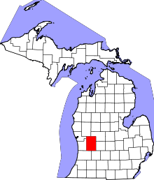 | |
| Villages | ||
| Charter townships | ||
| General law townships | ||
| CDPs | ||
| Other unincorporated communities | ||
| Footnotes | ‡This populated place also has portions in an adjacent county or counties | |