Casa, Arkansas
| Casa, Arkansas | |
|---|---|
| Town | |
 Location in Perry County and the state of Arkansas | |
| Coordinates: 35°1′25″N 93°2′50″W / 35.02361°N 93.04722°WCoordinates: 35°1′25″N 93°2′50″W / 35.02361°N 93.04722°W | |
| Country | United States |
| State | Arkansas |
| County | Perry |
| Area | |
| • Total | 1.1 sq mi (2.8 km2) |
| • Land | 1.1 sq mi (2.8 km2) |
| • Water | 0 sq mi (0 km2) |
| Elevation | 371 ft (113 m) |
| Population (2000) | |
| • Total | 209 |
| • Density | 190/sq mi (74.6/km2) |
| Time zone | Central (CST) (UTC-6) |
| • Summer (DST) | CDT (UTC-5) |
| ZIP code | 72025 |
| Area code(s) | 501 |
| FIPS code | 05-11890 |
| GNIS feature ID | 0057521 |
Casa is a town in Perry County, Arkansas, United States. Located in Central Arkansas, the town initially grew due to the mining of coal, harvesting of timber and cultivation of cotton. The Great Depression reduced the population greatly, and the community's economy never recovered. The population was 171 at the 2010 census.
Geography
Casa is located at 35°1′25″N 93°2′50″W / 35.02361°N 93.04722°W (35.023700, -93.047236).[1]
According to the United States Census Bureau, the town has a total area of 2.8 km² (1.1 mi²), all land.
Demographics
| Historical population | |||
|---|---|---|---|
| Census | Pop. | %± | |
| 1910 | 310 | — | |
| 1920 | 300 | −3.2% | |
| 1930 | 269 | −10.3% | |
| 1940 | 245 | −8.9% | |
| 1950 | 184 | −24.9% | |
| 1960 | 184 | 0.0% | |
| 1970 | 208 | 13.0% | |
| 1980 | 179 | −13.9% | |
| 1990 | 200 | 11.7% | |
| 2000 | 209 | 4.5% | |
| 2010 | 171 | −18.2% | |
| Est. 2015 | 167 | [2] | −2.3% |
2014 Estimate[4] | |||
According to the census[5] of 2000, there were 209 people, 79 households, and 59 families residing in the town. The population density was 74.0/km² (191.8/mi²). There were 93 housing units at an average density of 32.9/km² (85.4/mi²). The racial makeup of the town was 100.00% White.
There were 79 households out of which 34.2% had children under the age of 18 living with them, 58.2% were married couples living together, 10.1% had a female householder with no husband present, and 25.3% were non-families. 25.3% of all households were made up of individuals and 13.9% had someone living alone who was 65 years of age or older. The average household size was 2.65 and the average family size was 3.08.
In the town the population was spread out with 26.8% under the age of 18, 8.1% from 18 to 24, 28.2% from 25 to 44, 21.5% from 45 to 64, and 15.3% who were 65 years of age or older. The median age was 38 years. For every 100 females there were 106.9 males. For every 100 females age 18 and over, there were 96.2 males.
The average income for a household in the town was $27,813, and the median income for a family was $32,250. Males had a median income of $18,750 versus $19,375 for females. The per capita income for the town was $20,312. About 19.0% of families and 22.2% of the population were below the poverty line, including 38.6% of those under the age of eighteen and 7.1% of those sixty five or over.
Education
Free access to public education is provided by the following school districts:
- Two Rivers School District including Two Rivers High School.
- Perryville School District, including Perryville High School.
References
- ↑ "US Gazetteer files: 2010, 2000, and 1990". United States Census Bureau. 2011-02-12. Retrieved 2011-04-23.
- ↑ "Annual Estimates of the Resident Population for Incorporated Places: April 1, 2010 to July 1, 2015". Retrieved July 2, 2016.
- ↑ "Census of Population and Housing". Census.gov. Archived from the original on April 22, 2013. Retrieved June 4, 2015.
- ↑ "Annual Estimates of the Resident Population for Incorporated Places: April 1, 2010 to July 1, 2014". Retrieved June 4, 2015.
- ↑ "American FactFinder". United States Census Bureau. Archived from the original on 2013-09-11. Retrieved 2008-01-31.
Municipalities and communities of Perry County, Arkansas, United States | ||
|---|---|---|
| City | 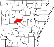 | |
| Towns | ||
| Unincorporated communities | ||