Bigelow, Arkansas
| Bigelow, Arkansas | |
|---|---|
| Town | |
 Location in Perry County and the state of Arkansas | |
| Coordinates: 34°59′57″N 92°37′52″W / 34.99917°N 92.63111°WCoordinates: 34°59′57″N 92°37′52″W / 34.99917°N 92.63111°W | |
| Country | United States |
| State | Arkansas |
| County | Perry |
| Area | |
| • Total | 0.8 sq mi (2.2 km2) |
| • Land | 0.8 sq mi (2.2 km2) |
| • Water | 0 sq mi (0 km2) |
| Elevation | 302 ft (92 m) |
| Population (2000) | |
| • Total | 329 |
| • Density | 411.3/sq mi (149.5/km2) |
| Time zone | Central (CST) (UTC-6) |
| • Summer (DST) | CDT (UTC-5) |
| ZIP code | 72016 |
| Area code(s) | 501 |
| FIPS code | 05-05920 |
| GNIS feature ID | 0046615 |
Bigelow is a town in Perry County, Arkansas, United States. Located in Central Arkansas near the confluence of the Fourche La Fave River and Arkansas River, the community was incorporated in 1905 as Esau. Based largely on the timber industry, the town grew until the lumber mills were closed in 1920. The population was 329 at the 2000 census.
History
Bigelow didn't exist by its current name until 1911. It used to be called "Esau"—a community a few miles southwest of the present Toadsuck Ferry Bridge that grew to touch the edge of the small town of Fourche. In 1911, Fourche River Mill owner, N.P. Bigelow, built an elaborate white house of the best lumber on a hill above the town. He was elected mayor, and then gained permission from the state's General Assembly to change the name of Esau to Bigelow. It was at one time the biggest town in the county; a vote was taken to move the county seat from Perryville to Bigelow, Bigelow won the vote, but the move was never made.
Geography
Bigelow is located at 34°59′57″N 92°37′52″W / 34.99917°N 92.63111°W (34.999061, -92.631203).[1]
According to the United States Census Bureau, the town has a total area of 0.8 square miles (2.1 km2), all land.
Demographics
| Historical population | |||
|---|---|---|---|
| Census | Pop. | %± | |
| 1910 | 292 | — | |
| 1920 | 589 | 101.7% | |
| 1930 | 338 | −42.6% | |
| 1940 | 377 | 11.5% | |
| 1950 | 292 | −22.5% | |
| 1960 | 231 | −20.9% | |
| 1970 | 258 | 11.7% | |
| 1980 | 373 | 44.6% | |
| 1990 | 340 | −8.8% | |
| 2000 | 329 | −3.2% | |
| 2010 | 315 | −4.3% | |
| Est. 2015 | 308 | [2] | −2.2% |
2014 Estimate[4] | |||
As of the census[5] of 2000, there were 329 people, 127 households, and 91 families residing in the town. The population density was 391.5 inhabitants per square mile (151.2/km²). There were 144 housing units at an average density of 171.3 per square mile (66.2/km²). The racial makeup of the town was 97.57% White, 0.61% Black or African American, 0.91% Native American, 0.61% Asian, and 0.30% from two or more races. 2.43% of the population were Hispanic or Latino of any race.
There were 127 households out of which 33.9% had children under the age of 18 living with them, 55.9% were married couples living together, 12.6% had a female householder with no husband present, and 27.6% were non-families. 24.4% of all households were made up of individuals and 16.5% had someone living alone who was 65 years of age or older. The average household size was 2.59 and the average family size was 3.05.
In the town the population was spread out with 28.3% under the age of 18, 8.8% from 18 to 24, 27.1% from 25 to 44, 22.2% from 45 to 64, and 13.7% who were 65 years of age or older. The median age was 36 years. For every 100 females there were 89.1 males. For every 100 females age 18 and over, there were 85.8 males.
The median income for a household in the town was $32,000, and the median income for a family was $47,750. Males had a median income of $27,500 versus $21,429 for females. The per capita income for the town was $16,574. About 11.0% of families and 18.0% of the population were below the poverty line, including 32.1% of those under age 18 and 22.2% of those age 65 or over.
Education
Public education for elementary and secondary school students is primarily provided by the East End School District, which leads to graduation from Bigelow High School.
See also
-
 Arkansas portal
References
- ↑ "US Gazetteer files: 2010, 2000, and 1990". United States Census Bureau. 2011-02-12. Retrieved 2011-04-23.
- ↑ "Annual Estimates of the Resident Population for Incorporated Places: April 1, 2010 to July 1, 2015". Retrieved July 2, 2016.
- ↑ "Census of Population and Housing". Census.gov. Archived from the original on May 11, 2015. Retrieved June 4, 2015.
- ↑ "Annual Estimates of the Resident Population for Incorporated Places: April 1, 2010 to July 1, 2014". Retrieved June 4, 2015.
- ↑ "American FactFinder". United States Census Bureau. Archived from the original on 2013-09-11. Retrieved 2008-01-31.
Municipalities and communities of Perry County, Arkansas, United States | ||
|---|---|---|
| City | 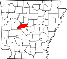 | |
| Towns | ||
| Unincorporated communities | ||