Carrollton Township, Boone County, Arkansas
| Carrollton Township | |
|---|---|
| Township | |
 Carrollton Township Location in Arkansas | |
| Coordinates: 36°18′0.91″N 93°16′22.81″W / 36.3002528°N 93.2730028°WCoordinates: 36°18′0.91″N 93°16′22.81″W / 36.3002528°N 93.2730028°W | |
| Country |
|
| State |
|
| County | Boone |
| Area | |
| • Total | 26.149 sq mi (67.73 km2) |
| • Land | 25.935 sq mi (67.17 km2) |
| • Water | 0.214 sq mi (0.55 km2) |
| Population (2010) | |
| • Total | 843 |
| • Density | 32.5/sq mi (12.5/km2) |
| Time zone | CST (UTC-6) |
| • Summer (DST) | CDT (UTC-5) |
| Zip Code | 72611 (Alpena) |
| Area code(s) | 870 |
Carrollton Township is one of twenty current townships in Boone County, Arkansas, USA.[1] As of the 2010 census, its total population was 843.
Geography
According to the United States Census Bureau, Carrollton Township covers an area of 26.149 square miles (67.73 km2); 25.935 square miles (67.17 km2) of land and 0.214 square miles (0.55 km2) of water.
Cities, towns, and villages
- Alpena (part)
Population history
Between 1920 and 1980, the population of Boone County's Carrollton Township included the total population of the town of Alpena, even though Alpena is in both Boone County and in parts of two townships in Carroll County. Starting in 2000, the US Census broke the population of Alpena down by township across both counties.
| Historical population | |||
|---|---|---|---|
| Census | Pop. | %± | |
| 1870 | 577 | — | |
| 1880 | 802 | 39.0% | |
| 1890 | 1,129 | 40.8% | |
| 1900 | 1,212 | 7.4% | |
| 1910 | 664 | −45.2% | |
| 1920 | 693 | 4.4% | |
| 1930 | 812 | 17.2% | |
| 1940 | 732 | −9.9% | |
| 1950 | 665 | −9.2% | |
| 1960 | 568 | −14.6% | |
| 1970 | 648 | 14.1% | |
| 1980 | 753 | 16.2% | |
| 1990 | 777 | 3.2% | |
| 2000 | 768 | −1.2% | |
| 2010 | 843 | 9.8% | |
References
- United States Census Bureau 2008 TIGER/Line Shapefiles
- United States Board on Geographic Names (GNIS)
- United States National Atlas
- ↑ "Carrollton Township, Boone County, Arkansas." U.S. Census Bureau. Breakdown. Retrieved June 1, 2012.
External links
Municipalities and communities of Boone County, Arkansas, United States | ||
|---|---|---|
| Cities | 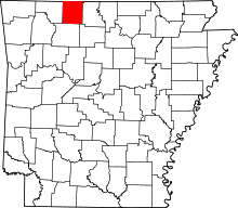 | |
| Towns | ||
| Townships | ||
| Unincorporated communities | ||
| Ghost town | ||
| Footnotes | ‡This populated place also has portions in an adjacent county or counties | |
This article is issued from Wikipedia - version of the 11/16/2016. The text is available under the Creative Commons Attribution/Share Alike but additional terms may apply for the media files.