Captain Aníbal Arab Airport
| Captain Aníbal Arab Airport Aeropuerto Capitán Aníbal Arab | |||||||||||
|---|---|---|---|---|---|---|---|---|---|---|---|
|
| |||||||||||
| IATA: CIJ – ICAO: SLCO | |||||||||||
| Summary | |||||||||||
| Airport type | Public | ||||||||||
| Operator | Government | ||||||||||
| Serves | Cobija, Bolivia | ||||||||||
| Elevation AMSL | 892 ft / 272 m | ||||||||||
| Coordinates | 11°02′25″S 068°46′58″W / 11.04028°S 68.78278°WCoordinates: 11°02′25″S 068°46′58″W / 11.04028°S 68.78278°W | ||||||||||
| Map | |||||||||||
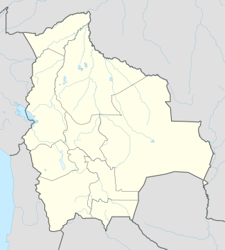
 CIJ Location of airport in Bolivia | |||||||||||
| Runways | |||||||||||
| |||||||||||
Captain Aníbal Arab Airport (Spanish: Aeropuerto Capitán Aníbal Arab) (IATA: CIJ, ICAO: SLCO) is an airport serving Cobija,[2] a city in the Pando department of Bolivia.[1][2]
Facilities
The airport resides at an elevation of 892 feet (272 m) above mean sea level. It has one runway designated 02/20 with an asphalt surface measuring 6,562 by 98 feet (2,000 m × 30 m).[2]
Airlines and destinations
| Airlines | Destinations |
|---|---|
| Boliviana de Aviación | Cochabamba, La Paz, Santa Cruz |
| EcoJet | Cochabamba, La Paz, Santa Cruz de la Sierra, Trinidad, Sucre, Tarija[4] |
| TAM - Transporte Aéreo Militar | La Paz, Trinidad |
References
- 1 2 "Aeropuertos Controlados" (in Spanish). Administración de Aeropuertos y Servicios Auxliares a la Navegación Aérea (AASANA). Archived from the original on 2008-06-23. External link in
|publisher=(help) - 1 2 3 4 Airport information for SLCO from DAFIF (effective October 2006)
- ↑ Airport information for CIJ at Great Circle Mapper. Source: DAFIF (effective October 2006).
- ↑ October 2014, Timetable, (spanish) http://www.ecojet.bo/reservas-y-servicios
External links
This article is issued from Wikipedia - version of the 11/27/2016. The text is available under the Creative Commons Attribution/Share Alike but additional terms may apply for the media files.