Capron, Illinois
| Capron | |
| Village | |
| Country | United States |
|---|---|
| State | Illinois |
| County | Boone |
| Coordinates | 42°23′52″N 88°44′23″W / 42.39778°N 88.73972°WCoordinates: 42°23′52″N 88°44′23″W / 42.39778°N 88.73972°W |
| Area | 0.78 sq mi (2 km2) |
| - land | 0.78 sq mi (2 km2) |
| - water | 0.00 sq mi (0 km2) |
| Population | 1,376 (2010) |
| Density | 1,319.5/sq mi (509/km2) |
| Village president | JoAnn Caveliere |
| Timezone | CST (UTC-6) |
| - summer (DST) | CDT (UTC-5) |
| Postal code | 61012 |
| Area code | 815 & 779 |
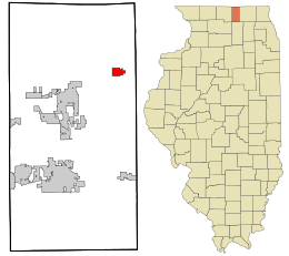 Location in Boone County and the state of Illinois.
| |
| Wikimedia Commons: Capron, Illinois | |
| Website: http://www.villageofcapron.com/ | |
Capron is a village in Boone County, Illinois, United States. It is part of the Rockford, Illinois Metropolitan Statistical Area. The population was 1,376 at the 2010 census, up from 961 in the 2000 census.
History
A post office has operated under the name Capron since 1861.[1] Capron was named for John Capron, a pioneer settler.[2]
Geography
Capron is located at 42°23′52″N 88°44′23″W / 42.39778°N 88.73972°W (42.397729, -88.739684).[3]
According to the 2010 census, Capron has a total area of 0.771 square miles (2.00 km2), of which 0.77 square miles (1.99 km2) (or 99.87%) is land and 0.001 square miles (0.00 km2) (or 0.13%) is water.[4]
Route 173 runs through the town.
Demographics
| Historical population | |||
|---|---|---|---|
| Census | Pop. | %± | |
| 1880 | 323 | — | |
| 1890 | 436 | 35.0% | |
| 1900 | 502 | 15.1% | |
| 1910 | 562 | 12.0% | |
| 1920 | 550 | −2.1% | |
| 1930 | 397 | −27.8% | |
| 1940 | 487 | 22.7% | |
| 1950 | 572 | 17.5% | |
| 1960 | 656 | 14.7% | |
| 1970 | 654 | −0.3% | |
| 1980 | 678 | 3.7% | |
| 1990 | 682 | 0.6% | |
| 2000 | 961 | 40.9% | |
| 2010 | 1,376 | 43.2% | |
| Est. 2015 | 1,348 | [5] | −2.0% |
As of the census[7] of 2000, there were 961 people, 332 households, and 245 families residing in the village. The population density was 1,319.5 people per square mile (508.3/km²). There were 354 housing units at an average density of 486.1 per square mile (187.2/km²). The racial makeup of the village was 91.57% White, 0.94% African American, 1.14% Native American, 0.52% Asian, 4.27% from other races, and 1.56% from two or more races. Hispanic or Latino of any race were 12.80% of the population.
There were 332 households out of which 42.2% had children under the age of 18 living with them, 63.0% were married couples living together, 7.2% had a female householder with no husband present, and 26.2% were non-families. 19.0% of all households were made up of individuals and 6.6% had someone living alone who was 65 years of age or older. The average household size was 2.89 and the average family size was 3.33.
In the village the population was spread out with 31.1% under the age of 18, 8.8% from 18 to 24, 33.0% from 25 to 44, 18.1% from 45 to 64, and 8.9% who were 65 years of age or older. The median age was 32 years. For every 100 females there were 103.2 males. For every 100 females age 18 and over, there were 103.1 males.
The median income for a household in the village was $46,786, and the median income for a family was $52,500. Males had a median income of $36,406 versus $24,226 for females. The per capita income for the village was $17,624. About 2.8% of families and 3.1% of the population were below the poverty line, including 1.6% of those under age 18 and 10.3% of those age 65 or over.
References
- ↑ "Boone County". Jim Forte Postal History. Retrieved 28 February 2015.
- ↑ Chicago and North Western Railway Company (1908). A History of the Origin of the Place Names Connected with the Chicago & North Western and Chicago, St. Paul, Minneapolis & Omaha Railways. p. 51.
- ↑ "US Gazetteer files: 2010, 2000, and 1990". United States Census Bureau. 2011-02-12. Retrieved 2011-04-23.
- ↑ "G001 - Geographic Identifiers - 2010 Census Summary File 1". United States Census Bureau. Retrieved 2015-08-02.
- ↑ "Annual Estimates of the Resident Population for Incorporated Places: April 1, 2010 to July 1, 2015". Retrieved July 2, 2016.
- ↑ "Census of Population and Housing". Census.gov. Archived from the original on May 11, 2015. Retrieved June 4, 2015.
- ↑ "American FactFinder". United States Census Bureau. Archived from the original on 2013-09-11. Retrieved 2008-01-31.
Municipalities and communities of Boone County, Illinois, United States | ||
|---|---|---|
| Cities | ||
| Villages | ||
| Townships | ||
| Unincorporated communities | ||
| Ghost town | ||
| Footnotes | ‡This populated place also has portions in an adjacent county or counties | |