Caledonia Township, Boone County, Illinois
| Caledonia Township | |
|---|---|
| Township | |
 Location in Boone County | |
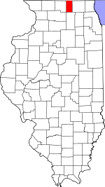 Boone County's location in Illinois | |
| Coordinates: 42°22′15″N 88°54′06″W / 42.37083°N 88.90167°WCoordinates: 42°22′15″N 88°54′06″W / 42.37083°N 88.90167°W | |
| Country | United States |
| State | Illinois |
| County | Boone |
| Settlement | November 6, 1849 |
| Area | |
| • Total | 24.35 sq mi (63.1 km2) |
| • Land | 24.04 sq mi (62.3 km2) |
| • Water | 0.31 sq mi (0.8 km2) 1.27% |
| Elevation | 912 ft (278 m) |
| Population (2010) | |
| • Total | 7,439 |
| • Density | 309.5/sq mi (119.5/km2) |
| Time zone | CST (UTC-6) |
| • Summer (DST) | CDT (UTC-5) |
| ZIP codes | 61008, 61011, 61065 |
| GNIS feature ID | 0428749 |
Caledonia Township is one of nine townships in Boone County, Illinois, USA. As of the 2010 census, its population was 7,439 and it contained 2,537 housing units.[1] Sometime after 1921, Poplar Grove Township was formed from a portion of Caledonia Township.
Geography
According to the 2010 census, the township has a total area of 24.35 square miles (63.1 km2), of which 24.04 square miles (62.3 km2) (or 98.73%) is land and 0.31 square miles (0.80 km2) (or 1.27%) is water.[1]
Cities
- Caledonia
- Loves Park (east edge)
- Poplar Grove (west edge)
- Timberlane (northwest three-quarters)
Extinct towns
- North Caledonia
Cemeteries
The township contains Drake Cemetery.
Major highways
School districts
- Belvidere Consolidated Unit School District 100
- North Boone Community Unit School District 200
- Rockford School District 205
Political districts
- Illinois' 16th congressional district
- State House District 69
- State Senate District 35
References
- "Caledonia Township, Boone County, Illinois". Geographic Names Information System. United States Geological Survey. Retrieved 2010-01-04.
- United States Census Bureau 2007 TIGER/Line Shapefiles
- United States National Atlas
- 1 2 "Population, Housing Units, Area, and Density: 2010 - County -- County Subdivision and Place -- 2010 Census Summary File 1". United States Census. Retrieved 2013-05-28.
External links
 |
Roscoe Township, Winnebago County | Manchester Township | | |
| Harlem Township, Winnebago County | |
Poplar Grove Township | ||
| ||||
| | ||||
| Rockford Township, Winnebago County | Belvidere Township |
Municipalities and communities of Boone County, Illinois, United States | ||
|---|---|---|
| Cities | ||
| Villages | ||
| Townships | ||
| Unincorporated communities | ||
| Ghost town | ||
| Footnotes | ‡This populated place also has portions in an adjacent county or counties | |
This article is issued from Wikipedia - version of the 11/12/2016. The text is available under the Creative Commons Attribution/Share Alike but additional terms may apply for the media files.