Camano, Washington
| Camano Island, Washington | |
|---|---|
| CDP | |
 Location of Camano, Washington | |
| Coordinates: 48°11′37″N 122°29′11″W / 48.19361°N 122.48639°WCoordinates: 48°11′37″N 122°29′11″W / 48.19361°N 122.48639°W | |
| Country | United States |
| State | Washington |
| County | Island |
| Area | |
| • Total | 94.9 sq mi (245.9 km2) |
| • Land | 39.8 sq mi (103.0 km2) |
| • Water | 55.2 sq mi (142.9 km2) |
| Elevation | 52 ft (16 m) |
| Population (2010) | |
| • Total | 15,661 |
| • Density | 335.6/sq mi (129.6/km2) |
| Time zone | Pacific (PST) (UTC-8) |
| • Summer (DST) | PDT (UTC-7) |
| FIPS code | 53-09365[1] |
| GNIS feature ID | 1503722[2] |
| Highways |
|
Camano is a census-designated place (CDP) in Island County, Washington, United States. The population was 13,347 at the 2000 census. Camano is coterminous with the namesake island on which it sits. Camano (as Camano Island)[3] has its own ZIP code (98282) but shares a post office with Stanwood, despite Stanwood's distance. Based on per capita income, one of the more reliable measures of affluence, Camano ranks 99th of 522 areas in the state of Washington to be ranked.
Geography
Camano is located at 48°11′37″N 122°29′11″W / 48.19361°N 122.48639°W (48.193606, -122.486419).[4]
According to the United States Census Bureau, the CDP has a total area of 94.9 square miles (245.9 km²), of which, 39.8 square miles (103.0 km²) of it is land and 55.2 square miles (142.9 km²) of it (58.11%) is water.
Demographics
As of the census[1] of 2000, there were 13,347 people, 5,357 households, and 4,028 families residing in the Camano Island CDP. The population density was 335.6 people per square mile (129.6/km²). There were 6,709 housing units at an average density of 168.7/sq mi (65.1/km²). The racial makeup of the CDP was 95.61% White, 0.25% African American, 0.83% Native American, 0.65% Asian, 0.25% Pacific Islander, 0.56% from other races, and 1.84% from two or more races. Hispanic or Latino of any race were 2.06% of the population.
There were 5,357 households out of which 28.8% had children under the age of 18 living with them, 66.0% were married couples living together, 6.3% had a female householder with no husband present, and 24.8% were non-families. 20.2% of all households were made up of individuals and 8.5% had someone living alone who was 65 years of age or older. The average household size was 2.49 and the average family size was 2.86.
In the CDP the population was spread out with 24.1% under the age of 18, 4.8% from 18 to 24, 25.2% from 25 to 44, 27.7% from 45 to 64, and 18.3% who were 65 years of age or older. The median age was 43 years. For every 100 females there were 99.5 males. For every 100 females age 18 and over, there were 96.9 males.
The median income for a household in the CDP was $54,262, and the median income for a family was $60,013. Males had a median income of $47,309 versus $31,250 for females. The per capita income for the CDP was $24,362. About 4.4% of families and 5.6% of the population were below the poverty line, including 6.5% of those under age 18 and 3.3% of those age 65 or over.
Notable people
- Laurie Z, musician
- Alfred Zeisler, film producer, director, actor and screenwriter
- Colton Harris-Moore, "barefoot bandit"
- Robert Neale (pilot), ace pilot
- Mary Margaret Haugen, state senator
- Thomas T. Minor, former mayor of Seattle and Port Townsend
- William Corson, actor
References
- 1 2 "American FactFinder". United States Census Bureau. Archived from the original on 2013-09-11. Retrieved 2008-01-31.
- ↑ "Camano". Geographic Names Information System. United States Geological Survey.
- ↑ According to the United States Postal Service.
- ↑ "US Gazetteer files: 2010, 2000, and 1990". United States Census Bureau. 2011-02-12. Retrieved 2011-04-23.
Municipalities and communities of Island County, Washington, United States | ||
|---|---|---|
| Cities | 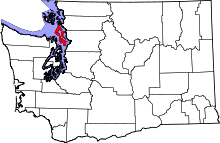 | |
| Town | ||
| CDPs | ||
| Other unincorporated communities | ||